Distance between Agudo and Nova Alvorada do Sul
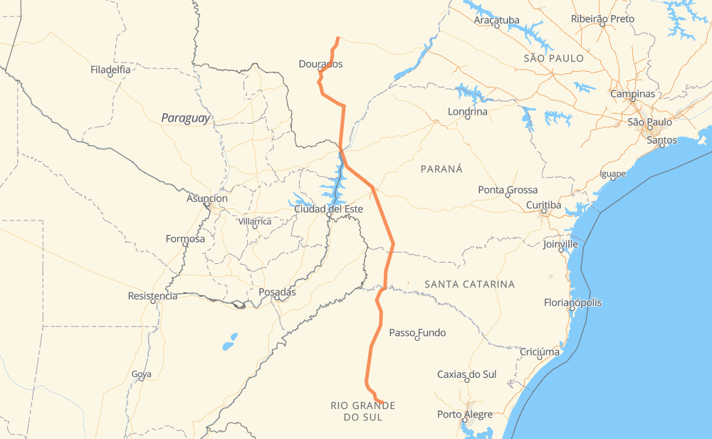
The distance from Agudo to Nova Alvorada do Sul is 1,187 kilometers by road including 79 kilometers on motorways. Road takes approximately 14 hours and 10 minutes and goes through Chácaras do Sul, Medianeira, Boca da Picada, Maravilha, Marechal Candido Rondon, Mundo Novo and Itaquiraí.
| Shortest distance by air | 917 km ✈️ |
| Car route length | 1,187 km 🚗 |
| Driving time | 14 h 10 min |
| Fuel amount | 95 L |
| Fuel cost | 170 AUD |
| Point | Distance | Time | Fuel | |
| -29.64233, -53.24940 | 0 km | 00 min | 0.0 L | |
|
BR-158 139 km, 1 h 38 min
|
||||
| Chácaras do Sul | 139 km | 1 h 38 min | 21.6 L | |
|
BR-158 52 km, 34 min
|
||||
| Medianeira | 190 km | 2 h 13 min | 26.0 L | |
|
BR-158 100 km, 1 h 06 min
|
||||
| Boca da Picada | 291 km | 3 h 20 min | 33.9 L | |
|
BR-386 BR-158 105 km, 1 h 25 min
|
||||
| Maravilha | 396 km | 4 h 46 min | 42.3 L | |
|
BR-163 352 km, 4 h 17 min
|
||||
| Marechal Candido Rondon | 748 km | 9 h 04 min | 70.3 L | |
|
BR-163 90 km, 1 h 02 min
|
||||
| Mundo Novo | 838 km | 10 h 07 min | 77.4 L | |
|
BR-163 61 km, 43 min
|
||||
| Itaquiraí | 900 km | 10 h 50 min | 82.2 L | |
|
BR-163 130 km, 1 h 32 min
|
||||
| Caarapó | 1,029 km | 12 h 22 min | 92.7 L | |
|
BR-163 111 km, 1 h 16 min
|
||||
| Rio Brilhante | 1,140 km | 13 h 39 min | 101.8 L | |
|
BR-163 47 km, 31 min
|
||||
| Nova Alvorada do Sul | 1,187 km | 14 h 10 min | 103.9 L | |
Frequently Asked Questions
How much does it cost to drive from Agudo to Nova Alvorada do Sul?
Fuel cost: 170 AUD
This fuel cost is calculated as: (Route length 1,187 km / 100 km) * (Fuel consumption 8 L/100 km) * (Fuel price 1.79 AUD / L)
You can adjust fuel consumption and fuel price here.
How long is a car ride from Agudo to Nova Alvorada do Sul?
Driving time: 14 h 10 min
This time is calculated for driving at the maximum permitted speed, taking into account traffic rules restrictions.
- 73 km with a maximum speed 110 km/h = 40 min
- 641 km with a maximum speed 90 km/h = 7 h 7 min
- 391 km with a maximum speed 80 km/h = 4 h 53 min
- 59 km with a maximum speed 60 km/h = 58 min
- 7 km with a maximum speed 50 km/h = 8 min
- 15 km with a maximum speed 40 km/h = 22 min
The calculated driving time does not take into account intermediate stops and traffic jams.
How far is Agudo to Nova Alvorada do Sul by land?
The distance between Agudo and Nova Alvorada do Sul is 1,187 km by road including 79 km on motorways.
Precise satellite coordinates of highways were used for this calculation. The start and finish points are the centers of Agudo and Nova Alvorada do Sul respectively.
How far is Agudo to Nova Alvorada do Sul by plane?
The shortest distance (air line, as the crow flies) between Agudo and Nova Alvorada do Sul is 917 km.
This distance is calculated using the Haversine formula as a great-circle distance between two points on the surface of a sphere. The start and finish points are the centers of Agudo and Nova Alvorada do Sul respectively. Actual distance between airports may be different.
How many hours is Agudo from Nova Alvorada do Sul by plane?
Boeing 737 airliner needs 1 h 8 min to cover the distance of 917 km at a cruising speed of 800 km/h.
Small plane "Cessna 172" needs 4 h 10 min to flight this distance at average speed of 220 km/h.
This time is approximate and do not take into account takeoff and landing times, airport location and other real world factors.
How long is a helicopter ride from Agudo to Nova Alvorada do Sul?
Fast helicopter "Eurocopter AS350" or "Hughes OH-6 Cayuse" need 3 h 49 min to cover the distance of 917 km at a cruising speed of 240 km/h.
Popular "Robinson R44" needs 4 h 22 min to flight this distance at average speed of 210 km/h.
This time is approximate and do not take into account takeoff and landing times, aerodrome location and other real world factors.
What city is halfway between Agudo and Nova Alvorada do Sul?
The halfway point between Agudo and Nova Alvorada do Sul is Flor da Serra. It is located about 7 km from the exact midpoint by road.
The distance from Flor da Serra to Agudo is 586 km and driving will take about 7 h 13 min. The road between Flor da Serra and Nova Alvorada do Sul has length 601 km and will take approximately 6 h 57 min.
The other cities located close to halfway point:
Where is Agudo in relation to Nova Alvorada do Sul?
Agudo is located 917 km south of Nova Alvorada do Sul.
Agudo has geographic coordinates: latitude -29.64233, longitude -53.2494.
Nova Alvorada do Sul has geographic coordinates: latitude -21.45873, longitude -54.37606.
Which highway goes from Agudo to Nova Alvorada do Sul?
The route from Agudo to Nova Alvorada do Sul follows BR-163, BR-158.
Other minor sections pass along the road:
- PR-182: 75 km
- BR-386: 74 km
- BR-467: 67 km
- BR-487: 62 km
- BR-267: 42 km
- PR-180: 37 km
- BR-392: 26 km
- PR-483: 26 km
- SC-160: 21 km
- ERS-348: 20 km
- ERS-149: 16 km
- SC-492: 16 km
- ERS-330: 8 km
- PR-317: 5 km
- BR-282: 3 km