Distance between Aiuaba and Januária
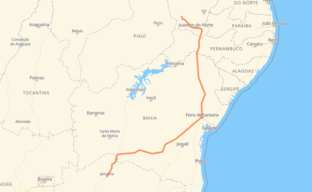
The distance from Aiuaba to Januária is 1,617 kilometers by road including 68 kilometers on motorways. Road takes approximately 18 hours and 59 minutes and goes through Teofilândia, São Jorge, Brás, Manga, São João das Missões and Itacarambi.
| Shortest distance by air | 1,094 km ✈️ |
| Car route length | 1,617 km 🚗 |
| Driving time | 18 h 59 min |
| Fuel amount | 129.3 L |
| Fuel cost | 231.5 AUD |
| Point | Distance | Time | Fuel | |
| Aiuaba | 0 km | 00 min | 0.0 L | |
|
CE-176 CE-292 185 km, 2 h 07 min
|
||||
| Café da Linha | 185 km | 2 h 07 min | 14.3 L | |
|
CE-293 BR-116 172 km, 1 h 55 min
|
||||
| Antônio Conselheiro | 357 km | 4 h 02 min | 28.2 L | |
|
BR-116 335 km, 3 h 54 min
|
||||
| Teofilândia | 692 km | 7 h 57 min | 54.7 L | |
|
BR-116 513 km, 5 h 41 min
|
||||
| São Jorge | 1,204 km | 13 h 39 min | 96.2 L | |
|
BR-030 104 km, 1 h 14 min
|
||||
| Brás | 1,308 km | 14 h 53 min | 104.4 L | |
|
BR-030 205 km, 2 h 37 min
|
||||
| Manga | 1,513 km | 17 h 31 min | 120.4 L | |
|
MGC-135 30 km, 25 min
|
||||
| São João das Missões | 1,543 km | 17 h 56 min | 121.7 L | |
|
BR-135 31 km, 23 min
|
||||
| Itacarambi | 1,574 km | 18 h 20 min | 125.2 L | |
|
BR-135 52 km, 39 min
|
||||
| Januária | 1,626 km | 18 h 59 min | 129.7 L | |
Hotels of Januária
Frequently Asked Questions
How much does it cost to drive from Aiuaba to Januária?
Fuel cost: 231.5 AUD
This fuel cost is calculated as: (Route length 1,617 km / 100 km) * (Fuel consumption 8 L/100 km) * (Fuel price 1.79 AUD / L)
You can adjust fuel consumption and fuel price here.
How long is a car ride from Aiuaba to Januária?
Driving time: 18 h 59 min
This time is calculated for driving at the maximum permitted speed, taking into account traffic rules restrictions.
- 44 km with a maximum speed 110 km/h = 24 min
- 23 km with a maximum speed 100 km/h = 13 min
- 966 km with a maximum speed 90 km/h = 10 h 43 min
- 561 km with a maximum speed 80 km/h = 7 h 1 min
- 13 km with a maximum speed 60 km/h = 12 min
- 16 km with a maximum speed 50 km/h = 18 min
- 2 km with a maximum speed 40 km/h = 2 min
- 1 km with a maximum speed 20 km/h = 1 min
The calculated driving time does not take into account intermediate stops and traffic jams.
How far is Aiuaba to Januária by land?
The distance between Aiuaba and Januária is 1,617 km by road including 68 km on motorways.
Precise satellite coordinates of highways were used for this calculation. The start and finish points are the centers of Aiuaba and Januária respectively.
How far is Aiuaba to Januária by plane?
The shortest distance (air line, as the crow flies) between Aiuaba and Januária is 1,094 km.
This distance is calculated using the Haversine formula as a great-circle distance between two points on the surface of a sphere. The start and finish points are the centers of Aiuaba and Januária respectively. Actual distance between airports may be different.
How many hours is Aiuaba from Januária by plane?
Boeing 737 airliner needs 1 h 22 min to cover the distance of 1,094 km at a cruising speed of 800 km/h.
Small plane "Cessna 172" needs 4 h 58 min to flight this distance at average speed of 220 km/h.
This time is approximate and do not take into account takeoff and landing times, airport location and other real world factors.
How long is a helicopter ride from Aiuaba to Januária?
Fast helicopter "Eurocopter AS350" or "Hughes OH-6 Cayuse" need 4 h 33 min to cover the distance of 1,094 km at a cruising speed of 240 km/h.
Popular "Robinson R44" needs 5 h 12 min to flight this distance at average speed of 210 km/h.
This time is approximate and do not take into account takeoff and landing times, aerodrome location and other real world factors.
What city is halfway between Aiuaba and Januária?
The halfway point between Aiuaba and Januária is Santo Estevão Velho. It is located about 1 km from the exact midpoint by road.
The distance from Santo Estevão Velho to Aiuaba is 807 km and driving will take about 9 h 17 min. The road between Santo Estevão Velho and Januária has length 810 km and will take approximately 9 h 42 min.
The other cities located close to halfway point:
Where is Aiuaba in relation to Januária?
Aiuaba is located 1,094 km north-east of Januária.
Aiuaba has geographic coordinates: latitude -6.57108, longitude -40.12123.
Januária has geographic coordinates: latitude -15.4875, longitude -44.36111.
Which highway goes from Aiuaba to Januária?
The route from Aiuaba to Januária follows BR-116, BR-030, BA-026, BR-135.
Other minor sections pass along the road:
- CE-176: 57 km
- CE-292: 54 km
- MGC-135: 46 km
- CE-388: 36 km
- CE-293: 35 km
- BR-230: 18 km
- BR-122: 10 km
- CE-585: 8 km
- CE-371: 2 km
- MG-401: 1 km