Distance between Banff AB and Little Canada MN
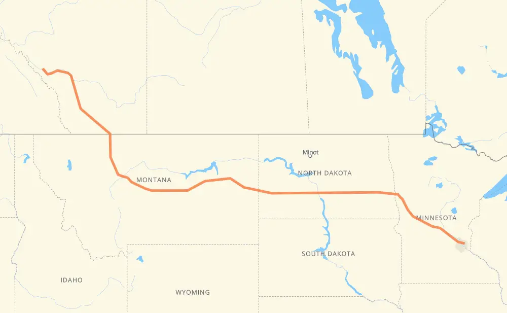
The distance from Banff to Little Canada is 2,198 kilometers by road including 1,380 kilometers on motorways. Road takes approximately 22 hours and 45 minutes and goes through Lethbridge, Great Falls, Dickinson, Mandan, Bismarck, West Fargo and Fargo.
| Shortest distance by air | 1,795 km ✈️ |
| Car route length | 2,198 km 🚗 |
| Driving time | 22 h 45 min |
| Fuel amount | 175.9 L |
| Fuel cost | 313.1 AUD |
| Point | Distance | Time | Fuel | |
| Banff | 0 km | 00 min | 0.0 L | |
|
1 22 km, 15 min
|
||||
| Harvie Heights | 22 km | 15 min | 1.5 L | |
|
1 2 310 km, 3 h 16 min
|
||||
| Lethbridge | 333 km | 3 h 31 min | 26.4 L | |
|
3 I 15 301 km, 3 h 22 min
|
||||
| Great Falls | 634 km | 6 h 54 min | 50.3 L | |
|
US 87 MT 200 722 km, 7 h 56 min
|
||||
| Dickinson | 1,356 km | 14 h 50 min | 107.8 L | |
|
I 94 127 km, 1 h 09 min
|
||||
| Mandan | 1,483 km | 15 h 59 min | 117.1 L | |
|
I 94 29 km, 16 min
|
||||
| Bismarck | 1,512 km | 16 h 15 min | 120.2 L | |
|
I 94 294 km, 2 h 40 min
|
||||
| West Fargo | 1,806 km | 18 h 56 min | 144.2 L | |
|
I 94 8 km, 04 min
|
||||
| Fargo | 1,813 km | 19 h 01 min | 144.7 L | |
|
US 52 I 94 385 km, 3 h 44 min
|
||||
| Little Canada | 2,198 km | 22 h 45 min | 175.7 L | |
Frequently Asked Questions
How much does it cost to drive from Banff to Little Canada?
Fuel cost: 313.1 AUD
This fuel cost is calculated as: (Route length 2,198 km / 100 km) * (Fuel consumption 8 L/100 km) * (Fuel price 1.78 AUD / L)
You can adjust fuel consumption and fuel price here.
How long is a car ride from Banff to Little Canada?
Driving time: 22 h 45 min
This time is calculated for driving at the maximum permitted speed, taking into account traffic rules restrictions.
- 867 km with a maximum speed 110 km/h = 7 h 53 min
- 6 km with a maximum speed 105 km/h = 3 min
- 281 km with a maximum speed 100 km/h = 2 h 48 min
- 28 km with a maximum speed 97 km/h = 17 min
- 790 km with a maximum speed 90 km/h = 8 h 46 min
- 18 km with a maximum speed 89 km/h = 12 min
- 183 km with a maximum speed 80 km/h = 2 h 17 min
- 4 km with a maximum speed 72 km/h = 3 min
- 6 km with a maximum speed 70 km/h = 4 min
- 2 km with a maximum speed 60 km/h = 2 min
- 2 km with a maximum speed 56 km/h = 2 min
- 6 km with a maximum speed 50 km/h = 7 min
- 1 km with a maximum speed 48 km/h = 1 min
- 3 km with a maximum speed 40 km/h = 4 min
The calculated driving time does not take into account intermediate stops and traffic jams.
How far is Banff to Little Canada by land?
The distance between Banff and Little Canada is 2,198 km by road including 1,380 km on motorways.
Precise satellite coordinates of highways were used for this calculation. The start and finish points are the centers of Banff and Little Canada respectively.
How far is Banff to Little Canada by plane?
The shortest distance (air line, as the crow flies) between Banff and Little Canada is 1,795 km.
This distance is calculated using the Haversine formula as a great-circle distance between two points on the surface of a sphere. The start and finish points are the centers of Banff and Little Canada respectively. Actual distance between airports may be different.
How many hours is Banff from Little Canada by plane?
Boeing 737 airliner needs 2 h 14 min to cover the distance of 1,795 km at a cruising speed of 800 km/h.
Small plane "Cessna 172" needs 8 h 9 min to flight this distance at average speed of 220 km/h.
This time is approximate and do not take into account takeoff and landing times, airport location and other real world factors.
How long is a helicopter ride from Banff to Little Canada?
Fast helicopter "Eurocopter AS350" or "Hughes OH-6 Cayuse" need 7 h 28 min to cover the distance of 1,795 km at a cruising speed of 240 km/h.
Popular "Robinson R44" needs 8 h 32 min to flight this distance at average speed of 210 km/h.
This time is approximate and do not take into account takeoff and landing times, aerodrome location and other real world factors.
What city is halfway between Banff and Little Canada?
The halfway point between Banff and Little Canada is Circle. It is located about 17 km from the exact midpoint by road.
The distance from Circle to Banff is 1,116 km and driving will take about 12 h 18 min. The road between Circle and Little Canada has length 1,082 km and will take approximately 10 h 26 min.
The other cities located close to halfway point:
Where is Banff in relation to Little Canada?
Banff is located 1,795 km north-west of Little Canada.
Banff has geographic coordinates: latitude 51.17778, longitude -115.56825.
Little Canada has geographic coordinates: latitude 45.02691, longitude -93.08772.
Which highway goes from Banff to Little Canada?
The route from Banff to Little Canada follows I 94, MT 200, US 87, I 15, US 52, MT 3, 2, 1.
Other minor sections pass along the road:
- 4: 100 km
- MT 200 S: 71 km
- US 89: 52 km
- US 83: 36 km
- 519: 32 km
- I 694: 27 km
- US 191: 24 km
- 3: 20 km
- US 59: 17 km
- ND 3: 12 km
- 23: 8 km
- ND 1: 8 km
- US 10: 8 km
- 8: 8 km
- MN 210: 5 km
- I 15 Business: 4 km
- ND 22 Bypass: 4 km
- 5: 3 km
- 501: 3 km
- US 52 Truck: 3 km
- 3A: 3 km
- US 281 Truck: 2 km
- 533: 1 km
- 2A: 1 km