Distance between Belém and Curitiba
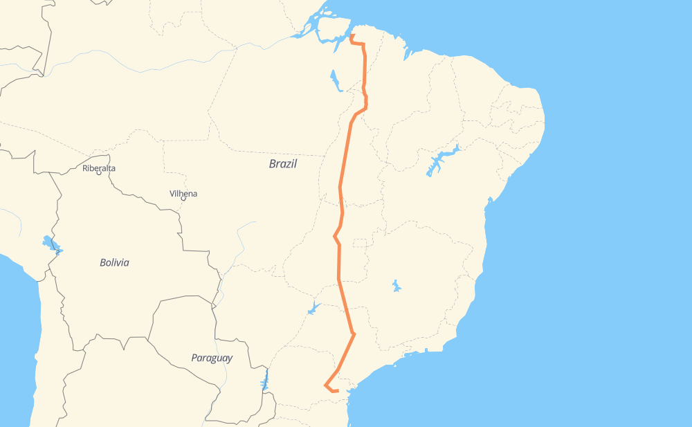
The distance from Belém to Curitiba is 3,213 kilometers by road including 534 kilometers on motorways. Road takes approximately 36 hours and 21 minutes and goes through Açailândia, Goiânia, Campo Largo, Estreito, Serrano II, Santana and Setor Galiléia.
| Shortest distance by air | 2,668 km ✈️ |
| Car route length | 3,213 km 🚗 |
| Driving time | 36 h 21 min |
| Fuel amount | 257.1 L |
| Fuel cost | 455 AUD |
| Point | Distance | Time | Fuel | |
| -1.45056, -48.46825 | 0 km | 00 min | 0.0 L | |
|
BR-010 529 km, 6 h 21 min
|
||||
| Açailândia | 529 km | 6 h 21 min | 82.9 L | |
|
BR-010 182 km, 2 h 08 min
|
||||
| Estreito | 711 km | 8 h 29 min | 97.9 L | |
|
BR-226 BR-153 480 km, 5 h 25 min
|
||||
| Serrano II | 1,191 km | 13 h 55 min | 136.6 L | |
|
BR-153 17 km, 12 min
|
||||
| Santana | 1,208 km | 14 h 07 min | 137.2 L | |
|
BR-153 347 km, 3 h 55 min
|
||||
| Setor Galiléia | 1,556 km | 18 h 02 min | 164.8 L | |
|
BR-153 398 km, 4 h 38 min
|
||||
| Chácara Bom Retiro | 1,954 km | 22 h 41 min | 196.8 L | |
|
GO-080 21 km, 15 min
|
||||
| Goiânia | 1,975 km | 22 h 56 min | 199.3 L | |
|
BR-153 8 km, 05 min
|
||||
| Granjas Reunidas Nossa Senhora de Lourdes | 1,982 km | 23 h 02 min | 199.9 L | |
|
BR-153 1,206 km, 12 h 58 min
|
||||
| Campo Largo | 3,188 km | 36 h 01 min | 295.9 L | |
|
BR-277 28 km, 20 min
|
||||
| Curitiba | 3,217 km | 36 h 21 min | 298.7 L | |
Hotels of Curitiba
Frequently Asked Questions
How much does it cost to drive from Belém to Curitiba?
Fuel cost: 455 AUD
This fuel cost is calculated as: (Route length 3,213 km / 100 km) * (Fuel consumption 8 L/100 km) * (Fuel price 1.77 AUD / L)
You can adjust fuel consumption and fuel price here.
How long is a car ride from Belém to Curitiba?
Driving time: 36 h 21 min
This time is calculated for driving at the maximum permitted speed, taking into account traffic rules restrictions.
- 383 km with a maximum speed 110 km/h = 3 h 28 min
- 75 km with a maximum speed 100 km/h = 45 min
- 1,940 km with a maximum speed 90 km/h = 21 h 33 min
- 770 km with a maximum speed 80 km/h = 9 h 37 min
- 31 km with a maximum speed 60 km/h = 31 min
- 4 km with a maximum speed 50 km/h = 4 min
- 14 km with a maximum speed 40 km/h = 21 min
The calculated driving time does not take into account intermediate stops and traffic jams.
How far is Belém to Curitiba by land?
The distance between Belém and Curitiba is 3,213 km by road including 534 km on motorways.
Precise satellite coordinates of highways were used for this calculation. The start and finish points are the centers of Belém and Curitiba respectively.
How far is Belém to Curitiba by plane?
The shortest distance (air line, as the crow flies) between Belém and Curitiba is 2,668 km.
This distance is calculated using the Haversine formula as a great-circle distance between two points on the surface of a sphere. The start and finish points are the centers of Belém and Curitiba respectively. Actual distance between airports may be different.
How many hours is Belém from Curitiba by plane?
Boeing 737 airliner needs 3 h 20 min to cover the distance of 2,668 km at a cruising speed of 800 km/h.
Small plane "Cessna 172" needs 12 h 7 min to flight this distance at average speed of 220 km/h.
This time is approximate and do not take into account takeoff and landing times, airport location and other real world factors.
How long is a helicopter ride from Belém to Curitiba?
Fast helicopter "Eurocopter AS350" or "Hughes OH-6 Cayuse" need 11 h 7 min to cover the distance of 2,668 km at a cruising speed of 240 km/h.
Popular "Robinson R44" needs 12 h 42 min to flight this distance at average speed of 210 km/h.
This time is approximate and do not take into account takeoff and landing times, aerodrome location and other real world factors.
What city is halfway between Belém and Curitiba?
The halfway point between Belém and Curitiba is Caxias. It is located about 25 km from the exact midpoint by road.
The distance from Caxias to Belém is 1,631 km and driving will take about 18 h 54 min. The road between Caxias and Curitiba has length 1,582 km and will take approximately 17 h 26 min.
The other cities located close to halfway point:
Where is Belém in relation to Curitiba?
Belém is located 2,668 km north of Curitiba.
Belém has geographic coordinates: latitude -1.45056, longitude -48.46825.
Curitiba has geographic coordinates: latitude -25.4296, longitude -49.27127.
Which highway goes from Belém to Curitiba?
The route from Belém to Curitiba follows BR-153, BR-010, SP-255, SP-326, PR-151, BR-222, GO-080, BR-364.
Other minor sections pass along the road:
- BR-226: 99 km
- PA-252: 92 km
- BR-272: 69 km
- BR-376: 67 km
- SP-281: 54 km
- BR-277: 47 km
- PA-483: 47 km
- PA-150: 39 km
- BR-414: 35 km
- PA-155: 34 km
- BR-455: 30 km
- LMG-810: 24 km
- SP-310: 18 km
- BR-262: 13 km
- BR-267: 12 km
- PR-239: 12 km
- PA-140: 11 km
- BR-316: 10 km
- PRC-373: 8 km
- BR-369: 6 km
- PR 151: 3 km
- MGC-455: 3 km
- SP-304: 2 km
- BR-230: 2 km
- SPI 274/310: 2 km