Distance between Branch KS and Beach ND
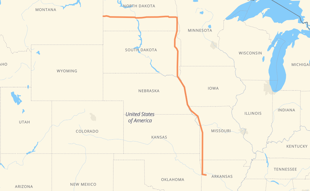
The distance from Branch to Beach is 2,022 kilometers by road including 1,951 kilometers on motorways. Road takes approximately 18 hours and 58 minutes and goes through Fort Smith, Fayetteville, Springdale, Kansas City, Sioux City, Sioux Falls and Brookings.
| Shortest distance by air | 1,539 km ✈️ |
| Car route length | 2,022 km 🚗 |
| Driving time | 18 h 58 min |
| Fuel amount | 161.8 L |
| Fuel cost | 291.2 AUD |
| Point | Distance | Time | Fuel | |
| Branch | 0 km | 00 min | 0.0 L | |
|
AR 22 42 km, 30 min
|
||||
| Fort Smith | 42 km | 30 min | 2.8 L | |
|
US 71 I 49 94 km, 52 min
|
||||
| Fayetteville | 136 km | 1 h 23 min | 10.3 L | |
|
I 49 16 km, 08 min
|
||||
| Springdale | 152 km | 1 h 32 min | 11.7 L | |
|
I 49 US 71 369 km, 3 h 29 min
|
||||
| Kansas City | 521 km | 5 h 01 min | 39.3 L | |
|
US 71 I 29 421 km, 3 h 55 min
|
||||
| Sioux City | 942 km | 8 h 56 min | 73.7 L | |
|
I 29 148 km, 1 h 21 min
|
||||
| Sioux Falls | 1,090 km | 10 h 18 min | 86.5 L | |
|
I 29 86 km, 47 min
|
||||
| Brookings | 1,176 km | 11 h 05 min | 93.9 L | |
|
I 29 73 km, 40 min
|
||||
| Watertown | 1,249 km | 11 h 45 min | 99.6 L | |
|
I 29 221 km, 2 h 00 min
|
||||
| Fargo | 1,470 km | 13 h 46 min | 117.2 L | |
|
I 29 8 km, 05 min
|
||||
| West Fargo | 1,478 km | 13 h 51 min | 118.0 L | |
|
I 94 294 km, 2 h 40 min
|
||||
| Bismarck | 1,772 km | 16 h 32 min | 141.0 L | |
|
I 94 29 km, 16 min
|
||||
| Mandan | 1,801 km | 16 h 48 min | 142.5 L | |
|
I 94 127 km, 1 h 12 min
|
||||
| Dickinson | 1,928 km | 18 h 01 min | 153.5 L | |
|
I 94 103 km, 56 min
|
||||
| Beach | 2,031 km | 18 h 57 min | 162.3 L | |
Hotels of Beach
Frequently Asked Questions
How much does it cost to drive from Branch to Beach?
Fuel cost: 291.2 AUD
This fuel cost is calculated as: (Route length 2,022 km / 100 km) * (Fuel consumption 8 L/100 km) * (Fuel price 1.8 AUD / L)
You can adjust fuel consumption and fuel price here.
How long is a car ride from Branch to Beach?
Driving time: 18 h 58 min
This time is calculated for driving at the maximum permitted speed, taking into account traffic rules restrictions.
- 1,762 km with a maximum speed 110 km/h = 16 h 1 min
- 111 km with a maximum speed 105 km/h = 1 h 3 min
- 8 km with a maximum speed 100 km/h = 4 min
- 12 km with a maximum speed 97 km/h = 7 min
- 11 km with a maximum speed 90 km/h = 7 min
- 41 km with a maximum speed 89 km/h = 27 min
- 68 km with a maximum speed 80 km/h = 51 min
- 16 km with a maximum speed 72 km/h = 13 min
- 1 km with a maximum speed 56 km/h = 1 min
The calculated driving time does not take into account intermediate stops and traffic jams.
How far is Branch to Beach by land?
The distance between Branch and Beach is 2,022 km by road including 1,951 km on motorways.
Precise satellite coordinates of highways were used for this calculation. The start and finish points are the centers of Branch and Beach respectively.
How far is Branch to Beach by plane?
The shortest distance (air line, as the crow flies) between Branch and Beach is 1,539 km.
This distance is calculated using the Haversine formula as a great-circle distance between two points on the surface of a sphere. The start and finish points are the centers of Branch and Beach respectively. Actual distance between airports may be different.
How many hours is Branch from Beach by plane?
Boeing 737 airliner needs 1 h 55 min to cover the distance of 1,539 km at a cruising speed of 800 km/h.
Small plane "Cessna 172" needs 6 h 59 min to flight this distance at average speed of 220 km/h.
This time is approximate and do not take into account takeoff and landing times, airport location and other real world factors.
How long is a helicopter ride from Branch to Beach?
Fast helicopter "Eurocopter AS350" or "Hughes OH-6 Cayuse" need 6 h 24 min to cover the distance of 1,539 km at a cruising speed of 240 km/h.
Popular "Robinson R44" needs 7 h 19 min to flight this distance at average speed of 210 km/h.
This time is approximate and do not take into account takeoff and landing times, aerodrome location and other real world factors.
What city is halfway between Branch and Beach?
The halfway point between Branch and Beach is Jefferson. It is located about 31 km from the exact midpoint by road.
The distance from Jefferson to Branch is 980 km and driving will take about 9 h 18 min. The road between Jefferson and Beach has length 1,042 km and will take approximately 9 h 40 min.
The other cities located close to halfway point:
Where is Branch in relation to Beach?
Branch is located 1,539 km south-east of Beach.
Branch has geographic coordinates: latitude 35.30565, longitude -93.95354.
Beach has geographic coordinates: latitude 46.91807, longitude -104.00437.
Which highway goes from Branch to Beach?
The route from Branch to Beach follows I 29, I 94, US 71, I 49, US 81, US 52.
Other minor sections pass along the road:
- AR 22: 40 km
- US 83: 36 km
- US 62: 35 km
- US 275: 18 km
- SD 20: 18 km
- I 540: 12 km
- ND 3: 12 km
- I 49 Business: 11 km
- MO 171: 11 km
- MO 249: 9 km
- US 169: 8 km
- ND 1: 8 km
- US 59: 7 km
- I 40: 7 km
- I 435: 4 km
- US 18: 4 km
- ND 22 Bypass: 4 km
- MO 7: 4 km
- US 52 Truck: 3 km
- MO 96: 2 km
- US 281 Truck: 2 km
- US 24: 2 km
- US 40: 2 km
- I 70: 2 km
- ND 16: 2 km
- AR 16: 2 km
- AR 12: 2 km
- MO 52: 2 km
- MO 2: 1 km