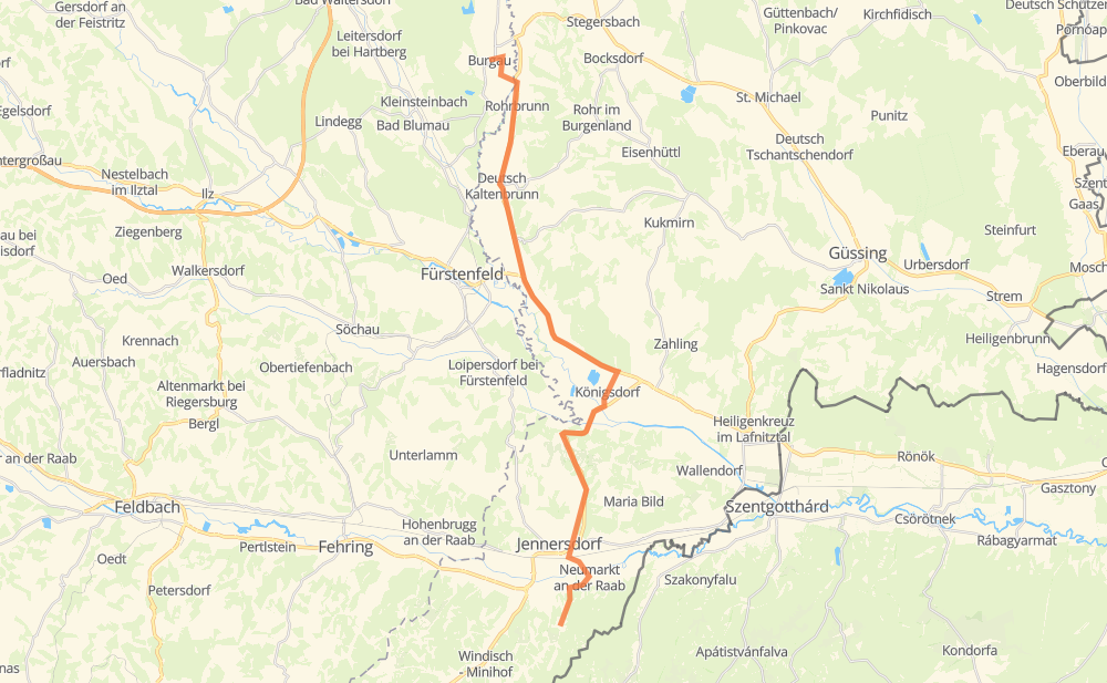
Distance between Burgau and Eisenberg an der Raab
The distance from Burgau to Eisenberg an der Raab is 34 kilometers by road. Road takes approximately 31 minutes and goes through Jennersdorf, Rohrbrunn, Deutsch Kaltenbrunn, Rudersdorf, Dobersdorf, Königsdorf and Neumarkt an der Raab.
| Shortest distance by air | 27 km ✈️ |
| Car route length | 34 km 🚗 |
| Driving time | 31 min |
| Fuel amount | 2.7 L |
| Fuel cost | 4.9 AUD |
| Point | Distance | Time | Fuel | |
| Burgau | 0 km | 00 min | 0.0 L | |
|
L402 B57a 4 km, 05 min
|
||||
| Rohrbrunn | 4 km | 05 min | 0.2 L | |
|
B57a 3 km, 02 min
|
||||
| Deutsch Kaltenbrunn | 7 km | 08 min | 0.4 L | |
|
B57a 6 km, 04 min
|
||||
| Rudersdorf | 12 km | 12 min | 1.0 L | |
|
B65 4 km, 02 min
|
||||
| Dobersdorf | 16 km | 15 min | 1.1 L | |
|
B65 4 km, 03 min
|
||||
| Königsdorf | 20 km | 18 min | 1.5 L | |
|
L414 B57 6 km, 05 min
|
||||
| Jennersdorf | 26 km | 23 min | 1.7 L | |
|
B57 L426 5 km, 04 min
|
||||
| Neumarkt an der Raab | 31 km | 28 min | 2.5 L | |
|
L255 3 km, 02 min
|
||||
| Eisenberg an der Raab | 34 km | 30 min | 2.7 L | |
Frequently Asked Questions
How much does it cost to drive from Burgau to Eisenberg an der Raab?
Fuel cost: 4.9 AUD
This fuel cost is calculated as: (Route length 34 km / 100 km) * (Fuel consumption 8 L/100 km) * (Fuel price 1.8 AUD / L)
You can adjust fuel consumption and fuel price here.
How long is a car ride from Burgau to Eisenberg an der Raab?
Driving time: 31 min
This time is calculated for driving at the maximum permitted speed, taking into account traffic rules restrictions.
- 12 km with a maximum speed 90 km/h = 7 min
- 13 km with a maximum speed 80 km/h = 9 min
- 8 km with a maximum speed 50 km/h = 9 min
- 1 km with a maximum speed 20 km/h = 3 min
The calculated driving time does not take into account intermediate stops and traffic jams.
How far is Burgau to Eisenberg an der Raab by land?
The distance between Burgau and Eisenberg an der Raab is 34 km by road.
Precise satellite coordinates of highways were used for this calculation. The start and finish points are the centers of Burgau and Eisenberg an der Raab respectively.
What city is halfway between Burgau and Eisenberg an der Raab?
The halfway point between Burgau and Eisenberg an der Raab is Dobersdorf. It is located about 1 km from the exact midpoint by road.
The distance from Dobersdorf to Burgau is 16 km and driving will take about 15 min. The road between Dobersdorf and Eisenberg an der Raab has length 18 km and will take approximately 15 min.
The other cities located close to halfway point:
Where is Burgau in relation to Eisenberg an der Raab?
Burgau is located 27 km north of Eisenberg an der Raab.
Burgau has geographic coordinates: latitude 47.14317, longitude 16.09861.
Eisenberg an der Raab has geographic coordinates: latitude 46.90666, longitude 16.14181.