Distance between Campos and Rio
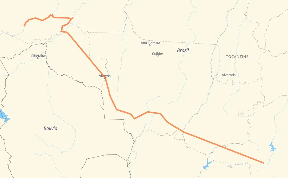
The distance from Campos to Rio is 3,974 kilometers by road including 132 kilometers on motorways. Road takes approximately 75 hours and 47 minutes and goes through Ariquemes, Porto Velho, Distrito Industrial, Condomínio Via Verde, Santa Juliana, Tocantins and Dona Zulmira.
| Shortest distance by air | 2,646 km ✈️ |
| Car route length | 3,974 km 🚗 |
| Driving time | 75 h 47 min |
| Fuel amount | 317.9 L |
| Fuel cost | 569.1 AUD |
| Point | Distance | Time | Fuel | |
| -19.99820, -45.98355 | 0 km | 00 min | 0.0 L | |
|
BR-262 161 km, 1 h 55 min
|
||||
| Distrito Industrial | 161 km | 1 h 55 min | 25.6 L | |
|
BR-452 4 km, 02 min
|
||||
| Condomínio Via Verde | 165 km | 1 h 58 min | 25.8 L | |
|
BR-452 73 km, 51 min
|
||||
| Santa Juliana | 237 km | 2 h 49 min | 31.1 L | |
|
BR-452 111 km, 1 h 13 min
|
||||
| Tocantins | 348 km | 4 h 03 min | 39.8 L | |
|
BR-365 MG-452 48 km, 31 min
|
||||
| Tupaciguara | 396 km | 4 h 34 min | 43.3 L | |
|
BR-452 BR-364 758 km, 8 h 39 min
|
||||
| Vila Goulart | 1,154 km | 13 h 14 min | 105.0 L | |
|
BR-364 BR-163 93 km, 1 h 06 min
|
||||
| Jaciara | 1,247 km | 14 h 21 min | 110.8 L | |
|
BR-163 142 km, 1 h 38 min
|
||||
| Novo Mundo | 1,389 km | 15 h 59 min | 123.3 L | |
|
BR-070 BR-174 1,223 km, 15 h 05 min
|
||||
| Ariquemes | 2,612 km | 31 h 04 min | 219.8 L | |
|
BR-364 217 km, 2 h 37 min
|
||||
| Porto Velho | 2,830 km | 33 h 41 min | 239.0 L | |
|
BR-319 BR-230 1,149 km, 42 h 05 min
|
||||
| -8.21956, -67.34284 | 3,978 km | 75 h 47 min | 331.1 L | |
Frequently Asked Questions
How much does it cost to drive from Campos to Rio?
Fuel cost: 569.1 AUD
This fuel cost is calculated as: (Route length 3,974 km / 100 km) * (Fuel consumption 8 L/100 km) * (Fuel price 1.79 AUD / L)
You can adjust fuel consumption and fuel price here.
How long is a car ride from Campos to Rio?
Driving time: 75 h 47 min
This time is calculated for driving at the maximum permitted speed, taking into account traffic rules restrictions.
- 44 km with a maximum speed 110 km/h = 24 min
- 69 km with a maximum speed 100 km/h = 41 min
- 1,606 km with a maximum speed 90 km/h = 17 h 50 min
- 1,401 km with a maximum speed 80 km/h = 17 h 31 min
- 19 km with a maximum speed 60 km/h = 19 min
- 93 km with a maximum speed 50 km/h = 1 h 52 min
- 3 km with a maximum speed 40 km/h = 5 min
- 741 km with a maximum speed 20 km/h = 37 h 3 min
The calculated driving time does not take into account intermediate stops and traffic jams.
How far is Campos to Rio by land?
The distance between Campos and Rio is 3,974 km by road including 132 km on motorways.
Precise satellite coordinates of highways were used for this calculation. The start and finish points are the centers of Campos and Rio respectively.
How far is Campos to Rio by plane?
The shortest distance (air line, as the crow flies) between Campos and Rio is 2,646 km.
This distance is calculated using the Haversine formula as a great-circle distance between two points on the surface of a sphere. The start and finish points are the centers of Campos and Rio respectively. Actual distance between airports may be different.
How many hours is Campos from Rio by plane?
Boeing 737 airliner needs 3 h 18 min to cover the distance of 2,646 km at a cruising speed of 800 km/h.
Small plane "Cessna 172" needs 12 h 1 min to flight this distance at average speed of 220 km/h.
This time is approximate and do not take into account takeoff and landing times, airport location and other real world factors.
How long is a helicopter ride from Campos to Rio?
Fast helicopter "Eurocopter AS350" or "Hughes OH-6 Cayuse" need 11 h 1 min to cover the distance of 2,646 km at a cruising speed of 240 km/h.
Popular "Robinson R44" needs 12 h 36 min to flight this distance at average speed of 210 km/h.
This time is approximate and do not take into account takeoff and landing times, aerodrome location and other real world factors.
What city is halfway between Campos and Rio?
The halfway point between Campos and Rio is Comodoro. It is located about 4 km from the exact midpoint by road.
The distance from Comodoro to Campos is 1,983 km and driving will take about 22 h 53 min. The road between Comodoro and Rio has length 1,991 km and will take approximately 52 h 53 min.
The other cities located close to halfway point:
Where is Campos in relation to Rio?
Campos is located 2,646 km south-east of Rio.
Campos has geographic coordinates: latitude -19.9982, longitude -45.98355.
Rio has geographic coordinates: latitude -8.21956, longitude -67.34284.
Which highway goes from Campos to Rio?
The route from Campos to Rio follows BR-364, BR-174, BR-452, BR-070, BR-230, BR-163, BR-319, BR-262.
Other minor sections pass along the road:
- BR-060: 96 km
- MG-452: 73 km
- BR-354: 45 km
- BR-365: 40 km
- MT-407: 16 km
- BR-153: 7 km
- MT-100: 7 km
- BR-158: 5 km
- BR-050: 5 km
- MGC-452: 2 km