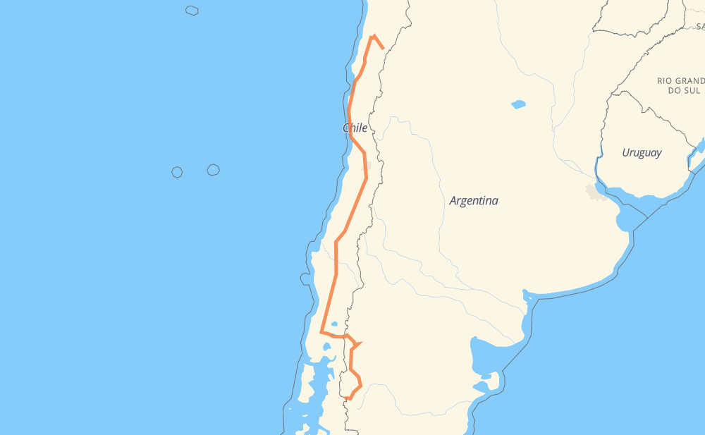
Distance between Carrizalillo and Futaleufú
The distance from Carrizalillo to Futaleufú is 2,426 kilometers by road including 1,685 kilometers on motorways. Road takes approximately 24 hours and 59 minutes and goes through Copiapó, Vallenar, La Serena, Coquimbo, Ovalle, Colina and San Bernardo.
| Shortest distance by air | 1,684 km ✈️ |
| Car route length | 2,426 km 🚗 |
| Driving time | 24 h 59 min |
| Fuel amount | 194 L |
| Fuel cost | 349.3 AUD |
| Point | Distance | Time | Fuel | |
| -28.13333, -69.80000 | 0 km | 00 min | 0.0 L | |
|
C-350 138 km, 1 h 38 min
|
||||
| Copiapó | 138 km | 1 h 38 min | 16.3 L | |
|
5 123 km, 1 h 18 min
|
||||
| Vallenar | 260 km | 2 h 56 min | 22.1 L | |
|
5 158 km, 1 h 40 min
|
||||
| La Serena | 418 km | 4 h 37 min | 40.2 L | |
|
5 48 km, 31 min
|
||||
| Coquimbo | 467 km | 5 h 08 min | 43.0 L | |
|
5 79 km, 44 min
|
||||
| Ovalle | 546 km | 5 h 53 min | 47.9 L | |
|
5 374 km, 3 h 30 min
|
||||
| San Bernardo | 920 km | 9 h 24 min | 81.0 L | |
|
5 65 km, 36 min
|
||||
| Rancagua | 985 km | 10 h 00 min | 86.6 L | |
|
5 47 km, 25 min
|
||||
| San Fernando | 1,032 km | 10 h 26 min | 90.0 L | |
|
5 55 km, 31 min
|
||||
| Curicó | 1,088 km | 10 h 58 min | 94.5 L | |
|
5 64 km, 35 min
|
||||
| Talca | 1,152 km | 11 h 34 min | 99.6 L | |
|
5 49 km, 26 min
|
||||
| Linares | 1,201 km | 12 h 00 min | 103.7 L | |
|
5 100 km, 55 min
|
||||
| Chillán | 1,301 km | 12 h 56 min | 111.8 L | |
|
5 105 km, 57 min
|
||||
| Los Ángeles | 1,406 km | 13 h 53 min | 118.6 L | |
|
5 160 km, 1 h 28 min
|
||||
| Temuco | 1,565 km | 15 h 22 min | 133.3 L | |
|
5 265 km, 2 h 31 min
|
||||
| Osorno | 1,831 km | 17 h 53 min | 153.4 L | |
|
215-CH 236 km, 2 h 56 min
|
||||
| San Carlos de Bariloche | 2,067 km | 20 h 49 min | 173.0 L | |
|
RP237 RN40 359 km, 4 h 09 min
|
||||
| Futaleufú | 2,426 km | 24 h 59 min | 202.1 L | |
Hotels of Futaleufú
Frequently Asked Questions
How much does it cost to drive from Carrizalillo to Futaleufú?
Fuel cost: 349.3 AUD
This fuel cost is calculated as: (Route length 2,426 km / 100 km) * (Fuel consumption 8 L/100 km) * (Fuel price 1.8 AUD / L)
You can adjust fuel consumption and fuel price here.
How long is a car ride from Carrizalillo to Futaleufú?
Driving time: 24 h 59 min
This time is calculated for driving at the maximum permitted speed, taking into account traffic rules restrictions.
- 1,220 km with a maximum speed 110 km/h = 11 h 5 min
- 360 km with a maximum speed 100 km/h = 3 h 36 min
- 421 km with a maximum speed 90 km/h = 4 h 40 min
- 356 km with a maximum speed 80 km/h = 4 h 26 min
- 5 km with a maximum speed 70 km/h = 4 min
- 51 km with a maximum speed 60 km/h = 51 min
- 9 km with a maximum speed 50 km/h = 10 min
- 2 km with a maximum speed 40 km/h = 3 min
The calculated driving time does not take into account intermediate stops and traffic jams.
How far is Carrizalillo to Futaleufú by land?
The distance between Carrizalillo and Futaleufú is 2,426 km by road including 1,685 km on motorways.
Precise satellite coordinates of highways were used for this calculation. The start and finish points are the centers of Carrizalillo and Futaleufú respectively.
How far is Carrizalillo to Futaleufú by plane?
The shortest distance (air line, as the crow flies) between Carrizalillo and Futaleufú is 1,684 km.
This distance is calculated using the Haversine formula as a great-circle distance between two points on the surface of a sphere. The start and finish points are the centers of Carrizalillo and Futaleufú respectively. Actual distance between airports may be different.
How many hours is Carrizalillo from Futaleufú by plane?
Boeing 737 airliner needs 2 h 6 min to cover the distance of 1,684 km at a cruising speed of 800 km/h.
Small plane "Cessna 172" needs 7 h 39 min to flight this distance at average speed of 220 km/h.
This time is approximate and do not take into account takeoff and landing times, airport location and other real world factors.
How long is a helicopter ride from Carrizalillo to Futaleufú?
Fast helicopter "Eurocopter AS350" or "Hughes OH-6 Cayuse" need 7 h 1 min to cover the distance of 1,684 km at a cruising speed of 240 km/h.
Popular "Robinson R44" needs 8 h 1 min to flight this distance at average speed of 210 km/h.
This time is approximate and do not take into account takeoff and landing times, aerodrome location and other real world factors.
What city is halfway between Carrizalillo and Futaleufú?
The halfway point between Carrizalillo and Futaleufú is Longaví. It is located about 2 km from the exact midpoint by road.
The distance from Longaví to Carrizalillo is 1,214 km and driving will take about 12 h 7 min. The road between Longaví and Futaleufú has length 1,211 km and will take approximately 12 h 52 min.
The other cities located close to halfway point:
Where is Carrizalillo in relation to Futaleufú?
Carrizalillo is located 1,684 km north of Futaleufú.
Carrizalillo has geographic coordinates: latitude -28.13333, longitude -69.8.
Futaleufú has geographic coordinates: latitude -43.18577, longitude -71.8667.
Which highway goes from Carrizalillo to Futaleufú?
The route from Carrizalillo to Futaleufú follows 5, RN40, 215-CH.
Other minor sections pass along the road:
- C-350: 90 km
- RN259: 55 km
- RN231: 31 km
- C-411: 25 km
- 74: 21 km
- 231-CH: 10 km
- RP34: 8 km
- RP237: 6 km
- C-535: 5 km
- C-33: 4 km
- RP71: 2 km