Distance between Ciudad Acuña and Ramos Arizpe
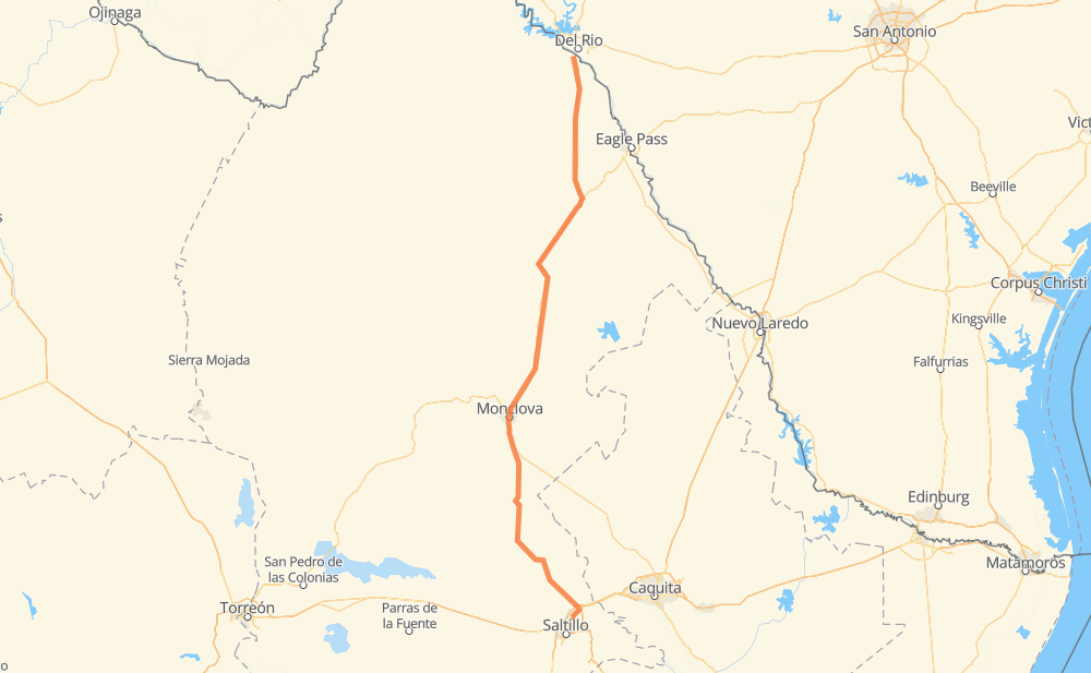
The distance from Ciudad Acuña to Ramos Arizpe is 476 kilometers by road including 60 kilometers on motorways. Road takes approximately 5 hours and 23 minutes and goes through Monclova, San Carlos, Allende, Nueva Rosita, Sabinas and Castaños.
| Shortest distance by air | 420 km ✈️ |
| Car route length | 476 km 🚗 |
| Driving time | 5 h 23 min |
| Fuel amount | 38.1 L |
| Fuel cost | 67 AUD |
| Toll roads cost | 0 + ? |
| Point | Distance | Time | Fuel | |
| Ciudad Acuña | 0 km | 00 min | 0.0 L | |
|
MEX 2 5 km, 03 min
|
||||
| Las Torres | 5 km | 03 min | 0.2 L | |
|
MEX 29 32 km, 21 min
|
||||
| San Carlos | 37 km | 25 min | 2.1 L | |
|
MEX 29 58 km, 40 min
|
||||
| Zaragoza | 94 km | 1 h 05 min | 7.5 L | |
|
MEX 29 18 km, 13 min
|
||||
| Allende | 112 km | 1 h 18 min | 8.7 L | |
|
MEX 57 MEX 57D 54 km, 30 min
|
||||
| Nueva Rosita | 166 km | 1 h 49 min | 12.8 L | |
|
MEX 57D MEX 57 13 km, 08 min
|
||||
| Sabinas | 179 km | 1 h 57 min | 13.9 L | |
|
MEX 57 115 km, 1 h 19 min
|
||||
| Monclova | 294 km | 3 h 16 min | 23.1 L | |
|
MEX 57 12 km, 09 min
|
||||
| Castaños | 307 km | 3 h 26 min | 24.2 L | |
|
MEX 57 169 km, 1 h 56 min
|
||||
| Ramos Arizpe | 476 km | 5 h 23 min | 37.8 L | |
Hotels of Ramos Arizpe
Frequently Asked Questions
How many toll booths are there from Ciudad Acuña to Ramos Arizpe?
There are 1 tollbooth between Ciudad Acuña and Ramos Arizpe: Autopista Premier.
How much does the toll booths cost from Ciudad Acuña to Ramos Arizpe?
Toll roads cost: Autopista Premier (?) = 0 + ?
How much does it cost to drive from Ciudad Acuña to Ramos Arizpe?
Fuel cost: 67 AUD
This fuel cost is calculated as: (Route length 476 km / 100 km) * (Fuel consumption 8 L/100 km) * (Fuel price 1.76 AUD / L)
You can adjust fuel consumption and fuel price here.
Toll roads cost: 0 + ?
How long is a car ride from Ciudad Acuña to Ramos Arizpe?
Driving time: 5 h 23 min
This time is calculated for driving at the maximum permitted speed, taking into account traffic rules restrictions.
- 52 km with a maximum speed 110 km/h = 28 min
- 5 km with a maximum speed 100 km/h = 3 min
- 339 km with a maximum speed 90 km/h = 3 h 45 min
- 70 km with a maximum speed 80 km/h = 52 min
- 1 km with a maximum speed 60 km/h = 1 min
- 6 km with a maximum speed 50 km/h = 7 min
- 2 km with a maximum speed 30 km/h = 4 min
The calculated driving time does not take into account intermediate stops and traffic jams.
How far is Ciudad Acuña to Ramos Arizpe by land?
The distance between Ciudad Acuña and Ramos Arizpe is 476 km by road including 60 km on motorways.
Precise satellite coordinates of highways were used for this calculation. The start and finish points are the centers of Ciudad Acuña and Ramos Arizpe respectively.
How far is Ciudad Acuña to Ramos Arizpe by plane?
The shortest distance (air line, as the crow flies) between Ciudad Acuña and Ramos Arizpe is 420 km.
This distance is calculated using the Haversine formula as a great-circle distance between two points on the surface of a sphere. The start and finish points are the centers of Ciudad Acuña and Ramos Arizpe respectively. Actual distance between airports may be different.
How many hours is Ciudad Acuña from Ramos Arizpe by plane?
Boeing 737 airliner needs 31 min to cover the distance of 420 km at a cruising speed of 800 km/h.
Small plane "Cessna 172" needs 1 h 54 min to flight this distance at average speed of 220 km/h.
This time is approximate and do not take into account takeoff and landing times, airport location and other real world factors.
How long is a helicopter ride from Ciudad Acuña to Ramos Arizpe?
Fast helicopter "Eurocopter AS350" or "Hughes OH-6 Cayuse" need 1 h 45 min to cover the distance of 420 km at a cruising speed of 240 km/h.
Popular "Robinson R44" needs 2 h to flight this distance at average speed of 210 km/h.
This time is approximate and do not take into account takeoff and landing times, aerodrome location and other real world factors.
What city is halfway between Ciudad Acuña and Ramos Arizpe?
The halfway point between Ciudad Acuña and Ramos Arizpe is Ejido Primero de Mayo. It is located about 13 km from the exact midpoint by road.
The distance from Ejido Primero de Mayo to Ciudad Acuña is 251 km and driving will take about 2 h 46 min. The road between Ejido Primero de Mayo and Ramos Arizpe has length 225 km and will take approximately 2 h 36 min.
The other cities located close to halfway point:
Where is Ciudad Acuña in relation to Ramos Arizpe?
Ciudad Acuña is located 420 km north of Ramos Arizpe.
Ciudad Acuña has geographic coordinates: latitude 29.3182, longitude -100.93588.
Ramos Arizpe has geographic coordinates: latitude 25.54079, longitude -100.94667.
Which highway goes from Ciudad Acuña to Ramos Arizpe?
The route from Ciudad Acuña to Ramos Arizpe follows MEX 57, MEX 29.
Other minor sections pass along the road:
- MEX 57D: 52 km
- MEX 40: 8 km
- MEX 2: 3 km