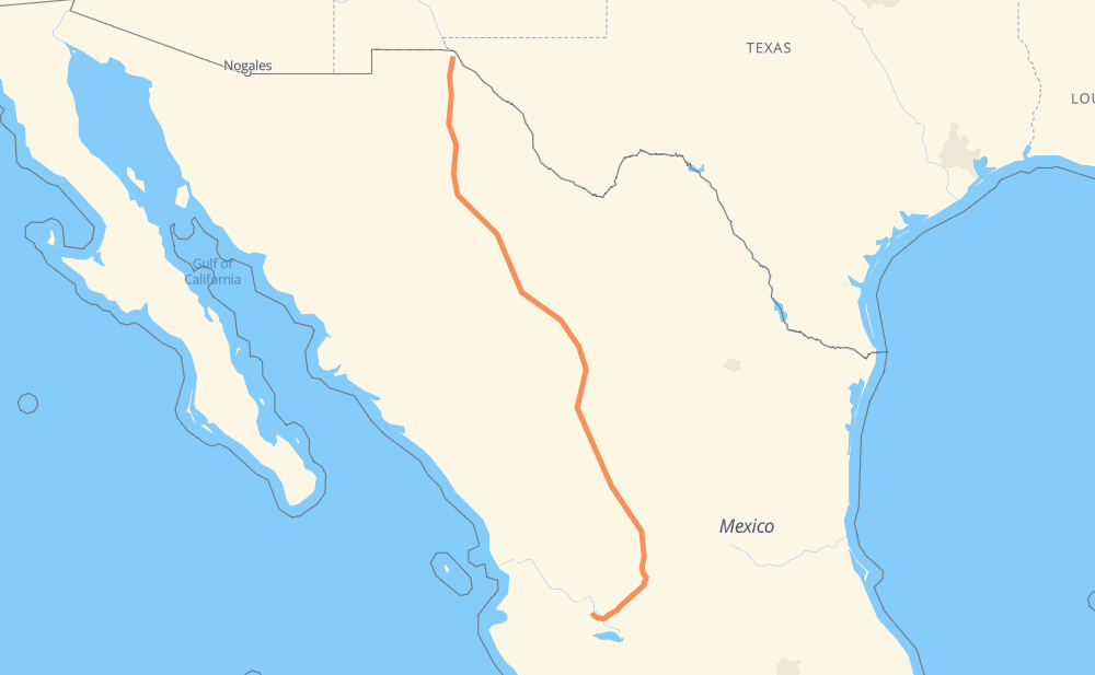
Distance between Ciudad Juárez and Zapopan
The distance from Ciudad Juárez to Zapopan is 1,543 kilometers by road including 609 kilometers on motorways. Road takes approximately 16 hours and 32 minutes and goes through Delicias, Camargo, Jiménez, Fresnillo, Aguascalientes, Tonalá and Guadalajara.
| Shortest distance by air | 1,253 km ✈️ |
| Car route length | 1,543 km 🚗 |
| Driving time | 16 h 32 min |
| Fuel amount | 123.4 L |
| Fuel cost | 218.5 AUD |
| Toll roads cost | 1,605 + ? MXN |
| Point | Distance | Time | Fuel | |
| Ciudad Juárez | 0 km | 00 min | 0.0 L | |
|
MEX 45 117 km, 1 h 20 min
|
||||
| Villa Ahumada | 117 km | 1 h 20 min | 8.7 L | |
|
MEX 45 331 km, 3 h 42 min
|
||||
| Delicias | 448 km | 5 h 02 min | 35.4 L | |
|
MEX 45 MEX 45D 69 km, 40 min
|
||||
| Camargo | 517 km | 5 h 43 min | 40.9 L | |
|
CHIH 187 MEX 45D 45 km, 28 min
|
||||
| Jiménez | 562 km | 6 h 11 min | 42.4 L | |
|
MEX 45D MEX 49D 576 km, 6 h 01 min
|
||||
| Fresnillo | 1,138 km | 12 h 13 min | 90.2 L | |
|
MEX 45D 178 km, 1 h 58 min
|
||||
| Aguascalientes | 1,316 km | 14 h 12 min | 104.9 L | |
|
MEX 70 MEX 80D 202 km, 2 h 01 min
|
||||
| Tonalá | 1,518 km | 16 h 13 min | 120.8 L | |
|
MEX 15D MEX 80 16 km, 11 min
|
||||
| Guadalajara | 1,534 km | 16 h 25 min | 122.5 L | |
|
MEX 23 9 km, 06 min
|
||||
| Zapopan | 1,543 km | 16 h 32 min | 123.4 L | |
Hotels of Zapopan
Frequently Asked Questions
How many toll booths are there from Ciudad Juárez to Zapopan?
There are 20 toll booths between Ciudad Juárez and Zapopan: Villa Ahumada, Sacramento, Libramiento Oriente de Chihuahua - Sacramento, Libramiento Oriente de Chihuahua - Jimenez, Saucillo, Camargo, Jimenez, Savalza, León Guzmán, Ceballos, Bermejillo, Cuencame, Morfín Chávez, Calera, Veta Grande, Zacatecas, Encarnacion De Diaz, Jalostotitlan, Tepatitlan and La Joya.
How much does the toll booths cost from Ciudad Juárez to Zapopan?
Toll roads cost: Villa Ahumada (188 MXN) + Sacramento (71 MXN) + Libramiento Oriente de Chihuahua - Sacramento (36 MXN) + Libramiento Oriente de Chihuahua - Jimenez (35 MXN) + Saucillo (71 MXN) + Camargo (71 MXN) + Jimenez (97 MXN) + Savalza (71 MXN) + Ceballos (145 MXN) + Bermejillo (127 MXN) + León Guzmán (?) + Cuencame (?) + Morfín Chávez (40 MXN) + Calera (23 MXN) + Veta Grande (48 MXN) + Zacatecas (41 MXN) + Encarnacion De Diaz (150 MXN) + Jalostotitlan (177 MXN) + Tepatitlan (214 MXN) + La Joya (?) = 1,605 + ? MXN
How much does it cost to drive from Ciudad Juárez to Zapopan?
Fuel cost: 218.5 AUD
This fuel cost is calculated as: (Route length 1,543 km / 100 km) * (Fuel consumption 8 L/100 km) * (Fuel price 1.77 AUD / L)
You can adjust fuel consumption and fuel price here.
Toll roads cost: 1,605 + ? MXN
How long is a car ride from Ciudad Juárez to Zapopan?
Driving time: 16 h 32 min
This time is calculated for driving at the maximum permitted speed, taking into account traffic rules restrictions.
- 274 km with a maximum speed 110 km/h = 2 h 29 min
- 307 km with a maximum speed 100 km/h = 3 h 4 min
- 856 km with a maximum speed 90 km/h = 9 h 30 min
- 83 km with a maximum speed 80 km/h = 1 h 2 min
- 15 km with a maximum speed 60 km/h = 15 min
- 5 km with a maximum speed 50 km/h = 5 min
- 1 km with a maximum speed 40 km/h = 1 min
- 1 km with a maximum speed 30 km/h = 2 min
The calculated driving time does not take into account intermediate stops and traffic jams.
How far is Ciudad Juárez to Zapopan by land?
The distance between Ciudad Juárez and Zapopan is 1,543 km by road including 609 km on motorways.
Precise satellite coordinates of highways were used for this calculation. The start and finish points are the centers of Ciudad Juárez and Zapopan respectively.
How far is Ciudad Juárez to Zapopan by plane?
The shortest distance (air line, as the crow flies) between Ciudad Juárez and Zapopan is 1,253 km.
This distance is calculated using the Haversine formula as a great-circle distance between two points on the surface of a sphere. The start and finish points are the centers of Ciudad Juárez and Zapopan respectively. Actual distance between airports may be different.
How many hours is Ciudad Juárez from Zapopan by plane?
Boeing 737 airliner needs 1 h 33 min to cover the distance of 1,253 km at a cruising speed of 800 km/h.
Small plane "Cessna 172" needs 5 h 41 min to flight this distance at average speed of 220 km/h.
This time is approximate and do not take into account takeoff and landing times, airport location and other real world factors.
How long is a helicopter ride from Ciudad Juárez to Zapopan?
Fast helicopter "Eurocopter AS350" or "Hughes OH-6 Cayuse" need 5 h 13 min to cover the distance of 1,253 km at a cruising speed of 240 km/h.
Popular "Robinson R44" needs 5 h 58 min to flight this distance at average speed of 210 km/h.
This time is approximate and do not take into account takeoff and landing times, aerodrome location and other real world factors.
What city is halfway between Ciudad Juárez and Zapopan?
The halfway point between Ciudad Juárez and Zapopan is Bermejillo. It is located about 4 km from the exact midpoint by road.
The distance from Bermejillo to Ciudad Juárez is 767 km and driving will take about 8 h 16 min. The road between Bermejillo and Zapopan has length 776 km and will take approximately 8 h 15 min.
The other cities located close to halfway point:
Where is Ciudad Juárez in relation to Zapopan?
Ciudad Juárez is located 1,253 km north-west of Zapopan.
Ciudad Juárez has geographic coordinates: latitude 31.65465, longitude -106.42911.
Zapopan has geographic coordinates: latitude 20.7211, longitude -103.39112.
Which highway goes from Ciudad Juárez to Zapopan?
The route from Ciudad Juárez to Zapopan follows MEX 45, MEX 45D, MEX 49D, MEX 49, MEX 80D.
Other minor sections pass along the road:
- MEX 40D: 85 km
- MEX 70: 73 km
- MEX 15D: 17 km
- MEX 40: 9 km
- CHIH 187: 6 km
- MEX 90D: 3 km
- MEX 40D:MEX 49D: 3 km
- MEX 23: 3 km
- MEX 80: 2 km
- MEX 54: 1 km
- CHIH 69: 1 km