Distance between Ciudad Valles and Colonia Chapultepec
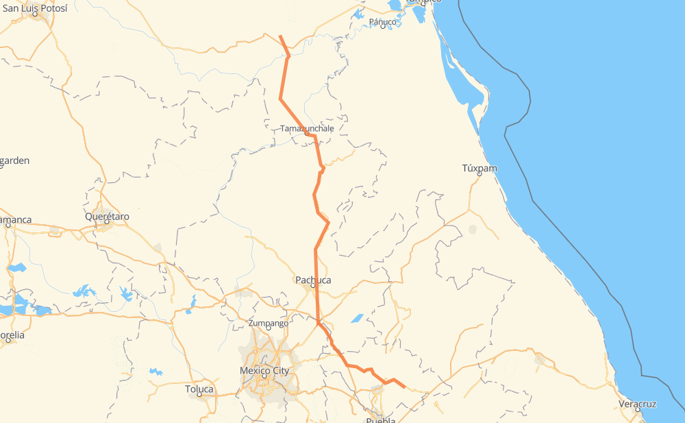
The distance from Ciudad Valles to Colonia Chapultepec is 459 kilometers by road including 51 kilometers on motorways. Road takes approximately 6 hours and 8 minutes and goes through Pachuca, Tancahuitz de Santos, Matlapa, Tamazunchale, Santiago Tolman and San Miguel Atepoxco.
| Shortest distance by air | 313 km ✈️ |
| Car route length | 459 km 🚗 |
| Driving time | 6 h 8 min |
| Fuel amount | 36.7 L |
| Fuel cost | 66.1 AUD |
| Toll roads cost | 0 + ? |
| Point | Distance | Time | Fuel | |
| Ciudad Valles | 0 km | 00 min | 0.0 L | |
|
MEX 85 24 km, 19 min
|
||||
| El Pujal | 24 km | 19 min | 1.2 L | |
|
MEX 85 25 km, 18 min
|
||||
| Tancahuitz de Santos | 48 km | 37 min | 2.6 L | |
|
MEX 85 22 km, 16 min
|
||||
| Huichihuayán | 71 km | 54 min | 5.1 L | |
|
MEX 85 17 km, 12 min
|
||||
| Matlapa | 88 km | 1 h 07 min | 6.3 L | |
|
MEX 85 16 km, 11 min
|
||||
| Tamazunchale | 104 km | 1 h 19 min | 7.9 L | |
|
MEX 85 MEX 102 8 km, 06 min
|
||||
| El Piñal | 112 km | 1 h 25 min | 8.8 L | |
|
MEX 102 16 km, 14 min
|
||||
| Temango | 129 km | 1 h 40 min | 9.8 L | |
|
MEX 105 213 km, 2 h 51 min
|
||||
| Pachuca | 342 km | 4 h 31 min | 26.7 L | |
|
MEX 88 35 km, 26 min
|
||||
| Santiago Tolman | 377 km | 4 h 57 min | 30.1 L | |
|
MEX 132 MEX 136 107 km, 1 h 10 min
|
||||
| 19.34462, -98.00272 | 484 km | 6 h 08 min | 38.7 L | |
Frequently Asked Questions
How many toll booths are there from Ciudad Valles to Colonia Chapultepec?
There are 2 toll booths between Ciudad Valles and Colonia Chapultepec: Tulancingo and Sanctorum.
How much does the toll booths cost from Ciudad Valles to Colonia Chapultepec?
Toll roads cost: Tulancingo (?) + Sanctorum (?) = 0 + ?
How much does it cost to drive from Ciudad Valles to Colonia Chapultepec?
Fuel cost: 66.1 AUD
This fuel cost is calculated as: (Route length 459 km / 100 km) * (Fuel consumption 8 L/100 km) * (Fuel price 1.8 AUD / L)
You can adjust fuel consumption and fuel price here.
Toll roads cost: 0 + ?
How long is a car ride from Ciudad Valles to Colonia Chapultepec?
Driving time: 6 h 8 min
This time is calculated for driving at the maximum permitted speed, taking into account traffic rules restrictions.
- 28 km with a maximum speed 100 km/h = 16 min
- 78 km with a maximum speed 90 km/h = 52 min
- 343 km with a maximum speed 80 km/h = 4 h 17 min
- 30 km with a maximum speed 50 km/h = 36 min
- 2 km with a maximum speed 40 km/h = 2 min
- 1 km with a maximum speed 20 km/h = 2 min
The calculated driving time does not take into account intermediate stops and traffic jams.
How far is Ciudad Valles to Colonia Chapultepec by land?
The distance between Ciudad Valles and Colonia Chapultepec is 459 km by road including 51 km on motorways.
Precise satellite coordinates of highways were used for this calculation. The start and finish points are the centers of Ciudad Valles and Colonia Chapultepec respectively.
How far is Ciudad Valles to Colonia Chapultepec by plane?
The shortest distance (air line, as the crow flies) between Ciudad Valles and Colonia Chapultepec is 313 km.
This distance is calculated using the Haversine formula as a great-circle distance between two points on the surface of a sphere. The start and finish points are the centers of Ciudad Valles and Colonia Chapultepec respectively. Actual distance between airports may be different.
How many hours is Ciudad Valles from Colonia Chapultepec by plane?
Boeing 737 airliner needs 23 min to cover the distance of 313 km at a cruising speed of 800 km/h.
Small plane "Cessna 172" needs 1 h 25 min to flight this distance at average speed of 220 km/h.
This time is approximate and do not take into account takeoff and landing times, airport location and other real world factors.
How long is a helicopter ride from Ciudad Valles to Colonia Chapultepec?
Fast helicopter "Eurocopter AS350" or "Hughes OH-6 Cayuse" need 1 h 18 min to cover the distance of 313 km at a cruising speed of 240 km/h.
Popular "Robinson R44" needs 1 h 29 min to flight this distance at average speed of 210 km/h.
This time is approximate and do not take into account takeoff and landing times, aerodrome location and other real world factors.
What city is halfway between Ciudad Valles and Colonia Chapultepec?
The halfway point between Ciudad Valles and Colonia Chapultepec is La Mojonera. It is located about 10 km from the exact midpoint by road.
The distance from La Mojonera to Ciudad Valles is 219 km and driving will take about 2 h 57 min. The road between La Mojonera and Colonia Chapultepec has length 240 km and will take approximately 3 h 11 min.
The other cities located close to halfway point:
Where is Ciudad Valles in relation to Colonia Chapultepec?
Ciudad Valles is located 313 km north-west of Colonia Chapultepec.
Ciudad Valles has geographic coordinates: latitude 21.99166, longitude -99.0103.
Colonia Chapultepec has geographic coordinates: latitude 19.34462, longitude -98.00272.
Which highway goes from Ciudad Valles to Colonia Chapultepec?
The route from Ciudad Valles to Colonia Chapultepec follows MEX 105.
Other minor sections pass along the road:
- MEX 85: 97 km
- MEX 136: 59 km
- MEX M40D: 44 km
- MEX 88: 18 km
- MEX 102: 8 km
- MEX 132: 6 km