Distance between Claros and Rio Vermelho
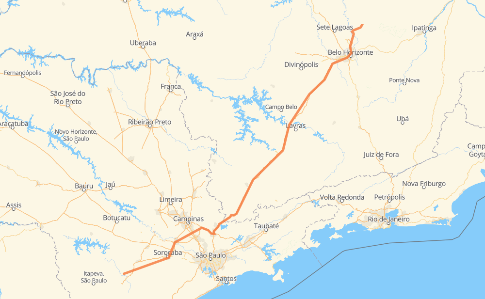
The distance from Claros to Rio Vermelho is 868 kilometers by road including 770 kilometers on motorways. Road takes approximately 8 hours and 58 minutes and goes through Votorantim, Itu, Itatiba, Atibaia and Betim.
| Shortest distance by air | 685 km ✈️ |
| Car route length | 868 km 🚗 |
| Driving time | 8 h 58 min |
| Fuel amount | 69.4 L |
| Fuel cost | 124.9 AUD |
| Point | Distance | Time | Fuel | |
| Claros | 0 km | 00 min | 0.0 L | |
|
SP-127 54 km, 42 min
|
||||
| Vila Barth II | 54 km | 42 min | 4.1 L | |
|
SP-270 5 km, 03 min
|
||||
| Vila Itapetininga | 59 km | 46 min | 4.6 L | |
|
SP-270 28 km, 17 min
|
||||
| Capanema | 87 km | 1 h 03 min | 6.7 L | |
|
SP-270 34 km, 20 min
|
||||
| Votorantim | 121 km | 1 h 24 min | 9.2 L | |
|
SP-270 SP-075 41 km, 24 min
|
||||
| Itu | 162 km | 1 h 48 min | 12.7 L | |
|
SP-300 67 km, 44 min
|
||||
| Itatiba | 229 km | 2 h 32 min | 17.7 L | |
|
SP-063 SP-065 29 km, 17 min
|
||||
| Atibaia | 258 km | 2 h 50 min | 19.5 L | |
|
SP-065 BR-381 492 km, 4 h 42 min
|
||||
| Betim | 750 km | 7 h 32 min | 59.6 L | |
|
BR-381 MG-010 118 km, 1 h 25 min
|
||||
| Rio Vermelho | 868 km | 8 h 57 min | 68.9 L | |
Frequently Asked Questions
How much does it cost to drive from Claros to Rio Vermelho?
Fuel cost: 124.9 AUD
This fuel cost is calculated as: (Route length 868 km / 100 km) * (Fuel consumption 8 L/100 km) * (Fuel price 1.8 AUD / L)
You can adjust fuel consumption and fuel price here.
How long is a car ride from Claros to Rio Vermelho?
Driving time: 8 h 58 min
This time is calculated for driving at the maximum permitted speed, taking into account traffic rules restrictions.
- 528 km with a maximum speed 110 km/h = 4 h 47 min
- 119 km with a maximum speed 100 km/h = 1 h 11 min
- 64 km with a maximum speed 90 km/h = 42 min
- 111 km with a maximum speed 80 km/h = 1 h 23 min
- 7 km with a maximum speed 70 km/h = 5 min
- 11 km with a maximum speed 60 km/h = 11 min
- 21 km with a maximum speed 50 km/h = 24 min
- 7 km with a maximum speed 40 km/h = 10 min
The calculated driving time does not take into account intermediate stops and traffic jams.
How far is Claros to Rio Vermelho by land?
The distance between Claros and Rio Vermelho is 868 km by road including 770 km on motorways.
Precise satellite coordinates of highways were used for this calculation. The start and finish points are the centers of Claros and Rio Vermelho respectively.
How far is Claros to Rio Vermelho by plane?
The shortest distance (air line, as the crow flies) between Claros and Rio Vermelho is 685 km.
This distance is calculated using the Haversine formula as a great-circle distance between two points on the surface of a sphere. The start and finish points are the centers of Claros and Rio Vermelho respectively. Actual distance between airports may be different.
How many hours is Claros from Rio Vermelho by plane?
Boeing 737 airliner needs 51 min to cover the distance of 685 km at a cruising speed of 800 km/h.
Small plane "Cessna 172" needs 3 h 6 min to flight this distance at average speed of 220 km/h.
This time is approximate and do not take into account takeoff and landing times, airport location and other real world factors.
How long is a helicopter ride from Claros to Rio Vermelho?
Fast helicopter "Eurocopter AS350" or "Hughes OH-6 Cayuse" need 2 h 51 min to cover the distance of 685 km at a cruising speed of 240 km/h.
Popular "Robinson R44" needs 3 h 15 min to flight this distance at average speed of 210 km/h.
This time is approximate and do not take into account takeoff and landing times, aerodrome location and other real world factors.
What city is halfway between Claros and Rio Vermelho?
The halfway point between Claros and Rio Vermelho is Careaçu. It is located about 5 km from the exact midpoint by road.
The distance from Careaçu to Claros is 429 km and driving will take about 4 h 26 min. The road between Careaçu and Rio Vermelho has length 439 km and will take approximately 4 h 31 min.
The other cities located close to halfway point:
Where is Claros in relation to Rio Vermelho?
Claros is located 685 km south-west of Rio Vermelho.
Claros has geographic coordinates: latitude -23.81398, longitude -48.31777.
Rio Vermelho has geographic coordinates: latitude -19.35623, longitude -43.74785.
Which highway goes from Claros to Rio Vermelho?
The route from Claros to Rio Vermelho follows BR-381.
Other minor sections pass along the road:
- SP-270: 77 km
- BR-272: 77 km
- MG-010: 68 km
- BR-373: 46 km
- SP-127: 46 km
- SP-300: 46 km
- SP-010: 36 km
- BR-262: 35 km
- SP-065: 28 km
- SP-075: 23 km
- SP-360: 19 km
- SP-063: 8 km
- SPI 091/270: 7 km
- BR-040: 3 km
- BR-494: 2 km