Distance between Culiacán and Guadalajara
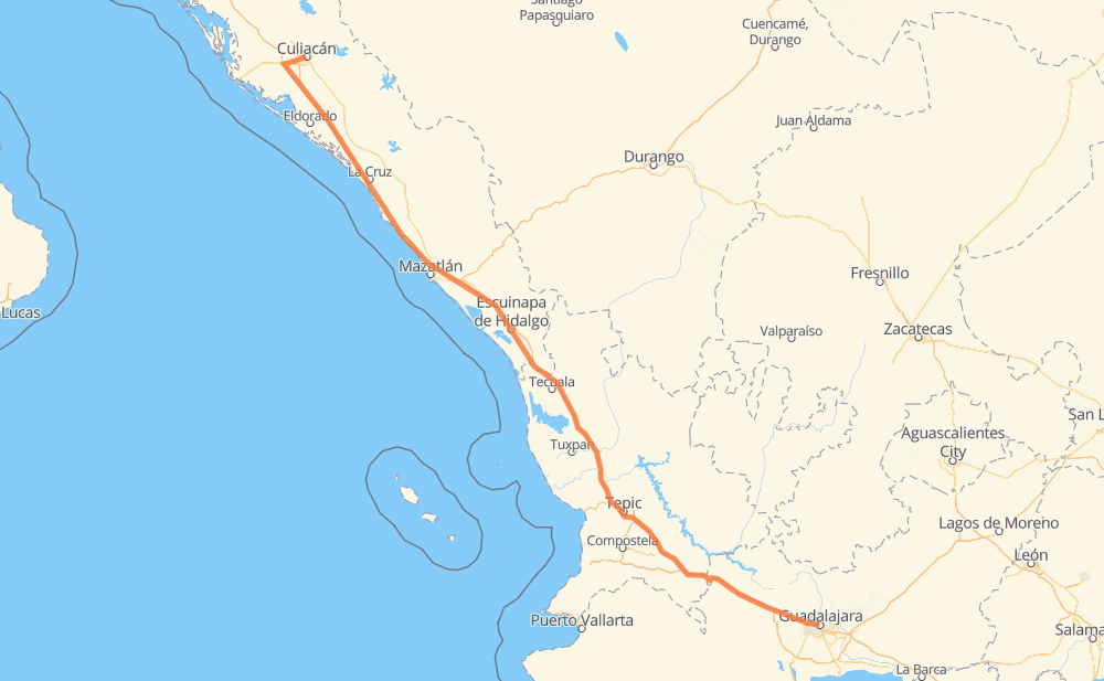
The distance from Culiacán to Guadalajara is 701 kilometers by road including 681 kilometers on motorways. Road takes approximately 7 hours and 33 minutes and goes through Dimas (Estación Dimas), Tepic, Campo Balbuena, Tanques, El Huajote, Otates and El Rosario.
| Shortest distance by air | 619 km ✈️ |
| Car route length | 701 km 🚗 |
| Driving time | 7 h 33 min |
| Fuel amount | 56.1 L |
| Fuel cost | 101 AUD |
| Toll roads cost | 1,171 MXN |
| Point | Distance | Time | Fuel | |
| Culiacán | 0 km | 00 min | 0.0 L | |
|
16 km, 15 min
|
||||
| Campo Balbuena | 16 km | 15 min | 0.5 L | |
|
MEX 15D 99 km, 1 h 01 min
|
||||
| Tanques | 116 km | 1 h 16 min | 8.8 L | |
|
MEX 15D 44 km, 31 min
|
||||
| Dimas (Estación Dimas) | 160 km | 1 h 48 min | 11.7 L | |
|
MEX 15D 110 km, 1 h 09 min
|
||||
| El Huajote | 269 km | 2 h 57 min | 20.7 L | |
|
MEX 15D 14 km, 09 min
|
||||
| Otates | 283 km | 3 h 06 min | 22.5 L | |
|
MEX 15D 11 km, 07 min
|
||||
| El Rosario | 294 km | 3 h 14 min | 22.8 L | |
|
MEX 15D 199 km, 2 h 12 min
|
||||
| Tepic | 493 km | 5 h 26 min | 38.8 L | |
|
MEX 15D 162 km, 1 h 35 min
|
||||
| El Arenal | 655 km | 7 h 02 min | 51.2 L | |
|
MEX 15D 46 km, 31 min
|
||||
| Guadalajara | 701 km | 7 h 33 min | 55.8 L | |
Hotels of Guadalajara
Frequently Asked Questions
How many toll booths are there from Culiacán to Guadalajara?
There are 10 toll booths between Culiacán and Guadalajara: San Pedro km 197+100, Culiacan, Costa Rica, Marmol, El Rosario, Ruiz, Trapichillo, Santa Maria del Oro, Plan de Barrancas and Arenal.
How much does the toll booths cost from Culiacán to Guadalajara?
Toll roads cost: Culiacan (73 MXN) + San Pedro km 197+100 (34 MXN) + Costa Rica (152 MXN) + Marmol (131 MXN) + El Rosario (140 MXN) + Ruiz (120 MXN) + Trapichillo (80 MXN) + Santa Maria del Oro (115 MXN) + Plan de Barrancas (195 MXN) + Arenal (131 MXN) = 1,171 MXN
How much does it cost to drive from Culiacán to Guadalajara?
Fuel cost: 101 AUD
This fuel cost is calculated as: (Route length 701 km / 100 km) * (Fuel consumption 8 L/100 km) * (Fuel price 1.8 AUD / L)
You can adjust fuel consumption and fuel price here.
Toll roads cost: 1,171 MXN
How long is a car ride from Culiacán to Guadalajara?
Driving time: 7 h 33 min
This time is calculated for driving at the maximum permitted speed, taking into account traffic rules restrictions.
- 148 km with a maximum speed 110 km/h = 1 h 20 min
- 314 km with a maximum speed 100 km/h = 3 h 8 min
- 34 km with a maximum speed 90 km/h = 22 min
- 180 km with a maximum speed 80 km/h = 2 h 14 min
- 12 km with a maximum speed 70 km/h = 10 min
- 6 km with a maximum speed 60 km/h = 6 min
- 1 km with a maximum speed 50 km/h = 1 min
- 6 km with a maximum speed 40 km/h = 8 min
The calculated driving time does not take into account intermediate stops and traffic jams.
How far is Culiacán to Guadalajara by land?
The distance between Culiacán and Guadalajara is 701 km by road including 681 km on motorways.
Precise satellite coordinates of highways were used for this calculation. The start and finish points are the centers of Culiacán and Guadalajara respectively.
How far is Culiacán to Guadalajara by plane?
The shortest distance (air line, as the crow flies) between Culiacán and Guadalajara is 619 km.
This distance is calculated using the Haversine formula as a great-circle distance between two points on the surface of a sphere. The start and finish points are the centers of Culiacán and Guadalajara respectively. Actual distance between airports may be different.
How many hours is Culiacán from Guadalajara by plane?
Boeing 737 airliner needs 46 min to cover the distance of 619 km at a cruising speed of 800 km/h.
Small plane "Cessna 172" needs 2 h 48 min to flight this distance at average speed of 220 km/h.
This time is approximate and do not take into account takeoff and landing times, airport location and other real world factors.
How long is a helicopter ride from Culiacán to Guadalajara?
Fast helicopter "Eurocopter AS350" or "Hughes OH-6 Cayuse" need 2 h 34 min to cover the distance of 619 km at a cruising speed of 240 km/h.
Popular "Robinson R44" needs 2 h 56 min to flight this distance at average speed of 210 km/h.
This time is approximate and do not take into account takeoff and landing times, aerodrome location and other real world factors.
What city is halfway between Culiacán and Guadalajara?
The halfway point between Culiacán and Guadalajara is Ojo de Agua de Palmillas. It is located about 8 km from the exact midpoint by road.
The distance from Ojo de Agua de Palmillas to Culiacán is 342 km and driving will take about 3 h 45 min. The road between Ojo de Agua de Palmillas and Guadalajara has length 359 km and will take approximately 3 h 48 min.
The other cities located close to halfway point:
Where is Culiacán in relation to Guadalajara?
Culiacán is located 619 km north-west of Guadalajara.
Culiacán has geographic coordinates: latitude 24.80172, longitude -107.39305.
Guadalajara has geographic coordinates: latitude 20.67614, longitude -103.347.
Which highway goes from Culiacán to Guadalajara?
The route from Culiacán to Guadalajara follows MEX 15D.
Other minor sections pass along the road:
- MEX 70: 18 km
- MEX 90: 18 km
- De las Torres: 2 km