Distance between Dauin and Caanawan
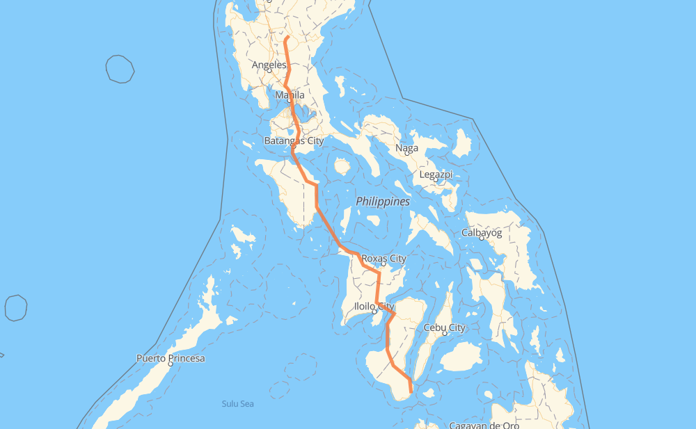
The distance from Dauin to Caanawan is 993 kilometers by road including 119 kilometers on motorways. Road takes approximately 18 hours and 22 minutes and goes through Dumaguete, Kabankalan, Himamaylan, La Carlota, Bacólod, City of Passi and Calapan.
| Shortest distance by air | 773 km ✈️ |
| Car route length | 993 km 🚗 |
| Driving time | 18 h 22 min |
| Fuel amount | 79.4 L |
| Fuel cost | 141.4 AUD |
| Point | Distance | Time | Fuel | |
| Dauin | 0 km | 00 min | 0.0 L | |
|
7 12 km, 09 min
|
||||
| Dumaguete | 12 km | 09 min | 0.3 L | |
|
7 6 119 km, 1 h 26 min
|
||||
| Kabankalan | 131 km | 1 h 35 min | 9.2 L | |
|
6 25 km, 18 min
|
||||
| Himamaylan | 156 km | 1 h 54 min | 11.9 L | |
|
6 40 km, 30 min
|
||||
| La Carlota | 196 km | 2 h 24 min | 15.7 L | |
|
710 6 38 km, 29 min
|
||||
| Bacólod | 234 km | 2 h 54 min | 18.6 L | |
|
7 5 76 km, 1 h 59 min
|
||||
| City of Passi | 311 km | 4 h 54 min | 24.7 L | |
|
5 452 381 km, 8 h 08 min
|
||||
| Calapan | 691 km | 13 h 02 min | 55.3 L | |
|
452 51 km, 2 h 17 min
|
||||
| Batangas City | 743 km | 15 h 20 min | 59.0 L | |
|
434 E2 26 km, 18 min
|
||||
| Lipa | 769 km | 15 h 39 min | 61.2 L | |
|
E2 15 km, 09 min
|
||||
| Tanauan | 784 km | 15 h 48 min | 62.6 L | |
|
E2 11 km, 06 min
|
||||
| Calamba | 795 km | 15 h 55 min | 63.1 L | |
|
E2 6 km, 03 min
|
||||
| Cabuyao | 801 km | 15 h 58 min | 64.0 L | |
|
E2 3 km, 01 min
|
||||
| Santa Rosa | 804 km | 16 h 00 min | 64.1 L | |
|
E2 7 km, 03 min
|
||||
| Biñan | 811 km | 16 h 04 min | 64.6 L | |
|
E2 5 km, 03 min
|
||||
| San Pedro | 816 km | 16 h 08 min | 65.2 L | |
|
E2 AH26 118 km, 1 h 26 min
|
||||
| Gapan | 934 km | 17 h 34 min | 74.1 L | |
|
1 49 km, 39 min
|
||||
| Muñoz | 983 km | 18 h 14 min | 78.4 L | |
|
1 10 km, 07 min
|
||||
| Caanawan | 993 km | 18 h 22 min | 79.2 L | |
Hotels of Caanawan
Frequently Asked Questions
How much does it cost to drive from Dauin to Caanawan?
Fuel cost: 141.4 AUD
This fuel cost is calculated as: (Route length 993 km / 100 km) * (Fuel consumption 8 L/100 km) * (Fuel price 1.78 AUD / L)
You can adjust fuel consumption and fuel price here.
How long is a car ride from Dauin to Caanawan?
Driving time: 18 h 22 min
This time is calculated for driving at the maximum permitted speed, taking into account traffic rules restrictions.
- 108 km with a maximum speed 100 km/h = 1 h 4 min
- 98 km with a maximum speed 90 km/h = 1 h 5 min
- 569 km with a maximum speed 80 km/h = 7 h 6 min
- 8 km with a maximum speed 70 km/h = 6 min
- 27 km with a maximum speed 60 km/h = 27 min
- 12 km with a maximum speed 50 km/h = 14 min
- 10 km with a maximum speed 40 km/h = 15 min
- 2 km with a maximum speed 30 km/h = 3 min
- 160 km with a maximum speed 20 km/h = 7 h 58 min
The calculated driving time does not take into account intermediate stops and traffic jams.
How far is Dauin to Caanawan by land?
The distance between Dauin and Caanawan is 993 km by road including 119 km on motorways.
Precise satellite coordinates of highways were used for this calculation. The start and finish points are the centers of Dauin and Caanawan respectively.
How far is Dauin to Caanawan by plane?
The shortest distance (air line, as the crow flies) between Dauin and Caanawan is 773 km.
This distance is calculated using the Haversine formula as a great-circle distance between two points on the surface of a sphere. The start and finish points are the centers of Dauin and Caanawan respectively. Actual distance between airports may be different.
How many hours is Dauin from Caanawan by plane?
Boeing 737 airliner needs 57 min to cover the distance of 773 km at a cruising speed of 800 km/h.
Small plane "Cessna 172" needs 3 h 30 min to flight this distance at average speed of 220 km/h.
This time is approximate and do not take into account takeoff and landing times, airport location and other real world factors.
How long is a helicopter ride from Dauin to Caanawan?
Fast helicopter "Eurocopter AS350" or "Hughes OH-6 Cayuse" need 3 h 13 min to cover the distance of 773 km at a cruising speed of 240 km/h.
Popular "Robinson R44" needs 3 h 40 min to flight this distance at average speed of 210 km/h.
This time is approximate and do not take into account takeoff and landing times, aerodrome location and other real world factors.
What city is halfway between Dauin and Caanawan?
The halfway point between Dauin and Caanawan is Malay. It is located about 17 km from the exact midpoint by road.
The distance from Malay to Dauin is 480 km and driving will take about 7 h 5 min. The road between Malay and Caanawan has length 513 km and will take approximately 11 h 16 min.
The other cities located close to halfway point:
Where is Dauin in relation to Caanawan?
Dauin is located 773 km south-east of Caanawan.
Dauin has geographic coordinates: latitude 9.19111, longitude 123.26556.
Caanawan has geographic coordinates: latitude 15.77072, longitude 120.9632.
Which highway goes from Dauin to Caanawan?
The route from Dauin to Caanawan follows 6, AH26, 452.
Other minor sections pass along the road:
- E2: 93 km
- 503: 87 km
- 1: 78 km
- 7: 68 km
- 5: 66 km
- E1: 23 km
- 502: 23 km
- 454: 21 km
- SRNH: 6 km
- 514: 6 km
- 140: 5 km
- 160: 4 km
- 434: 4 km
- 710: 3 km
- 145: 2 km
- 161: 1 km