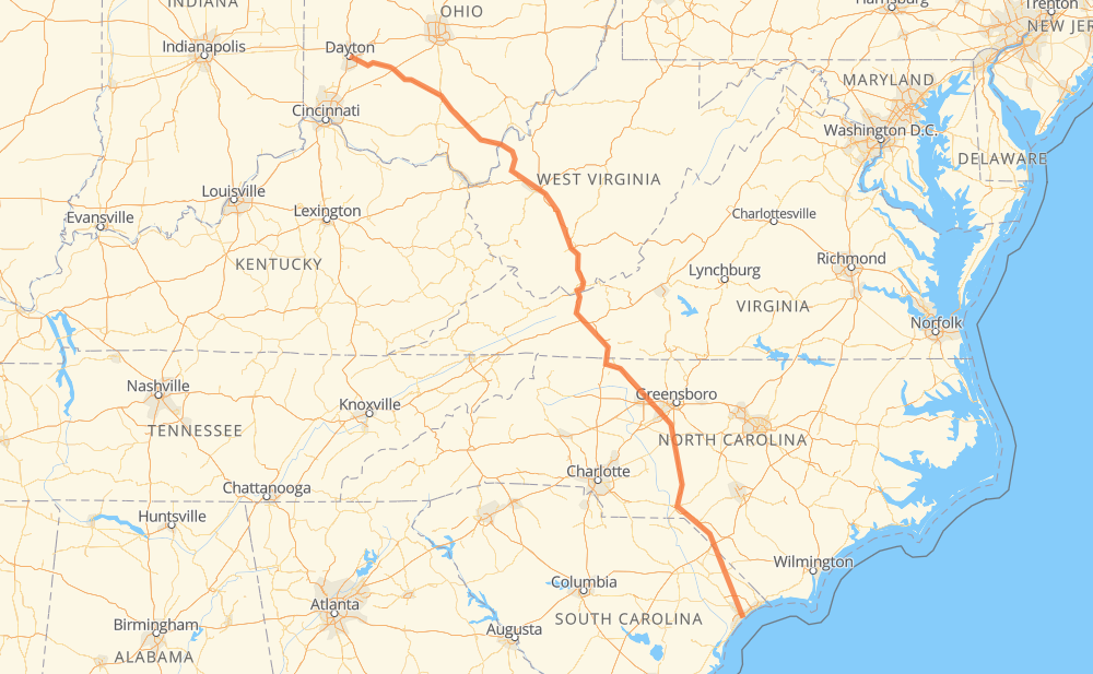
The distance from Dayton to Myrtle Beach is 1,008 kilometers by road including 732 kilometers on motorways. Road takes approximately 10 hours and 25 minutes and goes through Charleston, Charleston, Winston-Salem, Riverside, Beavercreek, Xenia and Chillicothe.
How much does it cost to drive from Dayton to Myrtle Beach?
Fuel cost:
145.1 AUD
This fuel cost is calculated as: (Route length 1,008 km / 100 km) * (Fuel consumption 8 L/100 km) * (Fuel price 1.8 AUD / L)
You can adjust fuel consumption and fuel price here.
How long is a car ride from Dayton to Myrtle Beach?
Driving time:
10 h 25 min
This time is calculated for driving at the maximum permitted speed, taking into account traffic rules restrictions.
289 km with a maximum speed 110 km/h = 2 h 37 min
199 km with a maximum speed 105 km/h = 1 h 54 min
137 km with a maximum speed 100 km/h = 1 h 21 min
27 km with a maximum speed 97 km/h = 16 min
100 km with a maximum speed 90 km/h = 1 h 6 min
92 km with a maximum speed 89 km/h = 1 h 2 min
3 km with a maximum speed 80 km/h = 2 min
150 km with a maximum speed 80 km/h = 1 h 52 min
7 km with a maximum speed 72 km/h = 5 min
4 km with a maximum speed 56 km/h = 3 min
1 km with a maximum speed 50 km/h = 1 min
The calculated driving time does not take into account intermediate stops and traffic jams.
How far is Dayton to Myrtle Beach by land?
The distance between Dayton and Myrtle Beach is 1,008 km by road including 732 km on motorways.
Precise satellite coordinates of highways were used for this calculation. The start and finish points are the centers of Dayton and Myrtle Beach respectively.
How far is Dayton to Myrtle Beach by plane?
The shortest distance (air line, as the crow flies) between Dayton and Myrtle Beach is 823 km.
This distance is calculated using the Haversine formula as a great-circle distance between two points on the surface of a sphere. The start and finish points are the centers of Dayton and Myrtle Beach respectively. Actual distance between airports may be different.
How many hours is Dayton from Myrtle Beach by plane?
Boeing 737 airliner needs 1 h 1 min to cover the distance of 823 km at a cruising speed of 800 km/h.
Small plane "Cessna 172" needs 3 h 44 min to flight this distance at average speed of 220 km/h.
This time is approximate and do not take into account takeoff and landing times, airport location and other real world factors.
How long is a helicopter ride from Dayton to Myrtle Beach?
Fast helicopter "Eurocopter AS350" or "Hughes OH-6 Cayuse" need 3 h 25 min to cover the distance of 823 km at a cruising speed of 240 km/h.
Popular "Robinson R44" needs 3 h 55 min to flight this distance at average speed of 210 km/h.
This time is approximate and do not take into account takeoff and landing times, aerodrome location and other real world factors.
What city is halfway between Dayton and Myrtle Beach?
The halfway point between Dayton and Myrtle Beach is Wytheville. It is located about 12 km from the exact midpoint by road.
The distance from Wytheville to Dayton is 516 km and driving will take about 5 h 8 min. The road between Wytheville and Myrtle Beach has length 492 km and will take approximately 5 h 16 min.
The other cities located close to halfway point:
Fort Chiswell is in 527 km from Dayton and 481 km from Myrtle Beach
Rocky Gap is in 476 km from Dayton and 532 km from Myrtle Beach
North Gap is in 475 km from Dayton and 533 km from Myrtle Beach
Where is Dayton in relation to Myrtle Beach?
Dayton is located 823 km north-west of Myrtle Beach.
Dayton has geographic coordinates: latitude 39.75895, longitude -84.19161.
Myrtle Beach has geographic coordinates: latitude 33.69565, longitude -78.89004.
Which highway goes from Dayton to Myrtle Beach?
The route from Dayton to Myrtle Beach follows US 35, I 77, I 74, US 501, I 64.