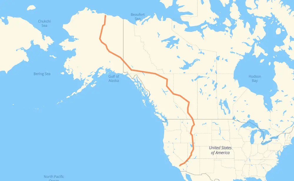
The distance from Deadhorse to Apple Valley is 6,420 kilometers by road including 2,422 kilometers on motorways. Road takes approximately 70 hours and 14 minutes and goes through Whitehorse, Fort St. John, Dawson Creek, Spruce Grove, Edmonton, Leduc and Lacombe.
How much does it cost to drive from Deadhorse to Apple Valley?
Fuel cost:
929.6 AUD
This fuel cost is calculated as: (Route length 6,420 km / 100 km) * (Fuel consumption 8 L/100 km) * (Fuel price 1.81 AUD / L)
You can adjust fuel consumption and fuel price here.
How long is a car ride from Deadhorse to Apple Valley?
Driving time:
70 h 14 min
This time is calculated for driving at the maximum permitted speed, taking into account traffic rules restrictions.
1,386 km with a maximum speed 110 km/h = 12 h 36 min
64 km with a maximum speed 105 km/h = 36 min
522 km with a maximum speed 100 km/h = 5 h 13 min
18 km with a maximum speed 97 km/h = 11 min
2,762 km with a maximum speed 90 km/h = 30 h 41 min
84 km with a maximum speed 89 km/h = 57 min
590 km with a maximum speed 80 km/h = 7 h 20 min
927 km with a maximum speed 80 km/h = 11 h 35 min
8 km with a maximum speed 72 km/h = 6 min
36 km with a maximum speed 70 km/h = 30 min
3 km with a maximum speed 60 km/h = 2 min
2 km with a maximum speed 56 km/h = 1 min
16 km with a maximum speed 50 km/h = 19 min
1 km with a maximum speed 48 km/h = 1 min
The calculated driving time does not take into account intermediate stops and traffic jams.
How far is Deadhorse to Apple Valley by land?
The distance between Deadhorse and Apple Valley is 6,420 km by road including 2,422 km on motorways.
Precise satellite coordinates of highways were used for this calculation. The start and finish points are the centers of Deadhorse and Apple Valley respectively.
How far is Deadhorse to Apple Valley by plane?
The shortest distance (air line, as the crow flies) between Deadhorse and Apple Valley is 4,394 km.
This distance is calculated using the Haversine formula as a great-circle distance between two points on the surface of a sphere. The start and finish points are the centers of Deadhorse and Apple Valley respectively. Actual distance between airports may be different.
How many hours is Deadhorse from Apple Valley by plane?
Boeing 737 airliner needs 5 h 29 min to cover the distance of 4,394 km at a cruising speed of 800 km/h.
Small plane "Cessna 172" needs 19 h 58 min to flight this distance at average speed of 220 km/h.
This time is approximate and do not take into account takeoff and landing times, airport location and other real world factors.
How long is a helicopter ride from Deadhorse to Apple Valley?
Fast helicopter "Eurocopter AS350" or "Hughes OH-6 Cayuse" need 18 h 18 min to cover the distance of 4,394 km at a cruising speed of 240 km/h.
Popular "Robinson R44" needs 20 h 55 min to flight this distance at average speed of 210 km/h.
This time is approximate and do not take into account takeoff and landing times, aerodrome location and other real world factors.
What city is halfway between Deadhorse and Apple Valley?
The halfway point between Deadhorse and Apple Valley is Beaverlodge. It is located about 18 km from the exact midpoint by road.
The distance from Beaverlodge to Deadhorse is 3,228 km and driving will take about 37 h 31 min. The road between Beaverlodge and Apple Valley has length 3,192 km and will take approximately 32 h 43 min.
The other cities located close to halfway point:
Wembley is in 3,251 km from Deadhorse and 3,169 km from Apple Valley
Pouce Coupe is in 3,156 km from Deadhorse and 3,264 km from Apple Valley
Dawson Creek is in 3,143 km from Deadhorse and 3,277 km from Apple Valley
Where is Deadhorse in relation to Apple Valley?
Deadhorse is located 4,394 km north-west of Apple Valley.
Deadhorse has geographic coordinates: latitude 70.2007, longitude -148.45982.
Apple Valley has geographic coordinates: latitude 34.50083, longitude -117.18588.
Which highway goes from Deadhorse to Apple Valley?
The route from Deadhorse to Apple Valley follows I 15, 97, 1, AK 11, AK 2, 2, 43.