Distance between Dhorimanna and Melur
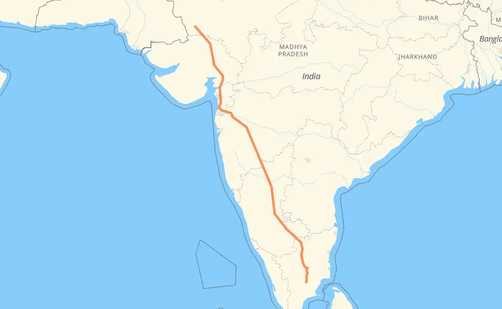
The distance from Dhorimanna to Melur is 2,161 kilometers by road including 119 kilometers on motorways. Road takes approximately 27 hours and 10 minutes and goes through Palanpur, Gandhinagar, Vadodara, Valsad, Nashik, Ahmadnagar and Vijayapura.
| Shortest distance by air | 1,838 km ✈️ |
| Car route length | 2,161 km 🚗 |
| Driving time | 27 h 10 min |
| Fuel amount | 172.9 L |
| Fuel cost | 307.8 AUD |
| Point | Distance | Time | Fuel | |
| Dhorimanna | 0 km | 00 min | 0.0 L | |
|
NH68 NH168A 172 km, 2 h 23 min
|
||||
| Palanpur | 172 km | 2 h 23 min | 13.1 L | |
|
SH 41 SH41 118 km, 1 h 24 min
|
||||
| Gandhinagar | 290 km | 3 h 47 min | 23.1 L | |
|
SH71 NE1 137 km, 1 h 27 min
|
||||
| Vadodara | 427 km | 5 h 14 min | 33.9 L | |
|
NH48 216 km, 2 h 32 min
|
||||
| Valsad | 643 km | 7 h 47 min | 51.4 L | |
|
NH48 NH848 140 km, 1 h 40 min
|
||||
| Nashik | 783 km | 9 h 27 min | 61.9 L | |
|
NH848 NH160 162 km, 1 h 57 min
|
||||
| Ahmadnagar | 944 km | 11 h 24 min | 75.4 L | |
|
NH561A 299 km, 3 h 36 min
|
||||
| Vijayapura | 1,243 km | 15 h 01 min | 98.7 L | |
|
NH50 449 km, 5 h 33 min
|
||||
| Tumakuru | 1,692 km | 20 h 34 min | 135.2 L | |
|
NH48 NH44 525 km, 6 h 35 min
|
||||
| Melur | 2,218 km | 27 h 10 min | 176.6 L | |
Frequently Asked Questions
How much does it cost to drive from Dhorimanna to Melur?
Fuel cost: 307.8 AUD
This fuel cost is calculated as: (Route length 2,161 km / 100 km) * (Fuel consumption 8 L/100 km) * (Fuel price 1.78 AUD / L)
You can adjust fuel consumption and fuel price here.
How long is a car ride from Dhorimanna to Melur?
Driving time: 27 h 10 min
This time is calculated for driving at the maximum permitted speed, taking into account traffic rules restrictions.
- 90 km with a maximum speed 100 km/h = 53 min
- 526 km with a maximum speed 90 km/h = 5 h 50 min
- 1,477 km with a maximum speed 80 km/h = 18 h 27 min
- 48 km with a maximum speed 70 km/h = 41 min
- 75 km with a maximum speed 60 km/h = 1 h 15 min
- 1 km with a maximum speed 50 km/h = 1 min
The calculated driving time does not take into account intermediate stops and traffic jams.
How far is Dhorimanna to Melur by land?
The distance between Dhorimanna and Melur is 2,161 km by road including 119 km on motorways.
Precise satellite coordinates of highways were used for this calculation. The start and finish points are the centers of Dhorimanna and Melur respectively.
How far is Dhorimanna to Melur by plane?
The shortest distance (air line, as the crow flies) between Dhorimanna and Melur is 1,838 km.
This distance is calculated using the Haversine formula as a great-circle distance between two points on the surface of a sphere. The start and finish points are the centers of Dhorimanna and Melur respectively. Actual distance between airports may be different.
How many hours is Dhorimanna from Melur by plane?
Boeing 737 airliner needs 2 h 17 min to cover the distance of 1,838 km at a cruising speed of 800 km/h.
Small plane "Cessna 172" needs 8 h 21 min to flight this distance at average speed of 220 km/h.
This time is approximate and do not take into account takeoff and landing times, airport location and other real world factors.
How long is a helicopter ride from Dhorimanna to Melur?
Fast helicopter "Eurocopter AS350" or "Hughes OH-6 Cayuse" need 7 h 39 min to cover the distance of 1,838 km at a cruising speed of 240 km/h.
Popular "Robinson R44" needs 8 h 45 min to flight this distance at average speed of 210 km/h.
This time is approximate and do not take into account takeoff and landing times, aerodrome location and other real world factors.
What city is halfway between Dhorimanna and Melur?
The halfway point between Dhorimanna and Melur is Karkamb. It is located about 21 km from the exact midpoint by road.
The distance from Karkamb to Dhorimanna is 1,102 km and driving will take about 13 h 16 min. The road between Karkamb and Melur has length 1,060 km and will take approximately 13 h 53 min.
The other cities located close to halfway point:
Where is Dhorimanna in relation to Melur?
Dhorimanna is located 1,838 km north-west of Melur.
Dhorimanna has geographic coordinates: latitude 25.20396, longitude 71.4385.
Melur has geographic coordinates: latitude 10.0309, longitude 78.33759.
Which highway goes from Dhorimanna to Melur?
The route from Dhorimanna to Melur follows NH48, NH50, NH561A, NH848, NH44, NH844.
Other minor sections pass along the road:
- NH68: 97 km
- NE1: 89 km
- SH71: 69 km
- NH168A: 64 km
- SH22: 61 km
- NH160: 55 km
- NH60: 49 km
- NH38: 48 km
- NH160D: 48 km
- NH381B: 45 km
- 754K: 44 km
- SH67: 38 km
- SH41: 36 km
- NH27: 29 km
- SH 71A: 28 km
- SH 41: 28 km
- 160: 27 km
- 48: 26 km
- SH129: 25 km
- ORR: 21 km
- SH36: 17 km
- SH7: 14 km
- 75: 13 km
- SH21: 11 km
- NH64: 10 km
- BETL: 9 km
- 50: 8 km
- NH67: 8 km
- 561A: 7 km
- NH52: 7 km
- NH147: 6 km
- NH47: 6 km
- NH65: 6 km
- NH61: 5 km
- NH168: 4 km
- 168A: 4 km
- 52: 3 km
- SH76: 3 km
- SH141: 2 km
- 360: 2 km
- NH83: 2 km
- NH383: 1 km
- SH17: 1 km
- SH25: 1 km
- SH54: 1 km
- SH64: 1 km
- 753F: 1 km