Distance between El Refugio Suchitlán and Chalchihuites
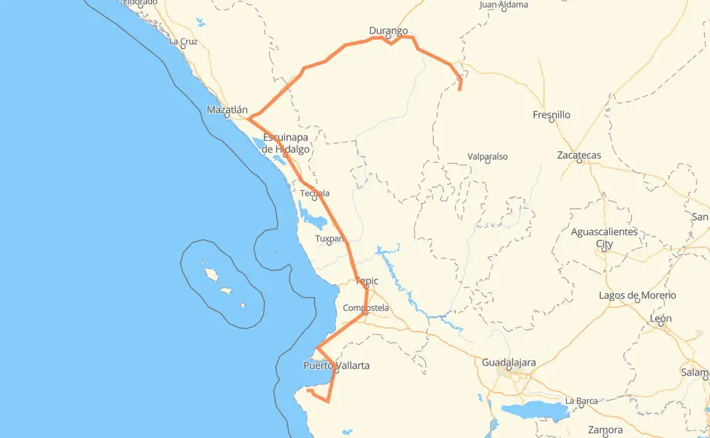
The distance from El Refugio Suchitlán to Chalchihuites is 832 kilometers by road including 344 kilometers on motorways. Road takes approximately 9 hours and 54 minutes and goes through Puerto Vallarta, Tepic, El Tuito, Mezcales, Lo de Marcos, Rincon de Guayabitos and Las Varas.
| Shortest distance by air | 378 km ✈️ |
| Car route length | 832 km 🚗 |
| Driving time | 9 h 54 min |
| Fuel amount | 66.5 L |
| Fuel cost | 118.4 AUD |
| Toll roads cost | 1,108 + ? MXN |
| Point | Distance | Time | Fuel | |
| El Refugio Suchitlán | 0 km | 00 min | 0.0 L | |
|
39 km, 38 min
|
||||
| El Tuito | 39 km | 38 min | 2.1 L | |
|
MEX 200 41 km, 34 min
|
||||
| Puerto Vallarta | 80 km | 1 h 12 min | 5.9 L | |
|
MEX 200 20 km, 16 min
|
||||
| Mezcales | 101 km | 1 h 28 min | 7.8 L | |
|
MEX 200 37 km, 26 min
|
||||
| Lo de Marcos | 137 km | 1 h 54 min | 10.6 L | |
|
MEX 200 39 km, 29 min
|
||||
| Las Varas | 177 km | 2 h 24 min | 14.0 L | |
|
MEX 200 28 km, 20 min
|
||||
| Compostela | 205 km | 2 h 44 min | 14.5 L | |
|
MEX 200 45 km, 33 min
|
||||
| Xalisco | 250 km | 3 h 17 min | 19.9 L | |
|
MEX 200 9 km, 07 min
|
||||
| Tepic | 259 km | 3 h 24 min | 20.1 L | |
|
MEX 15D 581 km, 6 h 29 min
|
||||
| Gualterio | 841 km | 9 h 54 min | 65.4 L | |
Frequently Asked Questions
How many toll booths are there from El Refugio Suchitlán to Chalchihuites?
There are 8 toll booths between El Refugio Suchitlán and Chalchihuites: Mesillas, El Rosario, Durango 95, Llano Grande, Coscomate, Acaponeta, Ruiz and Trapichillo.
How much does the toll booths cost from El Refugio Suchitlán to Chalchihuites?
Toll roads cost: Trapichillo (80 MXN) + Ruiz (?) + Acaponeta (240 MXN) + El Rosario (140 MXN) + Mesillas (166 MXN) + Coscomate (315 MXN) + Llano Grande (100 MXN) + Durango 95 (67 MXN) = 1,108 + ? MXN
How much does it cost to drive from El Refugio Suchitlán to Chalchihuites?
Fuel cost: 118.4 AUD
This fuel cost is calculated as: (Route length 832 km / 100 km) * (Fuel consumption 8 L/100 km) * (Fuel price 1.78 AUD / L)
You can adjust fuel consumption and fuel price here.
Toll roads cost: 1,108 + ? MXN
How long is a car ride from El Refugio Suchitlán to Chalchihuites?
Driving time: 9 h 54 min
This time is calculated for driving at the maximum permitted speed, taking into account traffic rules restrictions.
- 91 km with a maximum speed 110 km/h = 49 min
- 158 km with a maximum speed 100 km/h = 1 h 34 min
- 234 km with a maximum speed 90 km/h = 2 h 35 min
- 302 km with a maximum speed 80 km/h = 3 h 46 min
- 7 km with a maximum speed 70 km/h = 6 min
- 18 km with a maximum speed 60 km/h = 18 min
- 27 km with a maximum speed 50 km/h = 32 min
- 2 km with a maximum speed 40 km/h = 3 min
- 1 km with a maximum speed 10 km/h = 6 min
The calculated driving time does not take into account intermediate stops and traffic jams.
How far is El Refugio Suchitlán to Chalchihuites by land?
The distance between El Refugio Suchitlán and Chalchihuites is 832 km by road including 344 km on motorways.
Precise satellite coordinates of highways were used for this calculation. The start and finish points are the centers of El Refugio Suchitlán and Chalchihuites respectively.
How far is El Refugio Suchitlán to Chalchihuites by plane?
The shortest distance (air line, as the crow flies) between El Refugio Suchitlán and Chalchihuites is 378 km.
This distance is calculated using the Haversine formula as a great-circle distance between two points on the surface of a sphere. The start and finish points are the centers of El Refugio Suchitlán and Chalchihuites respectively. Actual distance between airports may be different.
How many hours is El Refugio Suchitlán from Chalchihuites by plane?
Boeing 737 airliner needs 28 min to cover the distance of 378 km at a cruising speed of 800 km/h.
Small plane "Cessna 172" needs 1 h 43 min to flight this distance at average speed of 220 km/h.
This time is approximate and do not take into account takeoff and landing times, airport location and other real world factors.
How long is a helicopter ride from El Refugio Suchitlán to Chalchihuites?
Fast helicopter "Eurocopter AS350" or "Hughes OH-6 Cayuse" need 1 h 34 min to cover the distance of 378 km at a cruising speed of 240 km/h.
Popular "Robinson R44" needs 1 h 48 min to flight this distance at average speed of 210 km/h.
This time is approximate and do not take into account takeoff and landing times, aerodrome location and other real world factors.
What city is halfway between El Refugio Suchitlán and Chalchihuites?
The halfway point between El Refugio Suchitlán and Chalchihuites is Ojo de Agua de Palmillas. It is located about 6 km from the exact midpoint by road.
The distance from Ojo de Agua de Palmillas to El Refugio Suchitlán is 410 km and driving will take about 4 h 53 min. The road between Ojo de Agua de Palmillas and Chalchihuites has length 422 km and will take approximately 5 h.
The other cities located close to halfway point:
Where is El Refugio Suchitlán in relation to Chalchihuites?
El Refugio Suchitlán is located 378 km south-west of Chalchihuites.
El Refugio Suchitlán has geographic coordinates: latitude 20.44322, longitude -105.54585.
Chalchihuites has geographic coordinates: latitude 23.47539, longitude -103.88224.
Which highway goes from El Refugio Suchitlán to Chalchihuites?
The route from El Refugio Suchitlán to Chalchihuites follows MEX 15D, MEX 200, MEX 40D.
Other minor sections pass along the road:
- MEX 45: 68 km
- DGO 45: 27 km
- DGO 241: 23 km
- ZAC 240: 14 km
- DGO 241: 14 km