Distance between Escuinapa de Hidalgo and Guamuchil
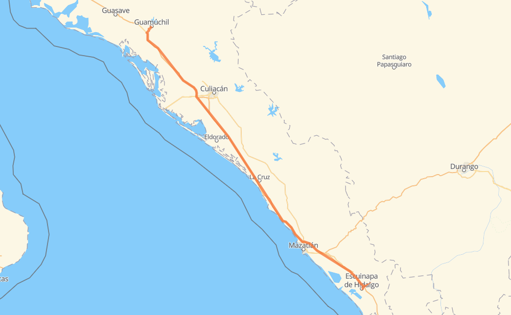
The distance from Escuinapa de Hidalgo to Guamuchil is 400 kilometers by road including 386 kilometers on motorways. Road takes approximately 4 hours and 16 minutes and goes through Dimas (Estación Dimas), El Rosario, Otates, El Huajote, Tanques, Campo Balbuena and Colonia Agrícola México (Palmitas).
| Shortest distance by air | 374 km ✈️ |
| Car route length | 400 km 🚗 |
| Driving time | 4 h 16 min |
| Fuel amount | 32 L |
| Fuel cost | 57.9 AUD |
| Toll roads cost | 530 + ? MXN |
| Point | Distance | Time | Fuel | |
| Escuinapa de Hidalgo | 0 km | 00 min | 0.0 L | |
|
MEX 15 MEX 15D 22 km, 13 min
|
||||
| El Rosario | 22 km | 13 min | 1.0 L | |
|
MEX 15D 11 km, 06 min
|
||||
| Otates | 33 km | 20 min | 2.4 L | |
|
MEX 15D 14 km, 08 min
|
||||
| El Huajote | 47 km | 28 min | 2.8 L | |
|
MEX 15D 15 km, 08 min
|
||||
| Ejido Caleritas | 61 km | 37 min | 4.6 L | |
|
MEX 15D 95 km, 59 min
|
||||
| Dimas (Estación Dimas) | 156 km | 1 h 36 min | 11.4 L | |
|
MEX 15D 44 km, 31 min
|
||||
| Tanques | 200 km | 2 h 07 min | 15.5 L | |
|
MEX 15D 93 km, 57 min
|
||||
| Campo Balbuena | 293 km | 3 h 05 min | 23.2 L | |
|
MEX 15D 61 km, 39 min
|
||||
| Colonia Agrícola México (Palmitas) | 354 km | 3 h 44 min | 27.9 L | |
|
MEX 15D 46 km, 32 min
|
||||
| Guamuchil | 400 km | 4 h 16 min | 31.7 L | |
Hotels of Guamuchil
Frequently Asked Questions
How many toll booths are there from Escuinapa de Hidalgo to Guamuchil?
There are 6 toll booths between Escuinapa de Hidalgo and Guamuchil: San Pedro km 197+100, Costa Rica, Marmol, El Rosario, El Pisal and Las Brisas.
How much does the toll booths cost from Escuinapa de Hidalgo to Guamuchil?
Toll roads cost: El Rosario (140 MXN) + Marmol (131 MXN) + Costa Rica (152 MXN) + San Pedro km 197+100 (34 MXN) + El Pisal (73 MXN) + Las Brisas (?) = 530 + ? MXN
How much does it cost to drive from Escuinapa de Hidalgo to Guamuchil?
Fuel cost: 57.9 AUD
This fuel cost is calculated as: (Route length 400 km / 100 km) * (Fuel consumption 8 L/100 km) * (Fuel price 1.81 AUD / L)
You can adjust fuel consumption and fuel price here.
Toll roads cost: 530 + ? MXN
How long is a car ride from Escuinapa de Hidalgo to Guamuchil?
Driving time: 4 h 16 min
This time is calculated for driving at the maximum permitted speed, taking into account traffic rules restrictions.
- 26 km with a maximum speed 110 km/h = 14 min
- 264 km with a maximum speed 100 km/h = 2 h 38 min
- 6 km with a maximum speed 90 km/h = 3 min
- 103 km with a maximum speed 80 km/h = 1 h 16 min
- 2 km with a maximum speed 30 km/h = 3 min
The calculated driving time does not take into account intermediate stops and traffic jams.
How far is Escuinapa de Hidalgo to Guamuchil by land?
The distance between Escuinapa de Hidalgo and Guamuchil is 400 km by road including 386 km on motorways.
Precise satellite coordinates of highways were used for this calculation. The start and finish points are the centers of Escuinapa de Hidalgo and Guamuchil respectively.
How far is Escuinapa de Hidalgo to Guamuchil by plane?
The shortest distance (air line, as the crow flies) between Escuinapa de Hidalgo and Guamuchil is 374 km.
This distance is calculated using the Haversine formula as a great-circle distance between two points on the surface of a sphere. The start and finish points are the centers of Escuinapa de Hidalgo and Guamuchil respectively. Actual distance between airports may be different.
How many hours is Escuinapa de Hidalgo from Guamuchil by plane?
Boeing 737 airliner needs 28 min to cover the distance of 374 km at a cruising speed of 800 km/h.
Small plane "Cessna 172" needs 1 h 42 min to flight this distance at average speed of 220 km/h.
This time is approximate and do not take into account takeoff and landing times, airport location and other real world factors.
How long is a helicopter ride from Escuinapa de Hidalgo to Guamuchil?
Fast helicopter "Eurocopter AS350" or "Hughes OH-6 Cayuse" need 1 h 33 min to cover the distance of 374 km at a cruising speed of 240 km/h.
Popular "Robinson R44" needs 1 h 46 min to flight this distance at average speed of 210 km/h.
This time is approximate and do not take into account takeoff and landing times, aerodrome location and other real world factors.
What city is halfway between Escuinapa de Hidalgo and Guamuchil?
The halfway point between Escuinapa de Hidalgo and Guamuchil is Tanques.
The distance from Tanques to Escuinapa de Hidalgo is 200 km and driving will take about 2 h 7 min. The road between Tanques and Guamuchil has length 200 km and will take approximately 2 h 9 min.
The other cities located close to halfway point:
Where is Escuinapa de Hidalgo in relation to Guamuchil?
Escuinapa de Hidalgo is located 374 km south-east of Guamuchil.
Escuinapa de Hidalgo has geographic coordinates: latitude 22.83446, longitude -105.77624.
Guamuchil has geographic coordinates: latitude 25.45756, longitude -108.07558.
Which highway goes from Escuinapa de Hidalgo to Guamuchil?
The route from Escuinapa de Hidalgo to Guamuchil follows MEX 15D.
Other minor sections pass along the road:
- Sin 223: 8 km