Distance between Eunápolis and Paulo Afonso
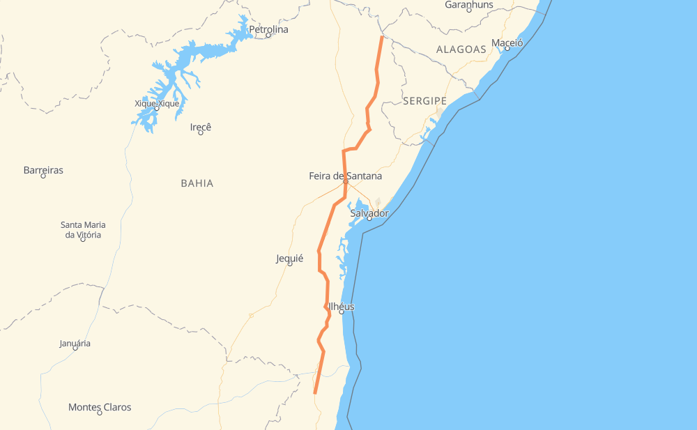
The distance from Eunápolis to Paulo Afonso is 936 kilometers by road. Road takes approximately 11 hours and 3 minutes and goes through Aurelino Leal, Ubaitaba, Parque Panorama, Teixeira do Progresso, Travessão, Itamarati and Entroncamento de Laje.
| Shortest distance by air | 789 km ✈️ |
| Car route length | 936 km 🚗 |
| Driving time | 11 h 3 min |
| Fuel amount | 74.9 L |
| Fuel cost | 131.8 AUD |
| Point | Distance | Time | Fuel | |
| -16.37225, -39.57570 | 0 km | 00 min | 0.0 L | |
|
BR-101 89 km, 1 h 00 min
|
||||
| Teixeira do Progresso | 89 km | 1 h 00 min | 13.3 L | |
|
BR-101 175 km, 2 h 00 min
|
||||
| Aurelino Leal | 264 km | 3 h 01 min | 27.1 L | |
|
BR-101 9 km, 06 min
|
||||
| Ubaitaba | 273 km | 3 h 08 min | 28.5 L | |
|
BR-101 14 km, 09 min
|
||||
| Travessão | 287 km | 3 h 18 min | 29.1 L | |
|
BR-101 21 km, 15 min
|
||||
| Itamarati | 308 km | 3 h 34 min | 30.2 L | |
|
BR-101 122 km, 1 h 23 min
|
||||
| Entroncamento de Laje | 431 km | 4 h 57 min | 40.6 L | |
|
BR-101 90 km, 1 h 09 min
|
||||
| Capoeiruçu | 521 km | 6 h 06 min | 48.3 L | |
|
BR-101 BA-502 35 km, 23 min
|
||||
| Parque Panorama | 556 km | 6 h 30 min | 51.1 L | |
|
BA-502 BR-116 24 km, 19 min
|
||||
| São Cristovão | 580 km | 6 h 49 min | 52.4 L | |
|
BR-116 BR-110 264 km, 2 h 58 min
|
||||
| Caritá | 844 km | 9 h 48 min | 73.4 L | |
|
BR-110 BR-423 98 km, 1 h 14 min
|
||||
| -9.39911, -38.22671 | 942 km | 11 h 02 min | 82.0 L | |
Hotels of Paulo Afonso
Frequently Asked Questions
How much does it cost to drive from Eunápolis to Paulo Afonso?
Fuel cost: 131.8 AUD
This fuel cost is calculated as: (Route length 936 km / 100 km) * (Fuel consumption 8 L/100 km) * (Fuel price 1.76 AUD / L)
You can adjust fuel consumption and fuel price here.
How long is a car ride from Eunápolis to Paulo Afonso?
Driving time: 11 h 3 min
This time is calculated for driving at the maximum permitted speed, taking into account traffic rules restrictions.
- 611 km with a maximum speed 90 km/h = 6 h 47 min
- 298 km with a maximum speed 80 km/h = 3 h 43 min
- 8 km with a maximum speed 70 km/h = 7 min
- 22 km with a maximum speed 60 km/h = 21 min
- 1 km with a maximum speed 40 km/h = 2 min
The calculated driving time does not take into account intermediate stops and traffic jams.
How far is Eunápolis to Paulo Afonso by land?
The distance between Eunápolis and Paulo Afonso is 936 km by road.
Precise satellite coordinates of highways were used for this calculation. The start and finish points are the centers of Eunápolis and Paulo Afonso respectively.
How far is Eunápolis to Paulo Afonso by plane?
The shortest distance (air line, as the crow flies) between Eunápolis and Paulo Afonso is 789 km.
This distance is calculated using the Haversine formula as a great-circle distance between two points on the surface of a sphere. The start and finish points are the centers of Eunápolis and Paulo Afonso respectively. Actual distance between airports may be different.
How many hours is Eunápolis from Paulo Afonso by plane?
Boeing 737 airliner needs 59 min to cover the distance of 789 km at a cruising speed of 800 km/h.
Small plane "Cessna 172" needs 3 h 35 min to flight this distance at average speed of 220 km/h.
This time is approximate and do not take into account takeoff and landing times, airport location and other real world factors.
How long is a helicopter ride from Eunápolis to Paulo Afonso?
Fast helicopter "Eurocopter AS350" or "Hughes OH-6 Cayuse" need 3 h 17 min to cover the distance of 789 km at a cruising speed of 240 km/h.
Popular "Robinson R44" needs 3 h 45 min to flight this distance at average speed of 210 km/h.
This time is approximate and do not take into account takeoff and landing times, aerodrome location and other real world factors.
What city is halfway between Eunápolis and Paulo Afonso?
The halfway point between Eunápolis and Paulo Afonso is Tabuleiro da Baiana. It is located about 36 km from the exact midpoint by road.
The distance from Tabuleiro da Baiana to Eunápolis is 504 km and driving will take about 5 h 52 min. The road between Tabuleiro da Baiana and Paulo Afonso has length 433 km and will take approximately 5 h 10 min.
The other cities located close to halfway point:
Where is Eunápolis in relation to Paulo Afonso?
Eunápolis is located 789 km south of Paulo Afonso.
Eunápolis has geographic coordinates: latitude -16.37225, longitude -39.5757.
Paulo Afonso has geographic coordinates: latitude -9.39911, longitude -38.22671.
Which highway goes from Eunápolis to Paulo Afonso?
The route from Eunápolis to Paulo Afonso follows BR-101, BR-110.
Other minor sections pass along the road:
- BR-423: 71 km
- BR-116: 69 km
- BA-084: 57 km
- BA-502: 31 km
- BA-233: 22 km
- BA-210: 5 km