Distance between Fresno CA and Peoria AZ
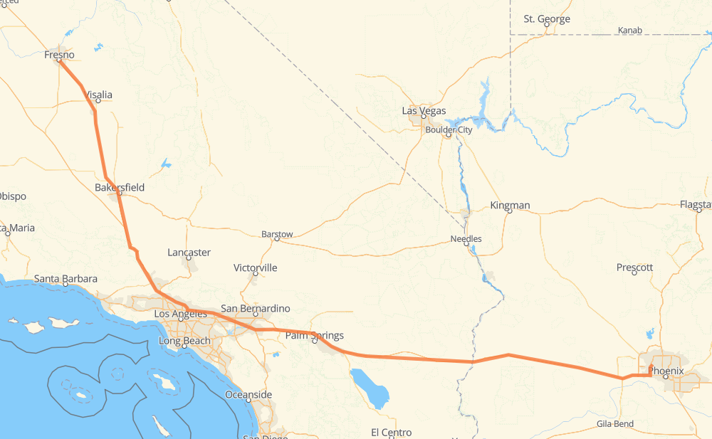
The distance from Fresno to Peoria is 942 kilometers by road including 937 kilometers on motorways. Road takes approximately 8 hours and 54 minutes and goes through Visalia, Bakersfield, Santa Clarita, Los Angeles, Glendale, La Cañada Flintridge and Pasadena.
| Shortest distance by air | 771 km ✈️ |
| Car route length | 942 km 🚗 |
| Driving time | 8 h 54 min |
| Fuel amount | 75.3 L |
| Fuel cost | 135.6 AUD |
| Point | Distance | Time | Fuel | |
| Fresno | 0 km | 00 min | 0.0 L | |
|
CA 99 63 km, 34 min
|
||||
| Visalia | 63 km | 34 min | 4.8 L | |
|
CA 99 112 km, 1 h 01 min
|
||||
| Bakersfield | 175 km | 1 h 36 min | 13.8 L | |
|
CA 99 I 5 125 km, 1 h 10 min
|
||||
| Santa Clarita | 299 km | 2 h 46 min | 23.4 L | |
|
I 5 24 km, 13 min
|
||||
| Los Angeles | 323 km | 3 h 00 min | 24.7 L | |
|
I 210 16 km, 08 min
|
||||
| Glendale | 339 km | 3 h 09 min | 27.0 L | |
|
I 210 6 km, 03 min
|
||||
| La Cañada Flintridge | 345 km | 3 h 12 min | 27.4 L | |
|
I 210 9 km, 05 min
|
||||
| Pasadena | 354 km | 3 h 17 min | 27.8 L | |
|
I 210 9 km, 05 min
|
||||
| Arcadia | 363 km | 3 h 22 min | 28.9 L | |
|
I 210 4 km, 02 min
|
||||
| Monrovia | 367 km | 3 h 25 min | 29.2 L | |
|
I 210 9 km, 05 min
|
||||
| Azusa | 376 km | 3 h 30 min | 29.8 L | |
|
I 210 CA 57 19 km, 11 min
|
||||
| Pomona | 395 km | 3 h 41 min | 31.2 L | |
|
CA 71 8 km, 05 min
|
||||
| Chino | 403 km | 3 h 47 min | 32.0 L | |
|
CA 60 8 km, 05 min
|
||||
| Ontario | 411 km | 3 h 53 min | 32.5 L | |
|
CA 60 27 km, 17 min
|
||||
| Riverside | 438 km | 4 h 11 min | 34.5 L | |
|
CA 60 18 km, 12 min
|
||||
| Moreno Valley | 456 km | 4 h 24 min | 35.6 L | |
|
CA 60 I 10 52 km, 30 min
|
||||
| Palm Springs | 509 km | 4 h 54 min | 40.2 L | |
|
I 10 36 km, 19 min
|
||||
| Indio | 544 km | 5 h 14 min | 42.7 L | |
|
I 10 385 km, 3 h 31 min
|
||||
| Phoenix | 929 km | 8 h 45 min | 74.1 L | |
|
AZ 101 Loop 12 km, 08 min
|
||||
| Peoria | 942 km | 8 h 54 min | 74.9 L | |
Frequently Asked Questions
How much does it cost to drive from Fresno to Peoria?
Fuel cost: 135.6 AUD
This fuel cost is calculated as: (Route length 942 km / 100 km) * (Fuel consumption 8 L/100 km) * (Fuel price 1.8 AUD / L)
You can adjust fuel consumption and fuel price here.
How long is a car ride from Fresno to Peoria?
Driving time: 8 h 54 min
This time is calculated for driving at the maximum permitted speed, taking into account traffic rules restrictions.
- 625 km with a maximum speed 110 km/h = 5 h 40 min
- 234 km with a maximum speed 105 km/h = 2 h 14 min
- 19 km with a maximum speed 100 km/h = 11 min
- 14 km with a maximum speed 89 km/h = 9 min
- 46 km with a maximum speed 80 km/h = 34 min
- 1 km with a maximum speed 72 km/h = 1 min
- 1 km with a maximum speed 64 km/h = 1 min
- 1 km with a maximum speed 50 km/h = 1 min
The calculated driving time does not take into account intermediate stops and traffic jams.
How far is Fresno to Peoria by land?
The distance between Fresno and Peoria is 942 km by road including 937 km on motorways.
Precise satellite coordinates of highways were used for this calculation. The start and finish points are the centers of Fresno and Peoria respectively.
How far is Fresno to Peoria by plane?
The shortest distance (air line, as the crow flies) between Fresno and Peoria is 771 km.
This distance is calculated using the Haversine formula as a great-circle distance between two points on the surface of a sphere. The start and finish points are the centers of Fresno and Peoria respectively. Actual distance between airports may be different.
How many hours is Fresno from Peoria by plane?
Boeing 737 airliner needs 57 min to cover the distance of 771 km at a cruising speed of 800 km/h.
Small plane "Cessna 172" needs 3 h 30 min to flight this distance at average speed of 220 km/h.
This time is approximate and do not take into account takeoff and landing times, airport location and other real world factors.
How long is a helicopter ride from Fresno to Peoria?
Fast helicopter "Eurocopter AS350" or "Hughes OH-6 Cayuse" need 3 h 12 min to cover the distance of 771 km at a cruising speed of 240 km/h.
Popular "Robinson R44" needs 3 h 40 min to flight this distance at average speed of 210 km/h.
This time is approximate and do not take into account takeoff and landing times, aerodrome location and other real world factors.
What city is halfway between Fresno and Peoria?
The halfway point between Fresno and Peoria is Beaumont. It is located about 1 km from the exact midpoint by road.
The distance from Beaumont to Fresno is 472 km and driving will take about 4 h 34 min. The road between Beaumont and Peoria has length 469 km and will take approximately 4 h 19 min.
The other cities located close to halfway point:
Where is Fresno in relation to Peoria?
Fresno is located 771 km north-west of Peoria.
Fresno has geographic coordinates: latitude 36.73944, longitude -119.78483.
Peoria has geographic coordinates: latitude 33.57662, longitude -112.23983.
Which highway goes from Fresno to Peoria?
The route from Fresno to Peoria follows I 10, CA 99.
Other minor sections pass along the road:
- I 5: 96 km
- CA 60: 74 km
- I 210: 71 km
- US 95: 31 km
- AZ 101 Loop: 13 km
- CA 71: 7 km
- CA 57: 7 km
- I 215: 6 km
- CA 58: 2 km
- CA 126: 2 km