Distance between Grouse Creek UT and Pine City MN
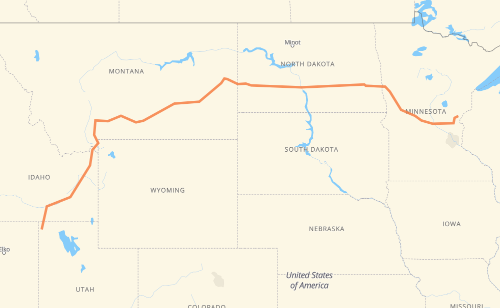
The distance from Grouse Creek to Pine City is 2,218 kilometers by road including 1,703 kilometers on motorways. Road takes approximately 23 hours and 9 minutes and goes through Pocatello, Idaho Falls, Bozeman, Billings, Dickinson, Mandan and Bismarck.
| Shortest distance by air | 1,736 km ✈️ |
| Car route length | 2,218 km 🚗 |
| Driving time | 23 h 9 min |
| Fuel amount | 177.4 L |
| Fuel cost | 319.4 AUD |
| Point | Distance | Time | Fuel | |
| Grouse Creek | 0 km | 00 min | 0.0 L | |
|
CR-1 US 30 239 km, 3 h 03 min
|
||||
| Pocatello | 239 km | 3 h 03 min | 17.2 L | |
|
I 86 I 15 87 km, 56 min
|
||||
| Idaho Falls | 326 km | 4 h 00 min | 25.6 L | |
|
US 20 315 km, 3 h 37 min
|
||||
| Bozeman | 641 km | 7 h 37 min | 51.1 L | |
|
US 191 I 90 225 km, 2 h 09 min
|
||||
| Billings | 866 km | 9 h 46 min | 68.6 L | |
|
I 90 I 94 518 km, 5 h 18 min
|
||||
| Dickinson | 1,383 km | 15 h 05 min | 110.0 L | |
|
I 94 127 km, 1 h 09 min
|
||||
| Mandan | 1,510 km | 16 h 14 min | 119.3 L | |
|
I 94 29 km, 16 min
|
||||
| Bismarck | 1,539 km | 16 h 31 min | 122.4 L | |
|
I 94 294 km, 2 h 40 min
|
||||
| West Fargo | 1,833 km | 19 h 11 min | 146.4 L | |
|
I 94 8 km, 04 min
|
||||
| Fargo | 1,841 km | 19 h 16 min | 146.9 L | |
|
US 52 I 94 275 km, 2 h 43 min
|
||||
| Saint Cloud | 2,116 km | 22 h 00 min | 169.2 L | |
|
MN 23 MN 95 120 km, 1 h 21 min
|
||||
| Pine City | 2,236 km | 23 h 22 min | 178.3 L | |
Hotels of Pine City
Frequently Asked Questions
How much does it cost to drive from Grouse Creek to Pine City?
Fuel cost: 319.4 AUD
This fuel cost is calculated as: (Route length 2,218 km / 100 km) * (Fuel consumption 8 L/100 km) * (Fuel price 1.8 AUD / L)
You can adjust fuel consumption and fuel price here.
How long is a car ride from Grouse Creek to Pine City?
Driving time: 23 h 9 min
This time is calculated for driving at the maximum permitted speed, taking into account traffic rules restrictions.
- 886 km with a maximum speed 110 km/h = 8 h 3 min
- 22 km with a maximum speed 105 km/h = 12 min
- 585 km with a maximum speed 100 km/h = 5 h 51 min
- 13 km with a maximum speed 97 km/h = 7 min
- 283 km with a maximum speed 90 km/h = 3 h 8 min
- 68 km with a maximum speed 89 km/h = 46 min
- 286 km with a maximum speed 80 km/h = 3 h 34 min
- 8 km with a maximum speed 72 km/h = 6 min
- 2 km with a maximum speed 64 km/h = 2 min
- 6 km with a maximum speed 56 km/h = 6 min
- 53 km with a maximum speed 50 km/h = 1 h 3 min
- 2 km with a maximum speed 48 km/h = 2 min
- 2 km with a maximum speed 40 km/h = 2 min
The calculated driving time does not take into account intermediate stops and traffic jams.
How far is Grouse Creek to Pine City by land?
The distance between Grouse Creek and Pine City is 2,218 km by road including 1,703 km on motorways.
Precise satellite coordinates of highways were used for this calculation. The start and finish points are the centers of Grouse Creek and Pine City respectively.
How far is Grouse Creek to Pine City by plane?
The shortest distance (air line, as the crow flies) between Grouse Creek and Pine City is 1,736 km.
This distance is calculated using the Haversine formula as a great-circle distance between two points on the surface of a sphere. The start and finish points are the centers of Grouse Creek and Pine City respectively. Actual distance between airports may be different.
How many hours is Grouse Creek from Pine City by plane?
Boeing 737 airliner needs 2 h 10 min to cover the distance of 1,736 km at a cruising speed of 800 km/h.
Small plane "Cessna 172" needs 7 h 53 min to flight this distance at average speed of 220 km/h.
This time is approximate and do not take into account takeoff and landing times, airport location and other real world factors.
How long is a helicopter ride from Grouse Creek to Pine City?
Fast helicopter "Eurocopter AS350" or "Hughes OH-6 Cayuse" need 7 h 14 min to cover the distance of 1,736 km at a cruising speed of 240 km/h.
Popular "Robinson R44" needs 8 h 16 min to flight this distance at average speed of 210 km/h.
This time is approximate and do not take into account takeoff and landing times, aerodrome location and other real world factors.
What city is halfway between Grouse Creek and Pine City?
The halfway point between Grouse Creek and Pine City is Miles City. It is located about 7 km from the exact midpoint by road.
The distance from Miles City to Grouse Creek is 1,102 km and driving will take about 12 h 13 min. The road between Miles City and Pine City has length 1,116 km and will take approximately 10 h 56 min.
The other cities located close to halfway point:
Where is Grouse Creek in relation to Pine City?
Grouse Creek is located 1,736 km west of Pine City.
Grouse Creek has geographic coordinates: latitude 41.70935, longitude -113.88334.
Pine City has geographic coordinates: latitude 45.82607, longitude -92.96854.
Which highway goes from Grouse Creek to Pine City?
The route from Grouse Creek to Pine City follows I 94, I 90, US 191, US 20, US 52, I 86, US 30.
Other minor sections pass along the road:
- US 12: 76 km
- I 15: 74 km
- MN 95: 67 km
- US 26: 37 km
- ID 77: 37 km
- US 83: 36 km
- US 212: 35 km
- US 59: 17 km
- MN 65: 15 km
- MN 70: 13 km
- MN 23: 13 km
- ND 3: 12 km
- CR 75: 12 km
- US 89: 11 km
- MT 84: 11 km
- I 84: 8 km
- ND 1: 8 km
- US 191 US 287: 7 km
- MN 107: 7 km
- US 287: 6 km
- I 35: 6 km
- CR-1: 5 km
- MN 210: 5 km
- US 87: 5 km
- ND 22 Bypass: 4 km
- US 52 Truck: 3 km
- US 281 Truck: 2 km
- I 90 Business: 2 km