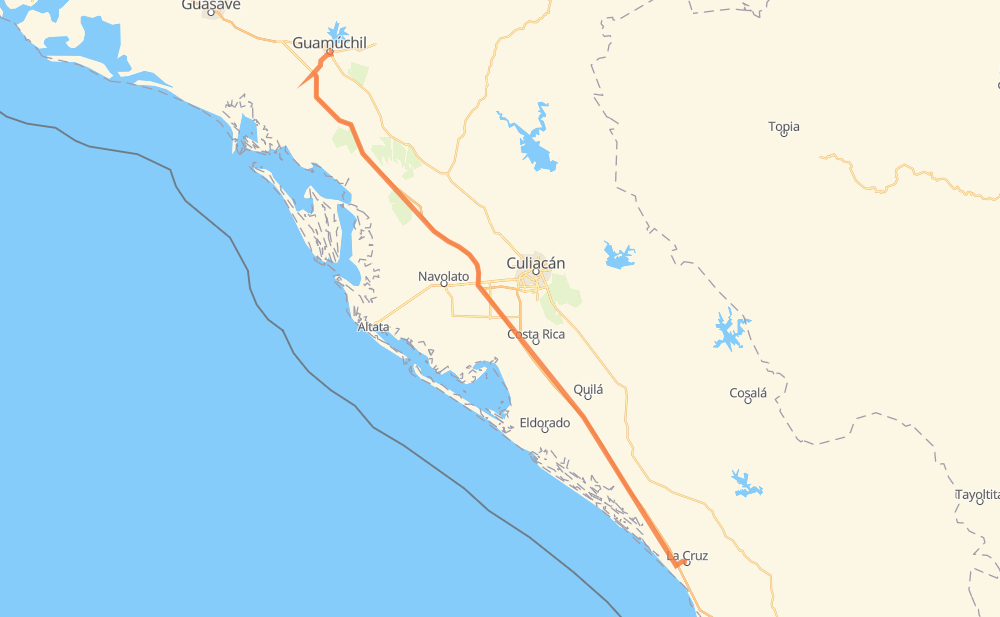
Distance between Guamuchil and La Cruz
The distance from Guamuchil to La Cruz is 226 kilometers by road including 211 kilometers on motorways. Road takes approximately 2 hours and 27 minutes and goes through Colonia Agrícola México (Palmitas), Campo Balbuena, Tanques, Cerro Bola, San Blas, El Batallón and Abuya y Ceuta Segunda (Ejido Echeverría).
| Shortest distance by air | 208 km ✈️ |
| Car route length | 226 km 🚗 |
| Driving time | 2 h 27 min |
| Fuel amount | 18.1 L |
| Fuel cost | 32 AUD |
| Toll roads cost | 335 MXN |
| Point | Distance | Time | Fuel | |
| Guamuchil | 0 km | 00 min | 0.0 L | |
|
Sin 223 MEX 15D 32 km, 21 min
|
||||
| Cerro Bola | 32 km | 21 min | 2.3 L | |
|
MEX 15D 16 km, 10 min
|
||||
| Colonia Agrícola México (Palmitas) | 47 km | 32 min | 3.4 L | |
|
MEX 15D 39 km, 24 min
|
||||
| San Blas | 86 km | 56 min | 6.5 L | |
|
MEX 15D 19 km, 12 min
|
||||
| El Batallón | 105 km | 1 h 08 min | 8.3 L | |
|
MEX 15D 4 km, 02 min
|
||||
| Campo Balbuena | 109 km | 1 h 11 min | 8.4 L | |
|
MEX 15D 69 km, 40 min
|
||||
| Abuya y Ceuta Segunda (Ejido Echeverría) | 177 km | 1 h 51 min | 14.0 L | |
|
MEX 15D 11 km, 07 min
|
||||
| Ricardo Flores Magón | 189 km | 1 h 59 min | 14.9 L | |
|
MEX 15D 13 km, 09 min
|
||||
| Tanques | 202 km | 2 h 08 min | 15.7 L | |
|
MEX 15D 25 km, 18 min
|
||||
| La Cruz | 226 km | 2 h 26 min | 17.8 L | |
Frequently Asked Questions
How many toll booths are there from Guamuchil to La Cruz?
There are 4 toll booths between Guamuchil and La Cruz: San Pedro km 197+100, Costa Rica, Las Brisas and El Pisal.
How much does the toll booths cost from Guamuchil to La Cruz?
Toll roads cost: Las Brisas (76 MXN) + El Pisal (73 MXN) + San Pedro km 197+100 (34 MXN) + Costa Rica (152 MXN) = 335 MXN
How much does it cost to drive from Guamuchil to La Cruz?
Fuel cost: 32 AUD
This fuel cost is calculated as: (Route length 226 km / 100 km) * (Fuel consumption 8 L/100 km) * (Fuel price 1.77 AUD / L)
You can adjust fuel consumption and fuel price here.
Toll roads cost: 335 MXN
How long is a car ride from Guamuchil to La Cruz?
Driving time: 2 h 27 min
This time is calculated for driving at the maximum permitted speed, taking into account traffic rules restrictions.
- 22 km with a maximum speed 110 km/h = 11 min
- 125 km with a maximum speed 100 km/h = 1 h 15 min
- 7 km with a maximum speed 90 km/h = 4 min
- 71 km with a maximum speed 80 km/h = 52 min
- 1 km with a maximum speed 40 km/h = 1 min
The calculated driving time does not take into account intermediate stops and traffic jams.
How far is Guamuchil to La Cruz by land?
The distance between Guamuchil and La Cruz is 226 km by road including 211 km on motorways.
Precise satellite coordinates of highways were used for this calculation. The start and finish points are the centers of Guamuchil and La Cruz respectively.
How far is Guamuchil to La Cruz by plane?
The shortest distance (air line, as the crow flies) between Guamuchil and La Cruz is 208 km.
This distance is calculated using the Haversine formula as a great-circle distance between two points on the surface of a sphere. The start and finish points are the centers of Guamuchil and La Cruz respectively. Actual distance between airports may be different.
How many hours is Guamuchil from La Cruz by plane?
Boeing 737 airliner needs 15 min to cover the distance of 208 km at a cruising speed of 800 km/h.
Small plane "Cessna 172" needs 56 min to flight this distance at average speed of 220 km/h.
This time is approximate and do not take into account takeoff and landing times, airport location and other real world factors.
How long is a helicopter ride from Guamuchil to La Cruz?
Fast helicopter "Eurocopter AS350" or "Hughes OH-6 Cayuse" need 52 min to cover the distance of 208 km at a cruising speed of 240 km/h.
Popular "Robinson R44" needs 59 min to flight this distance at average speed of 210 km/h.
This time is approximate and do not take into account takeoff and landing times, aerodrome location and other real world factors.
What city is halfway between Guamuchil and La Cruz?
The halfway point between Guamuchil and La Cruz is Campo Balbuena. It is located about 5 km from the exact midpoint by road.
The distance from Campo Balbuena to Guamuchil is 109 km and driving will take about 1 h 11 min. The road between Campo Balbuena and La Cruz has length 118 km and will take approximately 1 h 15 min.
The other cities located close to halfway point:
Where is Guamuchil in relation to La Cruz?
Guamuchil is located 208 km north-west of La Cruz.
Guamuchil has geographic coordinates: latitude 25.45756, longitude -108.07558.
La Cruz has geographic coordinates: latitude 23.92331, longitude -106.89365.
Which highway goes from Guamuchil to La Cruz?
The route from Guamuchil to La Cruz follows MEX 15D.
Other minor sections pass along the road:
- Sin 223: 8 km
- Sin 410: 2 km
- MEX 15: 1 km