Distance between Ituporanga and Felixlândia
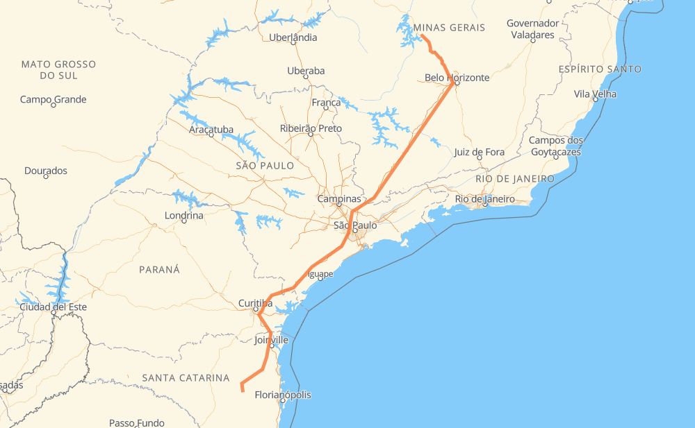
The distance from Ituporanga to Felixlândia is 1,462 kilometers by road including 1,153 kilometers on motorways. Road takes approximately 15 hours and 58 minutes and goes through Piraquara, Taboão da Serra, Barueri, Atibaia, Betim, Contagem and Ribeirão das Neves.
| Shortest distance by air | 1,076 km ✈️ |
| Car route length | 1,462 km 🚗 |
| Driving time | 15 h 58 min |
| Fuel amount | 117 L |
| Fuel cost | 210.6 AUD |
| Point | Distance | Time | Fuel | |
| Ituporanga | 0 km | 00 min | 0.0 L | |
|
SC-350 34 km, 25 min
|
||||
| Rainha | 34 km | 25 min | 2.5 L | |
|
BR-470 SC-108 284 km, 3 h 32 min
|
||||
| Piraquara | 318 km | 3 h 57 min | 24.8 L | |
|
BR-116 381 km, 4 h 05 min
|
||||
| Taboão da Serra | 699 km | 8 h 03 min | 55.9 L | |
|
SP-230 SP-021 18 km, 11 min
|
||||
| Barueri | 717 km | 8 h 14 min | 57.1 L | |
|
SP-021 SP-354 74 km, 52 min
|
||||
| Atibaia | 792 km | 9 h 06 min | 62.2 L | |
|
SP-065 BR-381 491 km, 4 h 42 min
|
||||
| Betim | 1,283 km | 13 h 48 min | 102.2 L | |
|
BR-381 16 km, 10 min
|
||||
| Contagem | 1,299 km | 13 h 59 min | 103.5 L | |
|
BR-040 22 km, 17 min
|
||||
| Ribeirão das Neves | 1,321 km | 14 h 16 min | 105.2 L | |
|
BR-040 160 km, 1 h 41 min
|
||||
| Felixlândia | 1,480 km | 15 h 57 min | 118.1 L | |
Frequently Asked Questions
How much does it cost to drive from Ituporanga to Felixlândia?
Fuel cost: 210.6 AUD
This fuel cost is calculated as: (Route length 1,462 km / 100 km) * (Fuel consumption 8 L/100 km) * (Fuel price 1.8 AUD / L)
You can adjust fuel consumption and fuel price here.
How long is a car ride from Ituporanga to Felixlândia?
Driving time: 15 h 58 min
This time is calculated for driving at the maximum permitted speed, taking into account traffic rules restrictions.
- 738 km with a maximum speed 110 km/h = 6 h 42 min
- 150 km with a maximum speed 100 km/h = 1 h 30 min
- 165 km with a maximum speed 90 km/h = 1 h 50 min
- 299 km with a maximum speed 80 km/h = 3 h 44 min
- 22 km with a maximum speed 70 km/h = 18 min
- 88 km with a maximum speed 60 km/h = 1 h 28 min
- 9 km with a maximum speed 50 km/h = 10 min
- 9 km with a maximum speed 40 km/h = 12 min
The calculated driving time does not take into account intermediate stops and traffic jams.
How far is Ituporanga to Felixlândia by land?
The distance between Ituporanga and Felixlândia is 1,462 km by road including 1,153 km on motorways.
Precise satellite coordinates of highways were used for this calculation. The start and finish points are the centers of Ituporanga and Felixlândia respectively.
How far is Ituporanga to Felixlândia by plane?
The shortest distance (air line, as the crow flies) between Ituporanga and Felixlândia is 1,076 km.
This distance is calculated using the Haversine formula as a great-circle distance between two points on the surface of a sphere. The start and finish points are the centers of Ituporanga and Felixlândia respectively. Actual distance between airports may be different.
How many hours is Ituporanga from Felixlândia by plane?
Boeing 737 airliner needs 1 h 20 min to cover the distance of 1,076 km at a cruising speed of 800 km/h.
Small plane "Cessna 172" needs 4 h 53 min to flight this distance at average speed of 220 km/h.
This time is approximate and do not take into account takeoff and landing times, airport location and other real world factors.
How long is a helicopter ride from Ituporanga to Felixlândia?
Fast helicopter "Eurocopter AS350" or "Hughes OH-6 Cayuse" need 4 h 29 min to cover the distance of 1,076 km at a cruising speed of 240 km/h.
Popular "Robinson R44" needs 5 h 7 min to flight this distance at average speed of 210 km/h.
This time is approximate and do not take into account takeoff and landing times, aerodrome location and other real world factors.
What city is halfway between Ituporanga and Felixlândia?
The halfway point between Ituporanga and Felixlândia is Colinas da Anhanguera. It is located about 1 km from the exact midpoint by road.
The distance from Colinas da Anhanguera to Ituporanga is 730 km and driving will take about 8 h 22 min. The road between Colinas da Anhanguera and Felixlândia has length 733 km and will take approximately 7 h 35 min.
The other cities located close to halfway point:
Where is Ituporanga in relation to Felixlândia?
Ituporanga is located 1,076 km south-west of Felixlândia.
Ituporanga has geographic coordinates: latitude -27.40962, longitude -49.60148.
Felixlândia has geographic coordinates: latitude -18.7574, longitude -44.89915.
Which highway goes from Ituporanga to Felixlândia?
The route from Ituporanga to Felixlândia follows BR-381, BR-116, SP-230, BR-040, BR-135.
Other minor sections pass along the road:
- BR-470: 83 km
- SC-108: 76 km
- BR-376: 74 km
- BR-478: 48 km
- SP-354: 38 km
- SP-010: 36 km
- BR-101: 33 km
- SC-350: 23 km
- SP-021: 22 km
- SP-330: 15 km
- BR-050: 15 km
- BR-477: 14 km
- SP-065: 13 km
- BR-277: 9 km
- JAR-354: 9 km
- BR-262: 7 km
- BR-280: 4 km
- MG-164: 4 km
- BR-494: 2 km