Distance between Koroit and Amamoor
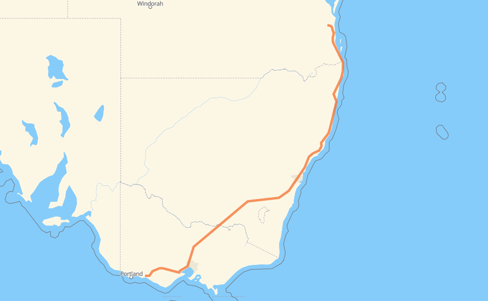
The distance from Koroit to Amamoor is 2,175 kilometers by road including 1,858 kilometers on motorways. Road takes approximately 21 hours and 10 minutes and goes through Warrnambool, Wangaratta, Wodonga, Coffs Harbour and Tweed Heads.
| Shortest distance by air | 1,642 km ✈️ |
| Car route length | 2,175 km 🚗 |
| Driving time | 21 h 10 min |
| Fuel amount | 174 L |
| Fuel cost | 314.9 AUD |
| Point | Distance | Time | Fuel | |
| Koroit | 0 km | 00 min | 0.0 L | |
|
C183 B120 63 km, 44 min
|
||||
| Mortlake | 63 km | 44 min | 3.6 L | |
|
B140 139 km, 1 h 32 min
|
||||
| Herne Hill | 201 km | 2 h 17 min | 16.0 L | |
|
M1 3 km, 01 min
|
||||
| Bell Post Hill | 205 km | 2 h 19 min | 16.3 L | |
|
M1 10 km, 06 min
|
||||
| Lara | 215 km | 2 h 25 min | 16.5 L | |
|
M1 25 km, 14 min
|
||||
| Werribee | 240 km | 2 h 40 min | 18.5 L | |
|
M1 M31 270 km, 2 h 31 min
|
||||
| Wangaratta | 510 km | 5 h 11 min | 40.4 L | |
|
M31 68 km, 37 min
|
||||
| Wodonga | 577 km | 5 h 48 min | 45.9 L | |
|
M31 1,061 km, 10 h 02 min
|
||||
| Coffs Harbour | 1,638 km | 15 h 51 min | 130.6 L | |
|
A1 M1 540 km, 5 h 20 min
|
||||
| Amamoor | 2,179 km | 21 h 11 min | 173.9 L | |
Hotels of Amamoor
Frequently Asked Questions
How much does it cost to drive from Koroit to Amamoor?
Fuel cost: 314.9 AUD
This fuel cost is calculated as: (Route length 2,175 km / 100 km) * (Fuel consumption 8 L/100 km) * (Fuel price 1.81 AUD / L)
You can adjust fuel consumption and fuel price here.
How long is a car ride from Koroit to Amamoor?
Driving time: 21 h 10 min
This time is calculated for driving at the maximum permitted speed, taking into account traffic rules restrictions.
- 1,508 km with a maximum speed 110 km/h = 13 h 42 min
- 321 km with a maximum speed 100 km/h = 3 h 12 min
- 207 km with a maximum speed 90 km/h = 2 h 18 min
- 80 km with a maximum speed 80 km/h = 1 h
- 32 km with a maximum speed 70 km/h = 27 min
- 18 km with a maximum speed 60 km/h = 17 min
- 9 km with a maximum speed 50 km/h = 10 min
The calculated driving time does not take into account intermediate stops and traffic jams.
How far is Koroit to Amamoor by land?
The distance between Koroit and Amamoor is 2,175 km by road including 1,858 km on motorways.
Precise satellite coordinates of highways were used for this calculation. The start and finish points are the centers of Koroit and Amamoor respectively.
How far is Koroit to Amamoor by plane?
The shortest distance (air line, as the crow flies) between Koroit and Amamoor is 1,642 km.
This distance is calculated using the Haversine formula as a great-circle distance between two points on the surface of a sphere. The start and finish points are the centers of Koroit and Amamoor respectively. Actual distance between airports may be different.
How many hours is Koroit from Amamoor by plane?
Boeing 737 airliner needs 2 h 3 min to cover the distance of 1,642 km at a cruising speed of 800 km/h.
Small plane "Cessna 172" needs 7 h 27 min to flight this distance at average speed of 220 km/h.
This time is approximate and do not take into account takeoff and landing times, airport location and other real world factors.
How long is a helicopter ride from Koroit to Amamoor?
Fast helicopter "Eurocopter AS350" or "Hughes OH-6 Cayuse" need 6 h 50 min to cover the distance of 1,642 km at a cruising speed of 240 km/h.
Popular "Robinson R44" needs 7 h 49 min to flight this distance at average speed of 210 km/h.
This time is approximate and do not take into account takeoff and landing times, aerodrome location and other real world factors.
What city is halfway between Koroit and Amamoor?
The halfway point between Koroit and Amamoor is Denham Court.
The distance from Denham Court to Koroit is 1,087 km and driving will take about 10 h 26 min. The road between Denham Court and Amamoor has length 1,088 km and will take approximately 10 h 43 min.
The other cities located close to halfway point:
Where is Koroit in relation to Amamoor?
Koroit is located 1,642 km south-west of Amamoor.
Koroit has geographic coordinates: latitude -38.29098, longitude 142.36426.
Amamoor has geographic coordinates: latitude -26.3453, longitude 152.67469.
Which highway goes from Koroit to Amamoor?
The route from Koroit to Amamoor follows M31, M1, A1, B140.
Other minor sections pass along the road:
- B120: 39 km
- A28: 33 km
- M80: 23 km
- B400: 15 km
- C183: 9 km
- M2: 5 km
- A43: 4 km
- 40: 3 km
- C174: 3 km
- 51: 2 km
- 42: 2 km
- A40: 1 km
- C146: 1 km