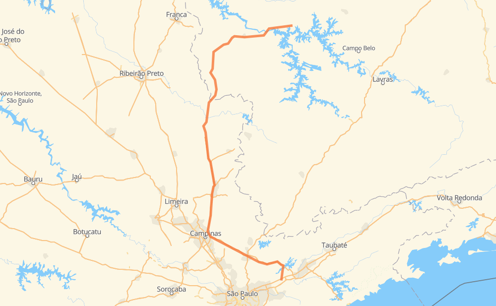
Distance between Lambari and Capitólio
The distance from Lambari to Capitólio is 496 kilometers by road including 274 kilometers on motorways. Road takes approximately 5 hours and 13 minutes and goes through Atibaia, Itatiba, Mogi Guaçu, Taboão, Nazaré Paulista, Bom Jesus dos Perdões and Distrito Industrial.
| Shortest distance by air | 307 km ✈️ |
| Car route length | 496 km 🚗 |
| Driving time | 5 h 13 min |
| Fuel amount | 39.7 L |
| Fuel cost | 71.4 AUD |
| Point | Distance | Time | Fuel | |
| Lambari | 0 km | 00 min | 0.0 L | |
|
SP-065 58 km, 38 min
|
||||
| Nazaré Paulista | 58 km | 38 min | 4.3 L | |
|
SP-065 9 km, 05 min
|
||||
| Bom Jesus dos Perdões | 67 km | 43 min | 5.1 L | |
|
SP-065 16 km, 09 min
|
||||
| Atibaia | 83 km | 53 min | 5.6 L | |
|
SP-065 26 km, 14 min
|
||||
| Itatiba | 109 km | 1 h 07 min | 8.3 L | |
|
SP-065 SP-340 75 km, 42 min
|
||||
| Distrito Industrial | 184 km | 1 h 50 min | 14.6 L | |
|
SP-340 12 km, 06 min
|
||||
| Mogi Guaçu | 196 km | 1 h 57 min | 15.1 L | |
|
SP-340 136 km, 1 h 22 min
|
||||
| Monte Santo de Minas | 332 km | 3 h 19 min | 26.0 L | |
|
BR-491 MG-050 77 km, 53 min
|
||||
| Itaú de Minas | 410 km | 4 h 13 min | 32.2 L | |
|
MG-050 43 km, 29 min
|
||||
| Cancã | 453 km | 4 h 43 min | 35.9 L | |
|
MG-050 43 km, 29 min
|
||||
| -20.61424, -46.04877 | 496 km | 5 h 13 min | 39.7 L | |
Frequently Asked Questions
How much does it cost to drive from Lambari to Capitólio?
Fuel cost: 71.4 AUD
This fuel cost is calculated as: (Route length 496 km / 100 km) * (Fuel consumption 8 L/100 km) * (Fuel price 1.8 AUD / L)
You can adjust fuel consumption and fuel price here.
How long is a car ride from Lambari to Capitólio?
Driving time: 5 h 13 min
This time is calculated for driving at the maximum permitted speed, taking into account traffic rules restrictions.
- 250 km with a maximum speed 110 km/h = 2 h 16 min
- 5 km with a maximum speed 100 km/h = 2 min
- 163 km with a maximum speed 90 km/h = 1 h 48 min
- 68 km with a maximum speed 80 km/h = 50 min
- 5 km with a maximum speed 50 km/h = 5 min
- 5 km with a maximum speed 40 km/h = 6 min
- 1 km with a maximum speed 20 km/h = 2 min
The calculated driving time does not take into account intermediate stops and traffic jams.
How far is Lambari to Capitólio by land?
The distance between Lambari and Capitólio is 496 km by road including 274 km on motorways.
Precise satellite coordinates of highways were used for this calculation. The start and finish points are the centers of Lambari and Capitólio respectively.
How far is Lambari to Capitólio by plane?
The shortest distance (air line, as the crow flies) between Lambari and Capitólio is 307 km.
This distance is calculated using the Haversine formula as a great-circle distance between two points on the surface of a sphere. The start and finish points are the centers of Lambari and Capitólio respectively. Actual distance between airports may be different.
How many hours is Lambari from Capitólio by plane?
Boeing 737 airliner needs 23 min to cover the distance of 307 km at a cruising speed of 800 km/h.
Small plane "Cessna 172" needs 1 h 23 min to flight this distance at average speed of 220 km/h.
This time is approximate and do not take into account takeoff and landing times, airport location and other real world factors.
How long is a helicopter ride from Lambari to Capitólio?
Fast helicopter "Eurocopter AS350" or "Hughes OH-6 Cayuse" need 1 h 16 min to cover the distance of 307 km at a cruising speed of 240 km/h.
Popular "Robinson R44" needs 1 h 27 min to flight this distance at average speed of 210 km/h.
This time is approximate and do not take into account takeoff and landing times, aerodrome location and other real world factors.
What city is halfway between Lambari and Capitólio?
The halfway point between Lambari and Capitólio is Chácara Alvorada. It is located about 33 km from the exact midpoint by road.
The distance from Chácara Alvorada to Lambari is 215 km and driving will take about 2 h 7 min. The road between Chácara Alvorada and Capitólio has length 281 km and will take approximately 3 h 6 min.
The other cities located close to halfway point:
Where is Lambari in relation to Capitólio?
Lambari is located 307 km south of Capitólio.
Lambari has geographic coordinates: latitude -23.36729, longitude -46.18142.
Capitólio has geographic coordinates: latitude -20.61424, longitude -46.04877.
Which highway goes from Lambari to Capitólio?
The route from Lambari to Capitólio follows SP-340, MG-050, SP-065.
Other minor sections pass along the road:
- BR-491: 49 km
- SP-056: 17 km
- BR-449: 15 km
- MG-449: 15 km
- SP-056/060: 3 km
- AMG-2405: 2 km