Distance between Lansing MI and Labrador City NL
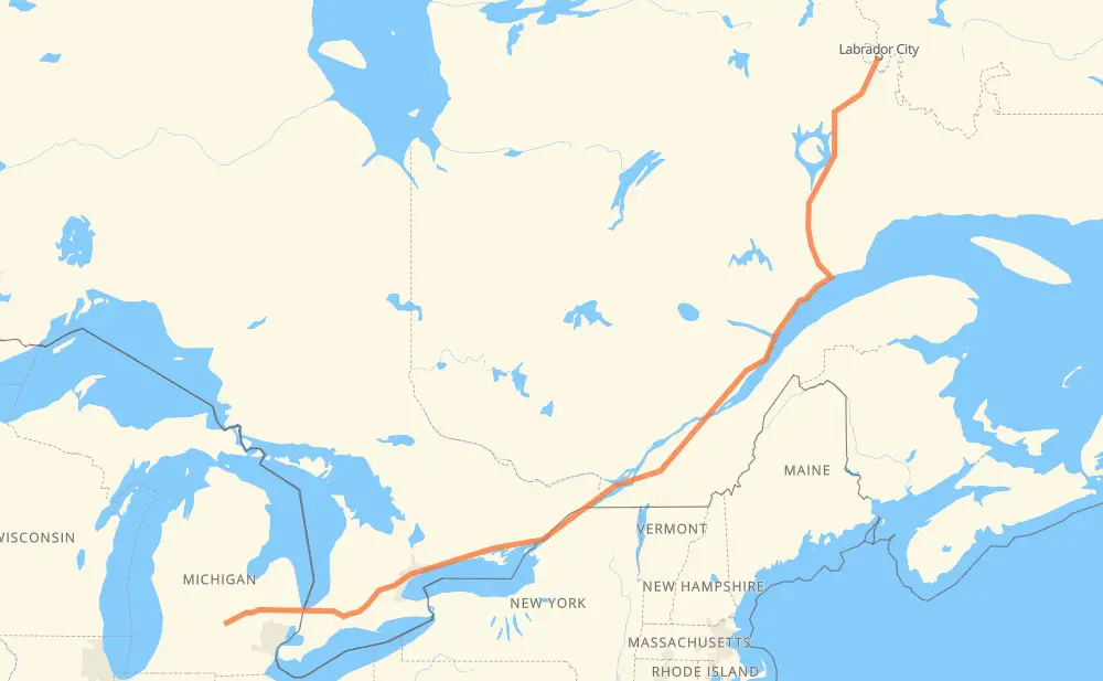
The distance from Lansing to Labrador City is 2,253 kilometers by road including 1,262 kilometers on motorways. Road takes approximately 24 hours and 10 minutes and goes through Flint, Sarnia, Woodstock, Kitchener, Mississauga, Toronto and Ajax.
| Shortest distance by air | 1,730 km ✈️ |
| Car route length | 2,253 km 🚗 |
| Driving time | 24 h 10 min |
| Fuel amount | 180.3 L |
| Fuel cost | 320.9 AUD |
| Point | Distance | Time | Fuel | |
| Lansing | 0 km | 00 min | 0.0 L | |
|
I 69 Business I 69 78 km, 46 min
|
||||
| Flint | 78 km | 46 min | 5.9 L | |
|
I 69 122 km, 1 h 14 min
|
||||
| Sarnia | 201 km | 2 h 01 min | 15.3 L | |
|
402 140 km, 1 h 19 min
|
||||
| Woodstock | 341 km | 3 h 21 min | 26.9 L | |
|
401 42 km, 25 min
|
||||
| Kitchener | 383 km | 3 h 46 min | 30.3 L | |
|
401 66 km, 39 min
|
||||
| Mississauga | 448 km | 4 h 25 min | 35.1 L | |
|
401 31 km, 18 min
|
||||
| Toronto | 479 km | 4 h 44 min | 36.6 L | |
|
401 32 km, 19 min
|
||||
| Ajax | 511 km | 5 h 03 min | 40.7 L | |
|
401 14 km, 08 min
|
||||
| Oshawa | 526 km | 5 h 11 min | 41.7 L | |
|
401 128 km, 1 h 16 min
|
||||
| Belleville | 653 km | 6 h 28 min | 51.7 L | |
|
401 75 km, 45 min
|
||||
| Kingston | 728 km | 7 h 13 min | 56.8 L | |
|
401 79 km, 47 min
|
||||
| Brockville | 807 km | 8 h 00 min | 64.0 L | |
|
401 92 km, 55 min
|
||||
| Cornwall | 899 km | 8 h 55 min | 71.6 L | |
|
401 108 km, 1 h 08 min
|
||||
| Montreal | 1,007 km | 10 h 04 min | 79.3 L | |
|
40 17 km, 13 min
|
||||
| Longueuil | 1,024 km | 10 h 17 min | 81.8 L | |
|
25 20 87 km, 52 min
|
||||
| Drummondville | 1,111 km | 11 h 09 min | 88.4 L | |
|
20 160 km, 1 h 37 min
|
||||
| Quebec | 1,271 km | 12 h 47 min | 100.8 L | |
|
440 138 419 km, 4 h 57 min
|
||||
| Baie-Comeau | 1,690 km | 17 h 44 min | 134.2 L | |
|
389 573 km, 6 h 25 min
|
||||
| Labrador City | 2,264 km | 24 h 10 min | 179.7 L | |
Hotels of Labrador City
Frequently Asked Questions
How much does it cost to drive from Lansing to Labrador City?
Fuel cost: 320.9 AUD
This fuel cost is calculated as: (Route length 2,253 km / 100 km) * (Fuel consumption 8 L/100 km) * (Fuel price 1.78 AUD / L)
You can adjust fuel consumption and fuel price here.
How long is a car ride from Lansing to Labrador City?
Driving time: 24 h 10 min
This time is calculated for driving at the maximum permitted speed, taking into account traffic rules restrictions.
- 171 km with a maximum speed 110 km/h = 1 h 33 min
- 1,052 km with a maximum speed 100 km/h = 10 h 31 min
- 860 km with a maximum speed 90 km/h = 9 h 33 min
- 2 km with a maximum speed 89 km/h = 1 min
- 104 km with a maximum speed 80 km/h = 1 h 17 min
- 4 km with a maximum speed 72 km/h = 2 min
- 50 km with a maximum speed 70 km/h = 43 min
- 3 km with a maximum speed 65 km/h = 2 min
- 3 km with a maximum speed 64 km/h = 2 min
- 1 km with a maximum speed 56 km/h = 1 min
- 10 km with a maximum speed 50 km/h = 12 min
- 2 km with a maximum speed 40 km/h = 2 min
- 2 km with a maximum speed 20 km/h = 5 min
The calculated driving time does not take into account intermediate stops and traffic jams.
How far is Lansing to Labrador City by land?
The distance between Lansing and Labrador City is 2,253 km by road including 1,262 km on motorways.
Precise satellite coordinates of highways were used for this calculation. The start and finish points are the centers of Lansing and Labrador City respectively.
How far is Lansing to Labrador City by plane?
The shortest distance (air line, as the crow flies) between Lansing and Labrador City is 1,730 km.
This distance is calculated using the Haversine formula as a great-circle distance between two points on the surface of a sphere. The start and finish points are the centers of Lansing and Labrador City respectively. Actual distance between airports may be different.
How many hours is Lansing from Labrador City by plane?
Boeing 737 airliner needs 2 h 9 min to cover the distance of 1,730 km at a cruising speed of 800 km/h.
Small plane "Cessna 172" needs 7 h 51 min to flight this distance at average speed of 220 km/h.
This time is approximate and do not take into account takeoff and landing times, airport location and other real world factors.
How long is a helicopter ride from Lansing to Labrador City?
Fast helicopter "Eurocopter AS350" or "Hughes OH-6 Cayuse" need 7 h 12 min to cover the distance of 1,730 km at a cruising speed of 240 km/h.
Popular "Robinson R44" needs 8 h 14 min to flight this distance at average speed of 210 km/h.
This time is approximate and do not take into account takeoff and landing times, aerodrome location and other real world factors.
What city is halfway between Lansing and Labrador City?
The halfway point between Lansing and Labrador City is Drummondville. It is located about 16 km from the exact midpoint by road.
The distance from Drummondville to Lansing is 1,111 km and driving will take about 11 h 9 min. The road between Drummondville and Labrador City has length 1,142 km and will take approximately 13 h 1 min.
The other cities located close to halfway point:
Where is Lansing in relation to Labrador City?
Lansing is located 1,730 km south-west of Labrador City.
Lansing has geographic coordinates: latitude 42.73377, longitude -84.55538.
Labrador City has geographic coordinates: latitude 52.94229, longitude -66.91774.
Which highway goes from Lansing to Labrador City?
The route from Lansing to Labrador City follows 401, 389, 138, 20, I 69, 402.
Other minor sections pass along the road:
- 40: 49 km
- 55: 35 km
- 500: 17 km
- I 69 Business: 14 km
- 440: 9 km
- 25: 8 km
- I 94: 5 km
- 116: 5 km
- M 43: 4 km
- 30: 3 km
- 73: 3 km
- 15: 2 km
- 201: 2 km
- 360: 2 km