Distance between Las Choapas and Ejido Siete Palmas
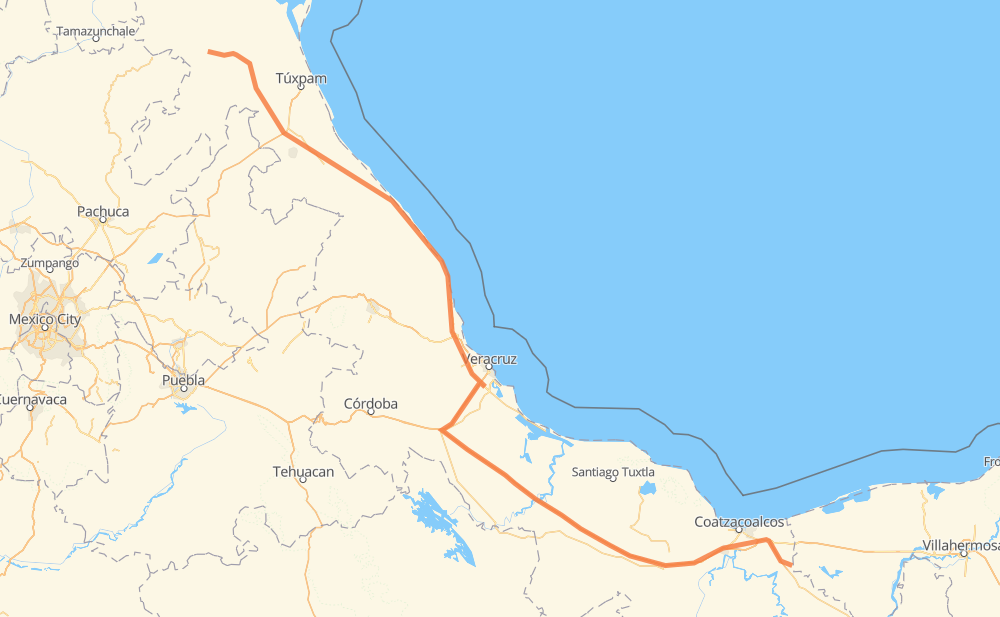
The distance from Las Choapas to Ejido Siete Palmas is 720 kilometers by road including 330 kilometers on motorways. Road takes approximately 8 hours and 3 minutes and goes through José Cardel, Álamo, Ixhuatlán del Sureste, San Pedro Mártir, Jamapa, Santa Rita and Delfino Victoria - Santa Fe.
| Shortest distance by air | 550 km ✈️ |
| Car route length | 720 km 🚗 |
| Driving time | 8 h 3 min |
| Fuel amount | 57.6 L |
| Fuel cost | 102.6 AUD |
| Toll roads cost | 510 + ? MXN |
| Point | Distance | Time | Fuel | |
| Las Choapas | 0 km | 00 min | 0.0 L | |
|
MEX 180D 47 km, 33 min
|
||||
| Ixhuatlán del Sureste | 47 km | 33 min | 3.3 L | |
|
MEX 180D 28 km, 18 min
|
||||
| San Pedro Mártir | 75 km | 51 min | 5.5 L | |
|
MEX 145D 260 km, 2 h 38 min
|
||||
| Jamapa | 334 km | 3 h 30 min | 26.6 L | |
|
MEX 150D MEX 180 21 km, 14 min
|
||||
| Santa Rita | 356 km | 3 h 45 min | 27.9 L | |
|
MEX 180 10 km, 06 min
|
||||
| Delfino Victoria - Santa Fe | 366 km | 3 h 52 min | 29.1 L | |
|
MEX 180 9 km, 05 min
|
||||
| San Julián | 375 km | 3 h 57 min | 29.6 L | |
|
MEX 180D 15 km, 08 min
|
||||
| José Cardel | 390 km | 4 h 06 min | 31.1 L | |
|
MEX 180 278 km, 3 h 19 min
|
||||
| Álamo | 668 km | 7 h 25 min | 52.8 L | |
|
MEX 180 MEX 127 52 km, 37 min
|
||||
| Poza Azul | 720 km | 8 h 03 min | 56.8 L | |
Frequently Asked Questions
How many toll booths are there from Las Choapas to Ejido Siete Palmas?
There are 10 toll booths between Las Choapas and Ejido Siete Palmas: Chapopote, Tuxpan, Cardel - Posa Rica, Nautla, La Antigua, San Julián, Cosamaloapan, Acayucan, Antonio Dovali and Las Choapas.
How much does the toll booths cost from Las Choapas to Ejido Siete Palmas?
Toll roads cost: Las Choapas (26 MXN) + Antonio Dovali (20 MXN) + Acayucan (?) + Cosamaloapan (229 MXN) + San Julián (?) + La Antigua (?) + Nautla (24 MXN) + Cardel - Posa Rica (205 MXN) + Tuxpan (6 MXN) + Chapopote (?) = 510 + ? MXN
How much does it cost to drive from Las Choapas to Ejido Siete Palmas?
Fuel cost: 102.6 AUD
This fuel cost is calculated as: (Route length 720 km / 100 km) * (Fuel consumption 8 L/100 km) * (Fuel price 1.78 AUD / L)
You can adjust fuel consumption and fuel price here.
Toll roads cost: 510 + ? MXN
How long is a car ride from Las Choapas to Ejido Siete Palmas?
Driving time: 8 h 3 min
This time is calculated for driving at the maximum permitted speed, taking into account traffic rules restrictions.
- 24 km with a maximum speed 110 km/h = 13 min
- 258 km with a maximum speed 100 km/h = 2 h 34 min
- 165 km with a maximum speed 90 km/h = 1 h 50 min
- 273 km with a maximum speed 80 km/h = 3 h 24 min
The calculated driving time does not take into account intermediate stops and traffic jams.
How far is Las Choapas to Ejido Siete Palmas by land?
The distance between Las Choapas and Ejido Siete Palmas is 720 km by road including 330 km on motorways.
Precise satellite coordinates of highways were used for this calculation. The start and finish points are the centers of Las Choapas and Ejido Siete Palmas respectively.
How far is Las Choapas to Ejido Siete Palmas by plane?
The shortest distance (air line, as the crow flies) between Las Choapas and Ejido Siete Palmas is 550 km.
This distance is calculated using the Haversine formula as a great-circle distance between two points on the surface of a sphere. The start and finish points are the centers of Las Choapas and Ejido Siete Palmas respectively. Actual distance between airports may be different.
How many hours is Las Choapas from Ejido Siete Palmas by plane?
Boeing 737 airliner needs 41 min to cover the distance of 550 km at a cruising speed of 800 km/h.
Small plane "Cessna 172" needs 2 h 30 min to flight this distance at average speed of 220 km/h.
This time is approximate and do not take into account takeoff and landing times, airport location and other real world factors.
How long is a helicopter ride from Las Choapas to Ejido Siete Palmas?
Fast helicopter "Eurocopter AS350" or "Hughes OH-6 Cayuse" need 2 h 17 min to cover the distance of 550 km at a cruising speed of 240 km/h.
Popular "Robinson R44" needs 2 h 37 min to flight this distance at average speed of 210 km/h.
This time is approximate and do not take into account takeoff and landing times, aerodrome location and other real world factors.
What city is halfway between Las Choapas and Ejido Siete Palmas?
The halfway point between Las Choapas and Ejido Siete Palmas is Santa Rita. It is located about 4 km from the exact midpoint by road.
The distance from Santa Rita to Las Choapas is 356 km and driving will take about 3 h 45 min. The road between Santa Rita and Ejido Siete Palmas has length 365 km and will take approximately 4 h 18 min.
The other cities located close to halfway point:
Where is Las Choapas in relation to Ejido Siete Palmas?
Las Choapas is located 550 km south-east of Ejido Siete Palmas.
Las Choapas has geographic coordinates: latitude 17.91, longitude -94.09278.
Ejido Siete Palmas has geographic coordinates: latitude 21.17722, longitude -98.035.
Which highway goes from Las Choapas to Ejido Siete Palmas?
The route from Las Choapas to Ejido Siete Palmas follows MEX 145D, MEX 180, MEX 180D.
Other minor sections pass along the road:
- MEX 127: 66 km
- MEX 150D: 44 km
- MEX 129: 23 km
- MEX 130: 4 km
- MEX 132: 4 km