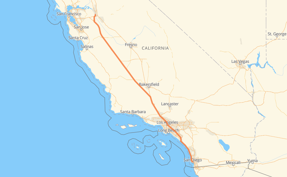
Distance between Lathrop CA and San Diego CA
The distance from Lathrop to San Diego is 722 kilometers by road including 719 kilometers on motorways. Road takes approximately 6 hours and 47 minutes and goes through Santa Clarita, Los Angeles, Burbank, Glendale, Downey, Norwalk and Santa Fe Springs.
| Shortest distance by air | 680 km ✈️ |
| Car route length | 722 km 🚗 |
| Driving time | 6 h 47 min |
| Fuel amount | 57.7 L |
| Fuel cost | 103.9 AUD |
| Point | Distance | Time | Fuel | |
| Lathrop | 0 km | 00 min | 0.0 L | |
|
I 5 476 km, 4 h 22 min
|
||||
| Santa Clarita | 476 km | 4 h 22 min | 37.5 L | |
|
I 5 21 km, 12 min
|
||||
| Los Angeles | 497 km | 4 h 34 min | 38.9 L | |
|
I 5 14 km, 08 min
|
||||
| Burbank | 511 km | 4 h 43 min | 40.7 L | |
|
I 5 4 km, 02 min
|
||||
| Glendale | 515 km | 4 h 45 min | 41.1 L | |
|
I 5 11 km, 06 min
|
||||
| Los Angeles | 526 km | 4 h 51 min | 41.3 L | |
|
I 5 21 km, 12 min
|
||||
| Downey | 547 km | 5 h 04 min | 43.5 L | |
|
I 5 6 km, 03 min
|
||||
| Norwalk | 553 km | 5 h 08 min | 43.9 L | |
|
I 5 5 km, 03 min
|
||||
| Santa Fe Springs | 557 km | 5 h 11 min | 44.5 L | |
|
I 5 1 km, 00 min
|
||||
| La Mirada | 559 km | 5 h 12 min | 44.6 L | |
|
I 5 3 km, 01 min
|
||||
| Buena Park | 561 km | 5 h 13 min | 44.7 L | |
|
I 5 2 km, 01 min
|
||||
| Fullerton | 563 km | 5 h 15 min | 45.1 L | |
|
I 5 5 km, 03 min
|
||||
| Anaheim | 569 km | 5 h 18 min | 45.1 L | |
|
I 5 6 km, 03 min
|
||||
| Orange | 575 km | 5 h 21 min | 45.9 L | |
|
I 5 4 km, 02 min
|
||||
| Santa Ana | 579 km | 5 h 24 min | 46.0 L | |
|
I 5 14 km, 08 min
|
||||
| Irvine | 593 km | 5 h 32 min | 46.9 L | |
|
I 5 15 km, 08 min
|
||||
| Mission Viejo | 608 km | 5 h 40 min | 48.4 L | |
|
I 5 18 km, 10 min
|
||||
| San Clemente | 626 km | 5 h 51 min | 49.7 L | |
|
I 5 35 km, 20 min
|
||||
| Oceanside | 661 km | 6 h 11 min | 52.8 L | |
|
I 5 60 km, 35 min
|
||||
| San Diego | 722 km | 6 h 46 min | 55.0 L | |
Hotels of San Diego
Frequently Asked Questions
How much does it cost to drive from Lathrop to San Diego?
Fuel cost: 103.9 AUD
This fuel cost is calculated as: (Route length 722 km / 100 km) * (Fuel consumption 8 L/100 km) * (Fuel price 1.8 AUD / L)
You can adjust fuel consumption and fuel price here.
How long is a car ride from Lathrop to San Diego?
Driving time: 6 h 47 min
This time is calculated for driving at the maximum permitted speed, taking into account traffic rules restrictions.
- 396 km with a maximum speed 110 km/h = 3 h 36 min
- 296 km with a maximum speed 105 km/h = 2 h 49 min
- 22 km with a maximum speed 89 km/h = 15 min
- 6 km with a maximum speed 80 km/h = 4 min
- 1 km with a maximum speed 50 km/h = 1 min
The calculated driving time does not take into account intermediate stops and traffic jams.
How far is Lathrop to San Diego by land?
The distance between Lathrop and San Diego is 722 km by road including 719 km on motorways.
Precise satellite coordinates of highways were used for this calculation. The start and finish points are the centers of Lathrop and San Diego respectively.
How far is Lathrop to San Diego by plane?
The shortest distance (air line, as the crow flies) between Lathrop and San Diego is 680 km.
This distance is calculated using the Haversine formula as a great-circle distance between two points on the surface of a sphere. The start and finish points are the centers of Lathrop and San Diego respectively. Actual distance between airports may be different.
How many hours is Lathrop from San Diego by plane?
Boeing 737 airliner needs 51 min to cover the distance of 680 km at a cruising speed of 800 km/h.
Small plane "Cessna 172" needs 3 h 5 min to flight this distance at average speed of 220 km/h.
This time is approximate and do not take into account takeoff and landing times, airport location and other real world factors.
How long is a helicopter ride from Lathrop to San Diego?
Fast helicopter "Eurocopter AS350" or "Hughes OH-6 Cayuse" need 2 h 50 min to cover the distance of 680 km at a cruising speed of 240 km/h.
Popular "Robinson R44" needs 3 h 14 min to flight this distance at average speed of 210 km/h.
This time is approximate and do not take into account takeoff and landing times, aerodrome location and other real world factors.
What city is halfway between Lathrop and San Diego?
The halfway point between Lathrop and San Diego is Wheeler Ridge. It is located about 32 km from the exact midpoint by road.
The distance from Wheeler Ridge to Lathrop is 393 km and driving will take about 3 h 35 min. The road between Wheeler Ridge and San Diego has length 329 km and will take approximately 3 h 12 min.
The other cities located close to halfway point:
Where is Lathrop in relation to San Diego?
Lathrop is located 680 km north-west of San Diego.
Lathrop has geographic coordinates: latitude 37.82269, longitude -121.27661.
San Diego has geographic coordinates: latitude 32.71741, longitude -117.16277.
Which highway goes from Lathrop to San Diego?
The route from Lathrop to San Diego follows I 5.
Other minor sections pass along the road:
- CA 33: 19 km
- I 5 Truck: 3 km
- CA 126: 2 km
- CA 57: 2 km
- I 10: 2 km