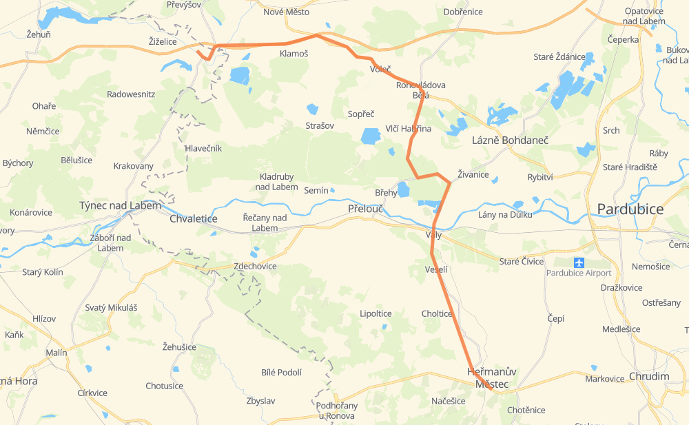
Distance between Loukonosy and Hermannstädtel
The distance from Loukonosy to Hermannstädtel is 38 kilometers by road including 6 kilometers on motorways. Road takes approximately 29 minutes and goes through Chlumetz an der Zidlina, Prelauc, Klamoš, Chýšť, Voleč, Rohovládova Bělá and Vlčí Habřina.
| Shortest distance by air | 27 km ✈️ |
| Car route length | 38 km 🚗 |
| Driving time | 29 min |
| Fuel amount | 3 L |
| Fuel cost | 5.4 AUD |
| Point | Distance | Time | Fuel | |
| Loukonosy | 0 km | 00 min | 0.0 L | |
|
327 D11 5 km, 03 min
|
||||
| Chlumetz an der Zidlina | 5 km | 03 min | 0.3 L | |
|
D11 3 km, 02 min
|
||||
| Chýšť | 9 km | 05 min | 0.6 L | |
|
36 3 km, 02 min
|
||||
| Voleč | 12 km | 08 min | 0.8 L | |
|
36 3 km, 02 min
|
||||
| Rohovládova Bělá | 15 km | 10 min | 1.2 L | |
|
36 3 km, 02 min
|
||||
| Vlčí Habřina | 18 km | 13 min | 1.2 L | |
|
323 5 km, 04 min
|
||||
| Prelauc | 24 km | 18 min | 1.7 L | |
|
32219 3 km, 02 min
|
||||
| Valy | 26 km | 20 min | 2.1 L | |
|
32219 2 km, 01 min
|
||||
| Veselí | 28 km | 22 min | 2.1 L | |
|
342 10 km, 07 min
|
||||
| Hermannstädtel | 38 km | 29 min | 3.0 L | |
Frequently Asked Questions
How much does it cost to drive from Loukonosy to Hermannstädtel?
Fuel cost: 5.4 AUD
This fuel cost is calculated as: (Route length 38 km / 100 km) * (Fuel consumption 8 L/100 km) * (Fuel price 1.78 AUD / L)
You can adjust fuel consumption and fuel price here.
How long is a car ride from Loukonosy to Hermannstädtel?
Driving time: 29 min
This time is calculated for driving at the maximum permitted speed, taking into account traffic rules restrictions.
- 5 km with a maximum speed 110 km/h = 2 min
- 3 km with a maximum speed 90 km/h = 2 min
- 22 km with a maximum speed 80 km/h = 16 min
- 6 km with a maximum speed 50 km/h = 7 min
The calculated driving time does not take into account intermediate stops and traffic jams.
How far is Loukonosy to Hermannstädtel by land?
The distance between Loukonosy and Hermannstädtel is 38 km by road including 6 km on motorways.
Precise satellite coordinates of highways were used for this calculation. The start and finish points are the centers of Loukonosy and Hermannstädtel respectively.
What city is halfway between Loukonosy and Hermannstädtel?
The halfway point between Loukonosy and Hermannstädtel is Vlčí Habřina. It is located about 1 km from the exact midpoint by road.
The distance from Vlčí Habřina to Loukonosy is 18 km and driving will take about 13 min. The road between Vlčí Habřina and Hermannstädtel has length 19 km and will take approximately 16 min.
The other cities located close to halfway point:
Where is Loukonosy in relation to Hermannstädtel?
Loukonosy is located 27 km north-west of Hermannstädtel.
Loukonosy has geographic coordinates: latitude 50.12702, longitude 15.42136.
Hermannstädtel has geographic coordinates: latitude 49.94704, longitude 15.66466.