Distance between Mañihuales and Caleta Tortel
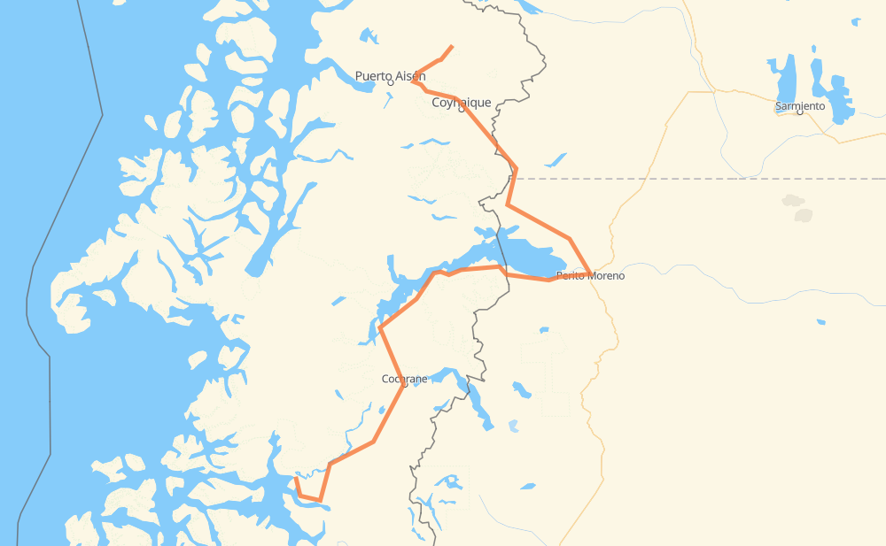
The distance from Mañihuales to Caleta Tortel is 666 kilometers by road. Road takes approximately 9 hours and 54 minutes and goes through Coyhaique, Polo Productivo, Los Antiguos and Cochrane.
| Shortest distance by air | 311 km ✈️ |
| Car route length | 666 km 🚗 |
| Driving time | 9 h 54 min |
| Fuel amount | 53.3 L |
| Fuel cost | 96.4 AUD |
| Point | Distance | Time | Fuel | |
| Mañihuales | 0 km | 00 min | 0.0 L | |
|
7 240 110 km, 1 h 16 min
|
||||
| Coyhaique | 110 km | 1 h 16 min | 5.9 L | |
|
7 39 km, 29 min
|
||||
| Estancia Valle Huemules | 150 km | 1 h 46 min | 11.7 L | |
|
RN260 RP45 111 km, 1 h 58 min
|
||||
| Polo Productivo | 260 km | 3 h 45 min | 20.7 L | |
|
RP45 RP43 44 km, 31 min
|
||||
| Los Antiguos | 305 km | 4 h 16 min | 22.8 L | |
|
RP43 265-CH 36 km, 26 min
|
||||
| Chile Chico | 340 km | 4 h 42 min | 26.6 L | |
|
265-CH 69 km, 47 min
|
||||
| Mallin Grande | 409 km | 5 h 30 min | 32.1 L | |
|
265-CH 32 km, 23 min
|
||||
| Puerto Guadal | 441 km | 5 h 54 min | 34.7 L | |
|
265-CH 7 15 km, 11 min
|
||||
| Seguel | 456 km | 6 h 05 min | 36.2 L | |
|
7 80 km, 1 h 00 min
|
||||
| Cochrane | 536 km | 7 h 05 min | 36.8 L | |
|
7 130 km, 2 h 48 min
|
||||
| -47.80347, -73.53764 | 666 km | 9 h 54 min | 53.3 L | |
Frequently Asked Questions
How much does it cost to drive from Mañihuales to Caleta Tortel?
Fuel cost: 96.4 AUD
This fuel cost is calculated as: (Route length 666 km / 100 km) * (Fuel consumption 8 L/100 km) * (Fuel price 1.81 AUD / L)
You can adjust fuel consumption and fuel price here.
How long is a car ride from Mañihuales to Caleta Tortel?
Driving time: 9 h 54 min
This time is calculated for driving at the maximum permitted speed, taking into account traffic rules restrictions.
- 217 km with a maximum speed 90 km/h = 2 h 24 min
- 383 km with a maximum speed 80 km/h = 4 h 47 min
- 18 km with a maximum speed 50 km/h = 21 min
- 47 km with a maximum speed 20 km/h = 2 h 19 min
The calculated driving time does not take into account intermediate stops and traffic jams.
How far is Mañihuales to Caleta Tortel by land?
The distance between Mañihuales and Caleta Tortel is 666 km by road.
Precise satellite coordinates of highways were used for this calculation. The start and finish points are the centers of Mañihuales and Caleta Tortel respectively.
How far is Mañihuales to Caleta Tortel by plane?
The shortest distance (air line, as the crow flies) between Mañihuales and Caleta Tortel is 311 km.
This distance is calculated using the Haversine formula as a great-circle distance between two points on the surface of a sphere. The start and finish points are the centers of Mañihuales and Caleta Tortel respectively. Actual distance between airports may be different.
How many hours is Mañihuales from Caleta Tortel by plane?
Boeing 737 airliner needs 23 min to cover the distance of 311 km at a cruising speed of 800 km/h.
Small plane "Cessna 172" needs 1 h 24 min to flight this distance at average speed of 220 km/h.
This time is approximate and do not take into account takeoff and landing times, airport location and other real world factors.
How long is a helicopter ride from Mañihuales to Caleta Tortel?
Fast helicopter "Eurocopter AS350" or "Hughes OH-6 Cayuse" need 1 h 17 min to cover the distance of 311 km at a cruising speed of 240 km/h.
Popular "Robinson R44" needs 1 h 28 min to flight this distance at average speed of 210 km/h.
This time is approximate and do not take into account takeoff and landing times, aerodrome location and other real world factors.
What city is halfway between Mañihuales and Caleta Tortel?
The halfway point between Mañihuales and Caleta Tortel is Chile Chico. It is located about 7 km from the exact midpoint by road.
The distance from Chile Chico to Mañihuales is 340 km and driving will take about 4 h 42 min. The road between Chile Chico and Caleta Tortel has length 326 km and will take approximately 5 h 12 min.
The other cities located close to halfway point:
Where is Mañihuales in relation to Caleta Tortel?
Mañihuales is located 311 km north-east of Caleta Tortel.
Mañihuales has geographic coordinates: latitude -45.17283, longitude -72.14698.
Caleta Tortel has geographic coordinates: latitude -47.80347, longitude -73.53764.
Which highway goes from Mañihuales to Caleta Tortel?
The route from Mañihuales to Caleta Tortel follows 7, 265-CH.
Other minor sections pass along the road:
- RP45: 95 km
- RP43: 59 km
- 240: 36 km
- X-50: 28 km
- 245-CH: 20 km
- RN260: 5 km
- RN40: 1 km