Distance between Malhada de Pedras and Guarulhos
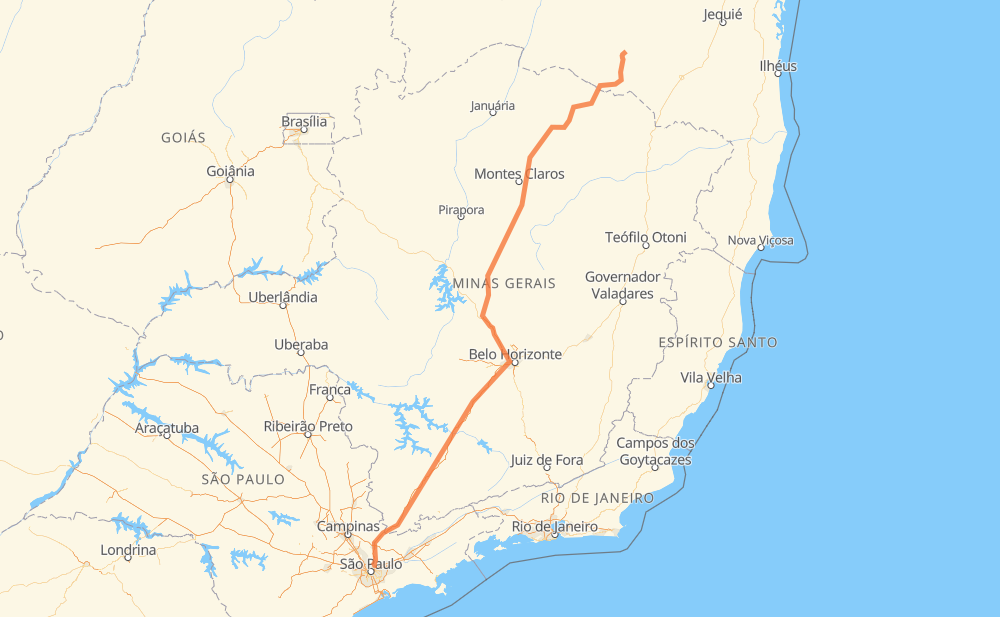
The distance from Malhada de Pedras to Guarulhos is 1,402 kilometers by road including 646 kilometers on motorways. Road takes approximately 15 hours and 34 minutes and goes through Ribeirão das Neves, Contagem, Betim and Atibaia.
| Shortest distance by air | 1,119 km ✈️ |
| Car route length | 1,402 km 🚗 |
| Driving time | 15 h 34 min |
| Fuel amount | 112.2 L |
| Fuel cost | 201.9 AUD |
| Point | Distance | Time | Fuel | |
| Malhada de Pedras | 0 km | 00 min | 0.0 L | |
|
BA-148 215 km, 2 h 33 min
|
||||
| Mato Verde | 215 km | 2 h 33 min | 14.6 L | |
|
LMG-635 BR-122 48 km, 35 min
|
||||
| Porteirinha | 263 km | 3 h 08 min | 19.9 L | |
|
BR-122 19 km, 13 min
|
||||
| Bom Jesus | 281 km | 3 h 22 min | 22.1 L | |
|
BR-122 11 km, 08 min
|
||||
| Colonização II | 292 km | 3 h 30 min | 22.9 L | |
|
BR-122 BR-135 533 km, 6 h 05 min
|
||||
| Ribeirão das Neves | 825 km | 9 h 36 min | 65.7 L | |
|
BR-040 22 km, 16 min
|
||||
| Contagem | 847 km | 9 h 53 min | 67.3 L | |
|
BR-381 16 km, 11 min
|
||||
| Betim | 863 km | 10 h 04 min | 68.6 L | |
|
BR-381 491 km, 4 h 52 min
|
||||
| Atibaia | 1,354 km | 14 h 56 min | 107.3 L | |
|
SP-010 BR-381 50 km, 37 min
|
||||
| Guarulhos | 1,404 km | 15 h 33 min | 112.1 L | |
Hotels of Guarulhos
Frequently Asked Questions
How much does it cost to drive from Malhada de Pedras to Guarulhos?
Fuel cost: 201.9 AUD
This fuel cost is calculated as: (Route length 1,402 km / 100 km) * (Fuel consumption 8 L/100 km) * (Fuel price 1.8 AUD / L)
You can adjust fuel consumption and fuel price here.
How long is a car ride from Malhada de Pedras to Guarulhos?
Driving time: 15 h 34 min
This time is calculated for driving at the maximum permitted speed, taking into account traffic rules restrictions.
- 378 km with a maximum speed 110 km/h = 3 h 26 min
- 106 km with a maximum speed 100 km/h = 1 h 3 min
- 414 km with a maximum speed 90 km/h = 4 h 36 min
- 475 km with a maximum speed 80 km/h = 5 h 55 min
- 15 km with a maximum speed 70 km/h = 13 min
- 5 km with a maximum speed 60 km/h = 5 min
- 5 km with a maximum speed 50 km/h = 5 min
- 5 km with a maximum speed 40 km/h = 8 min
The calculated driving time does not take into account intermediate stops and traffic jams.
How far is Malhada de Pedras to Guarulhos by land?
The distance between Malhada de Pedras and Guarulhos is 1,402 km by road including 646 km on motorways.
Precise satellite coordinates of highways were used for this calculation. The start and finish points are the centers of Malhada de Pedras and Guarulhos respectively.
How far is Malhada de Pedras to Guarulhos by plane?
The shortest distance (air line, as the crow flies) between Malhada de Pedras and Guarulhos is 1,119 km.
This distance is calculated using the Haversine formula as a great-circle distance between two points on the surface of a sphere. The start and finish points are the centers of Malhada de Pedras and Guarulhos respectively. Actual distance between airports may be different.
How many hours is Malhada de Pedras from Guarulhos by plane?
Boeing 737 airliner needs 1 h 23 min to cover the distance of 1,119 km at a cruising speed of 800 km/h.
Small plane "Cessna 172" needs 5 h 5 min to flight this distance at average speed of 220 km/h.
This time is approximate and do not take into account takeoff and landing times, airport location and other real world factors.
How long is a helicopter ride from Malhada de Pedras to Guarulhos?
Fast helicopter "Eurocopter AS350" or "Hughes OH-6 Cayuse" need 4 h 39 min to cover the distance of 1,119 km at a cruising speed of 240 km/h.
Popular "Robinson R44" needs 5 h 19 min to flight this distance at average speed of 210 km/h.
This time is approximate and do not take into account takeoff and landing times, aerodrome location and other real world factors.
What city is halfway between Malhada de Pedras and Guarulhos?
The halfway point between Malhada de Pedras and Guarulhos is Bananal. It is located about 11 km from the exact midpoint by road.
The distance from Bananal to Malhada de Pedras is 712 km and driving will take about 8 h 27 min. The road between Bananal and Guarulhos has length 690 km and will take approximately 7 h 6 min.
The other cities located close to halfway point:
Where is Malhada de Pedras in relation to Guarulhos?
Malhada de Pedras is located 1,119 km north-east of Guarulhos.
Malhada de Pedras has geographic coordinates: latitude -14.38663, longitude -41.87918.
Guarulhos has geographic coordinates: latitude -23.44306, longitude -46.52446.
Which highway goes from Malhada de Pedras to Guarulhos?
The route from Malhada de Pedras to Guarulhos follows BR-381, BR-135, BR-122, MGC-122, BR-040.
Other minor sections pass along the road:
- SP-010: 80 km
- LMG-635: 68 km
- BA-148: 52 km
- CMG-135: 46 km
- BR-251: 18 km
- LMG-653: 11 km
- CMG-122: 9 km
- CMG-251: 9 km
- MGC-251: 9 km
- BR-262: 7 km
- BA-156: 6 km
- BR-494: 3 km
- MG-401: 3 km
- MGT-122: 3 km