Distance between Manga and São Francisco de Itabapoana
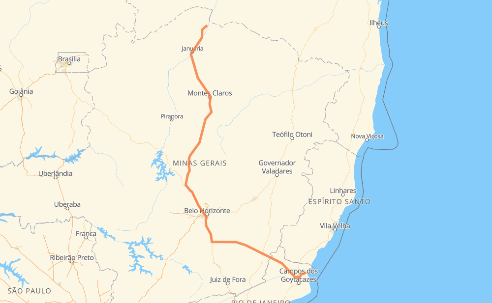
The distance from Manga to São Francisco de Itabapoana is 1,187 kilometers by road including 142 kilometers on motorways. Road takes approximately 14 hours and 15 minutes and goes through Ribeirão das Neves, Conselheiro Lafaiete, Muriaé, São João das Missões, Itacarambi, Januária and Pedras de Maria da Cruz.
| Shortest distance by air | 805 km ✈️ |
| Car route length | 1,187 km 🚗 |
| Driving time | 14 h 15 min |
| Fuel amount | 95 L |
| Fuel cost | 169 AUD |
| Point | Distance | Time | Fuel | |
| Manga | 0 km | 00 min | 0.0 L | |
|
BR-135 24 km, 18 min
|
||||
| São João das Missões | 24 km | 18 min | 0.2 L | |
|
BR-135 31 km, 23 min
|
||||
| Itacarambi | 55 km | 41 min | 3.7 L | |
|
BR-135 51 km, 38 min
|
||||
| Januária | 106 km | 1 h 19 min | 8.2 L | |
|
BR-135 16 km, 11 min
|
||||
| Pedras de Maria da Cruz | 122 km | 1 h 31 min | 9.4 L | |
|
BR-135 86 km, 1 h 03 min
|
||||
| Mirabela | 207 km | 2 h 34 min | 15.8 L | |
|
BR-135 75 km, 51 min
|
||||
| Santo Amaro | 282 km | 3 h 26 min | 22.5 L | |
|
CMG-135 BR-135 387 km, 4 h 23 min
|
||||
| Ribeirão das Neves | 669 km | 7 h 50 min | 53.2 L | |
|
BR-040 128 km, 1 h 33 min
|
||||
| Conselheiro Lafaiete | 797 km | 9 h 24 min | 62.4 L | |
|
BR-482 208 km, 2 h 37 min
|
||||
| Muriaé | 1,005 km | 12 h 01 min | 78.9 L | |
|
BR-356 186 km, 2 h 13 min
|
||||
| -21.47434, -41.11184 | 1,190 km | 14 h 15 min | 95.2 L | |
Frequently Asked Questions
How much does it cost to drive from Manga to São Francisco de Itabapoana?
Fuel cost: 169 AUD
This fuel cost is calculated as: (Route length 1,187 km / 100 km) * (Fuel consumption 8 L/100 km) * (Fuel price 1.78 AUD / L)
You can adjust fuel consumption and fuel price here.
How long is a car ride from Manga to São Francisco de Itabapoana?
Driving time: 14 h 15 min
This time is calculated for driving at the maximum permitted speed, taking into account traffic rules restrictions.
- 93 km with a maximum speed 110 km/h = 50 min
- 3 km with a maximum speed 100 km/h = 1 min
- 422 km with a maximum speed 90 km/h = 4 h 41 min
- 609 km with a maximum speed 80 km/h = 7 h 36 min
- 25 km with a maximum speed 70 km/h = 21 min
- 31 km with a maximum speed 60 km/h = 30 min
- 2 km with a maximum speed 50 km/h = 2 min
- 3 km with a maximum speed 40 km/h = 4 min
- 3 km with a maximum speed 30 km/h = 6 min
The calculated driving time does not take into account intermediate stops and traffic jams.
How far is Manga to São Francisco de Itabapoana by land?
The distance between Manga and São Francisco de Itabapoana is 1,187 km by road including 142 km on motorways.
Precise satellite coordinates of highways were used for this calculation. The start and finish points are the centers of Manga and São Francisco de Itabapoana respectively.
How far is Manga to São Francisco de Itabapoana by plane?
The shortest distance (air line, as the crow flies) between Manga and São Francisco de Itabapoana is 805 km.
This distance is calculated using the Haversine formula as a great-circle distance between two points on the surface of a sphere. The start and finish points are the centers of Manga and São Francisco de Itabapoana respectively. Actual distance between airports may be different.
How many hours is Manga from São Francisco de Itabapoana by plane?
Boeing 737 airliner needs 1 h to cover the distance of 805 km at a cruising speed of 800 km/h.
Small plane "Cessna 172" needs 3 h 39 min to flight this distance at average speed of 220 km/h.
This time is approximate and do not take into account takeoff and landing times, airport location and other real world factors.
How long is a helicopter ride from Manga to São Francisco de Itabapoana?
Fast helicopter "Eurocopter AS350" or "Hughes OH-6 Cayuse" need 3 h 21 min to cover the distance of 805 km at a cruising speed of 240 km/h.
Popular "Robinson R44" needs 3 h 50 min to flight this distance at average speed of 210 km/h.
This time is approximate and do not take into account takeoff and landing times, aerodrome location and other real world factors.
What city is halfway between Manga and São Francisco de Itabapoana?
The halfway point between Manga and São Francisco de Itabapoana is Paraopeba. It is located about 6 km from the exact midpoint by road.
The distance from Paraopeba to Manga is 600 km and driving will take about 7 h 9 min. The road between Paraopeba and São Francisco de Itabapoana has length 587 km and will take approximately 7 h 6 min.
The other cities located close to halfway point:
Where is Manga in relation to São Francisco de Itabapoana?
Manga is located 805 km north-west of São Francisco de Itabapoana.
Manga has geographic coordinates: latitude -14.7528, longitude -43.9417.
São Francisco de Itabapoana has geographic coordinates: latitude -21.47434, longitude -41.11184.
Which highway goes from Manga to São Francisco de Itabapoana?
The route from Manga to São Francisco de Itabapoana follows BR-135, BR-356, BR-040, BR-482, MGC-482.
Other minor sections pass along the road:
- CMG-135: 85 km
- MGC-135: 80 km
- MG-135: 42 km
- RJ-224: 31 km
- MGC-356: 28 km
- MGT-356: 16 km
- BR-120: 15 km
- CA-51: 5 km
- CAM-112: 5 km
- BR-381: 1 km
- BR-262: 1 km