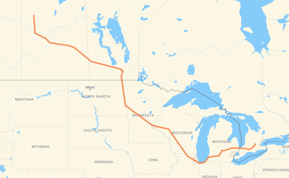
The distance from Meadow Lake to Kitchener is 3,214 kilometers by road including 2,052 kilometers on motorways. Road takes approximately 33 hours and 10 minutes and goes through North Battleford, Saskatoon, Yorkton, Portage la Prairie, Winnipeg, Grand Forks and Fargo.
How much does it cost to drive from Meadow Lake to Kitchener?
Fuel cost:
462.8 AUD
This fuel cost is calculated as: (Route length 3,214 km / 100 km) * (Fuel consumption 8 L/100 km) * (Fuel price 1.8 AUD / L)
You can adjust fuel consumption and fuel price here.
How long is a car ride from Meadow Lake to Kitchener?
Driving time:
33 h 10 min
This time is calculated for driving at the maximum permitted speed, taking into account traffic rules restrictions.
1,337 km with a maximum speed 110 km/h = 12 h 9 min
28 km with a maximum speed 105 km/h = 15 min
425 km with a maximum speed 100 km/h = 4 h 14 min
33 km with a maximum speed 97 km/h = 20 min
989 km with a maximum speed 90 km/h = 10 h 59 min
40 km with a maximum speed 89 km/h = 27 min
313 km with a maximum speed 80 km/h = 3 h 54 min
13 km with a maximum speed 72 km/h = 10 min
16 km with a maximum speed 70 km/h = 14 min
7 km with a maximum speed 60 km/h = 6 min
1 km with a maximum speed 56 km/h = 1 min
11 km with a maximum speed 50 km/h = 12 min
2 km with a maximum speed 40 km/h = 2 min
The calculated driving time does not take into account intermediate stops and traffic jams.
How far is Meadow Lake to Kitchener by land?
The distance between Meadow Lake and Kitchener is 3,214 km by road including 2,052 km on motorways.
Precise satellite coordinates of highways were used for this calculation. The start and finish points are the centers of Meadow Lake and Kitchener respectively.
How far is Meadow Lake to Kitchener by plane?
The shortest distance (air line, as the crow flies) between Meadow Lake and Kitchener is 2,344 km.
This distance is calculated using the Haversine formula as a great-circle distance between two points on the surface of a sphere. The start and finish points are the centers of Meadow Lake and Kitchener respectively. Actual distance between airports may be different.
How many hours is Meadow Lake from Kitchener by plane?
Boeing 737 airliner needs 2 h 55 min to cover the distance of 2,344 km at a cruising speed of 800 km/h.
Small plane "Cessna 172" needs 10 h 39 min to flight this distance at average speed of 220 km/h.
This time is approximate and do not take into account takeoff and landing times, airport location and other real world factors.
How long is a helicopter ride from Meadow Lake to Kitchener?
Fast helicopter "Eurocopter AS350" or "Hughes OH-6 Cayuse" need 9 h 46 min to cover the distance of 2,344 km at a cruising speed of 240 km/h.
Popular "Robinson R44" needs 11 h 9 min to flight this distance at average speed of 210 km/h.
This time is approximate and do not take into account takeoff and landing times, aerodrome location and other real world factors.
What city is halfway between Meadow Lake and Kitchener?
The halfway point between Meadow Lake and Kitchener is Alexandria. It is located about 9 km from the exact midpoint by road.
The distance from Alexandria to Meadow Lake is 1,598 km and driving will take about 17 h 51 min. The road between Alexandria and Kitchener has length 1,616 km and will take approximately 15 h 19 min.
The other cities located close to halfway point:
Melrose is in 1,650 km from Meadow Lake and 1,564 km from Kitchener
Freeport is in 1,660 km from Meadow Lake and 1,555 km from Kitchener
Avon is in 1,677 km from Meadow Lake and 1,537 km from Kitchener
Where is Meadow Lake in relation to Kitchener?
Meadow Lake is located 2,344 km north-west of Kitchener.
Meadow Lake has geographic coordinates: latitude 54.13026, longitude -108.43506.
Kitchener has geographic coordinates: latitude 43.45317, longitude -80.49443.
Which highway goes from Meadow Lake to Kitchener?
The route from Meadow Lake to Kitchener follows I 94, 16, I 90, PTH 16, I 69, I 29, US 81, 4, I 39, 402.