Distance between Monterrey and Acapulco
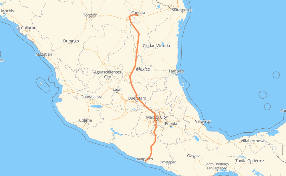
The distance from Monterrey to Acapulco is 1,281 kilometers by road including 1,240 kilometers on motorways. Road takes approximately 13 hours and 45 minutes and goes through San Juan del Rio, Cuernavaca, Chilpancingo, San Pedro Garza García, Santa Catarina, Rinconada and Arteaga.
| Shortest distance by air | 981 km ✈️ |
| Car route length | 1,281 km 🚗 |
| Driving time | 13 h 45 min |
| Fuel amount | 102.5 L |
| Fuel cost | 184.5 AUD |
| Toll roads cost | 1,015 + ? MXN |
| Point | Distance | Time | Fuel | |
| Monterrey | 0 km | 00 min | 0.0 L | |
|
MEX 40 10 km, 08 min
|
||||
| San Pedro Garza García | 10 km | 08 min | 0.3 L | |
|
20 9 km, 06 min
|
||||
| Santa Catarina | 19 km | 14 min | 1.2 L | |
|
MEX 40D 23 km, 12 min
|
||||
| Rinconada | 42 km | 27 min | 3.2 L | |
|
MEX 40D 38 km, 22 min
|
||||
| Arteaga | 80 km | 49 min | 6.2 L | |
|
MEX 57D 65 km, 38 min
|
||||
| San Rafael | 145 km | 1 h 28 min | 11.2 L | |
|
MEX 57 602 km, 6 h 20 min
|
||||
| San Juan del Rio | 747 km | 7 h 48 min | 59.3 L | |
|
MEX 57 MEX 57D 245 km, 2 h 47 min
|
||||
| Cuernavaca | 992 km | 10 h 35 min | 78.7 L | |
|
MEX 95D 180 km, 1 h 56 min
|
||||
| Chilpancingo | 1,172 km | 12 h 32 min | 93.2 L | |
|
MEX 95D 109 km, 1 h 13 min
|
||||
| Acapulco | 1,281 km | 13 h 45 min | 102.0 L | |
Hotels of Acapulco
Frequently Asked Questions
How many toll booths are there from Monterrey to Acapulco?
There are 15 toll booths between Monterrey and Acapulco: La Carbonera, Periférico, Los Chorros, Matehuala Omega, Libramiento Oriente De SLP, Chichimequillas, Maxitúnel Acapulco, La Venta, Palo Blanco, Paso Morelos, Francisco Velasco, Tlalpan, Palmillas, Tepotzotlán and Urbana Norte - Viaducto Minería.
How much does the toll booths cost from Monterrey to Acapulco?
Toll roads cost: Periférico (?) + La Carbonera (42 MXN) + Los Chorros (66 MXN) + Matehuala Omega (?) + Libramiento Oriente De SLP (70 MXN) + Chichimequillas (51 MXN) + Palmillas (89 MXN) + Tepotzotlán (89 MXN) + Urbana Norte - Viaducto Minería (?) + Tlalpan (114 MXN) + Francisco Velasco (73 MXN) + Paso Morelos (154 MXN) + Palo Blanco (142 MXN) + La Venta (125 MXN) + Maxitúnel Acapulco (?) = 1,015 + ? MXN
How much does it cost to drive from Monterrey to Acapulco?
Fuel cost: 184.5 AUD
This fuel cost is calculated as: (Route length 1,281 km / 100 km) * (Fuel consumption 8 L/100 km) * (Fuel price 1.8 AUD / L)
You can adjust fuel consumption and fuel price here.
Toll roads cost: 1,015 + ? MXN
How long is a car ride from Monterrey to Acapulco?
Driving time: 13 h 45 min
This time is calculated for driving at the maximum permitted speed, taking into account traffic rules restrictions.
- 163 km with a maximum speed 110 km/h = 1 h 28 min
- 597 km with a maximum speed 100 km/h = 5 h 58 min
- 202 km with a maximum speed 90 km/h = 2 h 14 min
- 307 km with a maximum speed 80 km/h = 3 h 50 min
- 6 km with a maximum speed 60 km/h = 5 min
- 4 km with a maximum speed 50 km/h = 5 min
- 2 km with a maximum speed 40 km/h = 2 min
The calculated driving time does not take into account intermediate stops and traffic jams.
How far is Monterrey to Acapulco by land?
The distance between Monterrey and Acapulco is 1,281 km by road including 1,240 km on motorways.
Precise satellite coordinates of highways were used for this calculation. The start and finish points are the centers of Monterrey and Acapulco respectively.
How far is Monterrey to Acapulco by plane?
The shortest distance (air line, as the crow flies) between Monterrey and Acapulco is 981 km.
This distance is calculated using the Haversine formula as a great-circle distance between two points on the surface of a sphere. The start and finish points are the centers of Monterrey and Acapulco respectively. Actual distance between airports may be different.
How many hours is Monterrey from Acapulco by plane?
Boeing 737 airliner needs 1 h 13 min to cover the distance of 981 km at a cruising speed of 800 km/h.
Small plane "Cessna 172" needs 4 h 27 min to flight this distance at average speed of 220 km/h.
This time is approximate and do not take into account takeoff and landing times, airport location and other real world factors.
How long is a helicopter ride from Monterrey to Acapulco?
Fast helicopter "Eurocopter AS350" or "Hughes OH-6 Cayuse" need 4 h 5 min to cover the distance of 981 km at a cruising speed of 240 km/h.
Popular "Robinson R44" needs 4 h 40 min to flight this distance at average speed of 210 km/h.
This time is approximate and do not take into account takeoff and landing times, aerodrome location and other real world factors.
What city is halfway between Monterrey and Acapulco?
The halfway point between Monterrey and Acapulco is Ojo de Agua. It is located about 16 km from the exact midpoint by road.
The distance from Ojo de Agua to Monterrey is 624 km and driving will take about 6 h 28 min. The road between Ojo de Agua and Acapulco has length 657 km and will take approximately 7 h 17 min.
The other cities located close to halfway point:
Where is Monterrey in relation to Acapulco?
Monterrey is located 981 km north of Acapulco.
Monterrey has geographic coordinates: latitude 25.66966, longitude -100.31782.
Acapulco has geographic coordinates: latitude 16.86029, longitude -99.87683.
Which highway goes from Monterrey to Acapulco?
The route from Monterrey to Acapulco follows MEX 57, MEX 95D, MEX 57D.
Other minor sections pass along the road:
- MEX 80: 82 km
- MEX 40D: 42 km
- MEX 45: 40 km
- Periférico: 14 km
- MEX 120: 12 km
- MEX 40: 11 km
- Periferico Norte: 7 km
- 20: 5 km
- 22: 5 km
- 210: 1 km