Distance between Navojoa and Golfo de Santa Clara
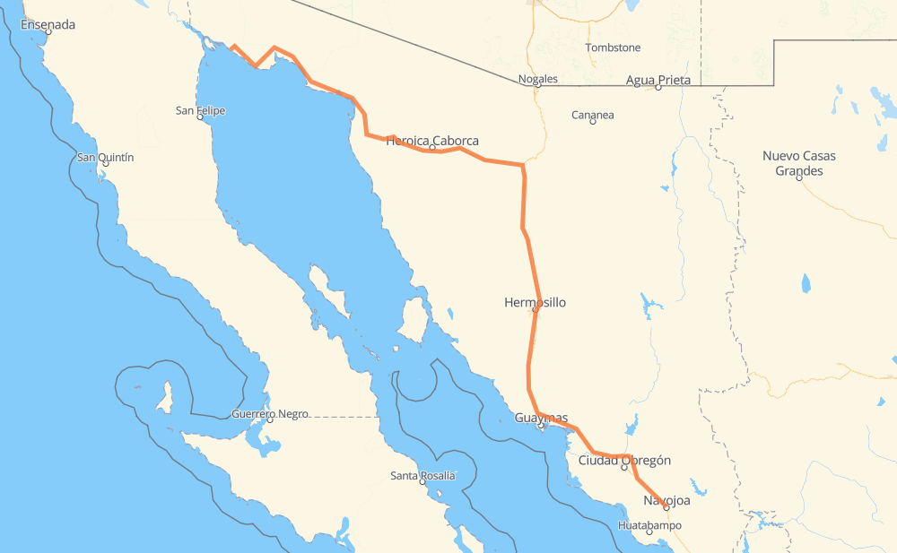
The distance from Navojoa to Golfo de Santa Clara is 913 kilometers by road including 471 kilometers on motorways. Road takes approximately 9 hours and 59 minutes and goes through Hermosillo, Heroica Caborca, Vicam, Santa Ana and Altar.
| Shortest distance by air | 708 km ✈️ |
| Car route length | 913 km 🚗 |
| Driving time | 9 h 59 min |
| Fuel amount | 73.1 L |
| Fuel cost | 131.5 AUD |
| Toll roads cost | 338 + ? MXN |
| Point | Distance | Time | Fuel | |
| Navojoa | 0 km | 00 min | 0.0 L | |
|
MEX 15D 7 km, 05 min
|
||||
| Porcina Pedro | 7 km | 05 min | 0.4 L | |
|
MEX 15D 4 km, 02 min
|
||||
| Union Gas | 10 km | 08 min | 0.6 L | |
|
MEX 15D 4 km, 02 min
|
||||
| Empaque de Juan Carlos Cuevas | 14 km | 11 min | 1.0 L | |
|
MEX 15D 105 km, 1 h 10 min
|
||||
| Vicam | 119 km | 1 h 22 min | 9.3 L | |
|
MEX 15D 203 km, 2 h 02 min
|
||||
| Hermosillo | 322 km | 3 h 24 min | 25.5 L | |
|
MEX 15 MEX 15D 170 km, 1 h 45 min
|
||||
| Santa Ana | 492 km | 5 h 09 min | 39.2 L | |
|
MEX 2D 72 km, 44 min
|
||||
| Altar | 564 km | 5 h 54 min | 45.0 L | |
|
MEX 2D MEX 2 30 km, 21 min
|
||||
| Heroica Caborca | 594 km | 6 h 15 min | 46.8 L | |
|
MEX 2 SON 003 319 km, 3 h 43 min
|
||||
| Golfo de Santa Clara | 913 km | 9 h 59 min | 72.8 L | |
Frequently Asked Questions
How many toll booths are there from Navojoa to Golfo de Santa Clara?
There are 5 toll booths between Navojoa and Golfo de Santa Clara: Santa Ana, Hermosillo, Guaymas, Libramiento Cd Obregon and Fundicion.
How much does the toll booths cost from Navojoa to Golfo de Santa Clara?
Toll roads cost: Fundicion (90 MXN) + Libramiento Cd Obregon (?) + Guaymas (38 MXN) + Hermosillo (90 MXN) + Santa Ana (120 MXN) = 338 + ? MXN
How much does it cost to drive from Navojoa to Golfo de Santa Clara?
Fuel cost: 131.5 AUD
This fuel cost is calculated as: (Route length 913 km / 100 km) * (Fuel consumption 8 L/100 km) * (Fuel price 1.8 AUD / L)
You can adjust fuel consumption and fuel price here.
Toll roads cost: 338 + ? MXN
How long is a car ride from Navojoa to Golfo de Santa Clara?
Driving time: 9 h 59 min
This time is calculated for driving at the maximum permitted speed, taking into account traffic rules restrictions.
- 216 km with a maximum speed 110 km/h = 1 h 58 min
- 163 km with a maximum speed 100 km/h = 1 h 37 min
- 328 km with a maximum speed 90 km/h = 3 h 38 min
- 173 km with a maximum speed 80 km/h = 2 h 10 min
- 25 km with a maximum speed 60 km/h = 25 min
- 5 km with a maximum speed 50 km/h = 6 min
- 1 km with a maximum speed 40 km/h = 2 min
The calculated driving time does not take into account intermediate stops and traffic jams.
How far is Navojoa to Golfo de Santa Clara by land?
The distance between Navojoa and Golfo de Santa Clara is 913 km by road including 471 km on motorways.
Precise satellite coordinates of highways were used for this calculation. The start and finish points are the centers of Navojoa and Golfo de Santa Clara respectively.
How far is Navojoa to Golfo de Santa Clara by plane?
The shortest distance (air line, as the crow flies) between Navojoa and Golfo de Santa Clara is 708 km.
This distance is calculated using the Haversine formula as a great-circle distance between two points on the surface of a sphere. The start and finish points are the centers of Navojoa and Golfo de Santa Clara respectively. Actual distance between airports may be different.
How many hours is Navojoa from Golfo de Santa Clara by plane?
Boeing 737 airliner needs 53 min to cover the distance of 708 km at a cruising speed of 800 km/h.
Small plane "Cessna 172" needs 3 h 13 min to flight this distance at average speed of 220 km/h.
This time is approximate and do not take into account takeoff and landing times, airport location and other real world factors.
How long is a helicopter ride from Navojoa to Golfo de Santa Clara?
Fast helicopter "Eurocopter AS350" or "Hughes OH-6 Cayuse" need 2 h 57 min to cover the distance of 708 km at a cruising speed of 240 km/h.
Popular "Robinson R44" needs 3 h 22 min to flight this distance at average speed of 210 km/h.
This time is approximate and do not take into account takeoff and landing times, aerodrome location and other real world factors.
What city is halfway between Navojoa and Golfo de Santa Clara?
The halfway point between Navojoa and Golfo de Santa Clara is La Noria. It is located about 2 km from the exact midpoint by road.
The distance from La Noria to Navojoa is 455 km and driving will take about 4 h 44 min. The road between La Noria and Golfo de Santa Clara has length 459 km and will take approximately 5 h 14 min.
The other cities located close to halfway point:
Where is Navojoa in relation to Golfo de Santa Clara?
Navojoa is located 708 km south-east of Golfo de Santa Clara.
Navojoa has geographic coordinates: latitude 27.07922, longitude -109.4475.
Golfo de Santa Clara has geographic coordinates: latitude 31.68774, longitude -114.49423.
Which highway goes from Navojoa to Golfo de Santa Clara?
The route from Navojoa to Golfo de Santa Clara follows MEX 15D, SON 003, SON 3.
Other minor sections pass along the road:
- MEX 2D: 75 km
- SON 44: 58 km
- MEX 15: 36 km
- MEX 2: 30 km
- MEX 15d: 3 km