Distance between Nochistlán de Mejía and Zacatecas
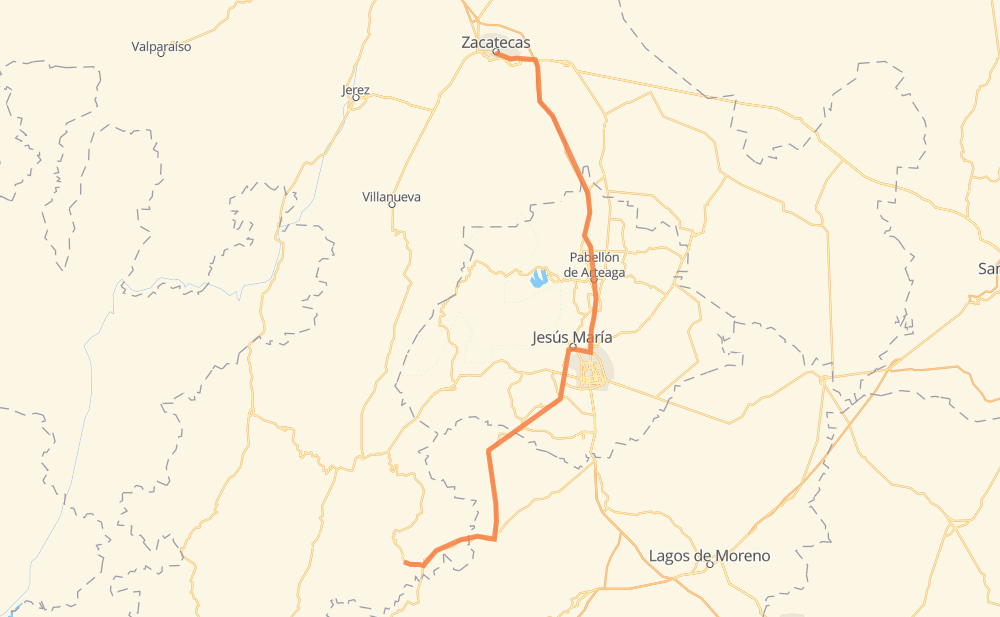
The distance from Nochistlán de Mejía to Zacatecas is 228 kilometers by road including 10 kilometers on motorways. Road takes approximately 2 hours and 42 minutes and goes through Jesús María, Guadalupe, Teocaltitche, Villa Hidalgo, San Francisco de Los Romo, Pabellón de Arteaga and San Pedro Piedra Gorda.
| Shortest distance by air | 159 km ✈️ |
| Car route length | 228 km 🚗 |
| Driving time | 2 h 42 min |
| Fuel amount | 18.3 L |
| Fuel cost | 32.3 AUD |
| Toll roads cost | 41 MXN |
| Point | Distance | Time | Fuel | |
| Nochistlán de Mejía | 0 km | 00 min | 0.0 L | |
|
33 km, 24 min
|
||||
| Teocaltitche | 33 km | 24 min | 0.5 L | |
|
JAL 205 33 km, 24 min
|
||||
| Villa Hidalgo | 67 km | 48 min | 4.8 L | |
|
JAL 211 17 km, 11 min
|
||||
| Centro de Arriba (El Taray) | 83 km | 1 h 00 min | 5.9 L | |
|
MEX 71 30 km, 21 min
|
||||
| Jesús María | 113 km | 1 h 21 min | 9.0 L | |
|
AGS MEX 45 19 km, 13 min
|
||||
| San Francisco de Los Romo | 132 km | 1 h 34 min | 10.3 L | |
|
MEX 45 8 km, 05 min
|
||||
| Pabellón de Arteaga | 141 km | 1 h 40 min | 10.9 L | |
|
MEX 45 35 km, 24 min
|
||||
| San Pedro Piedra Gorda | 176 km | 2 h 05 min | 13.6 L | |
|
MEX 45D 45 km, 31 min
|
||||
| Guadalupe | 221 km | 2 h 36 min | 17.2 L | |
|
MEX 45 7 km, 05 min
|
||||
| Zacatecas | 228 km | 2 h 42 min | 18.1 L | |
Hotels of Zacatecas
Frequently Asked Questions
How many toll booths are there from Nochistlán de Mejía to Zacatecas?
There are 1 tollbooth between Nochistlán de Mejía and Zacatecas: Zacatecas.
How much does the toll booths cost from Nochistlán de Mejía to Zacatecas?
Toll roads cost: Zacatecas (41 MXN) = 41 MXN
How much does it cost to drive from Nochistlán de Mejía to Zacatecas?
Fuel cost: 32.3 AUD
This fuel cost is calculated as: (Route length 228 km / 100 km) * (Fuel consumption 8 L/100 km) * (Fuel price 1.77 AUD / L)
You can adjust fuel consumption and fuel price here.
Toll roads cost: 41 MXN
How long is a car ride from Nochistlán de Mejía to Zacatecas?
Driving time: 2 h 42 min
This time is calculated for driving at the maximum permitted speed, taking into account traffic rules restrictions.
- 8 km with a maximum speed 100 km/h = 4 min
- 148 km with a maximum speed 90 km/h = 1 h 38 min
- 62 km with a maximum speed 80 km/h = 46 min
- 6 km with a maximum speed 60 km/h = 6 min
- 1 km with a maximum speed 50 km/h = 1 min
- 2 km with a maximum speed 40 km/h = 2 min
- 1 km with a maximum speed 30 km/h = 1 min
The calculated driving time does not take into account intermediate stops and traffic jams.
How far is Nochistlán de Mejía to Zacatecas by land?
The distance between Nochistlán de Mejía and Zacatecas is 228 km by road including 10 km on motorways.
Precise satellite coordinates of highways were used for this calculation. The start and finish points are the centers of Nochistlán de Mejía and Zacatecas respectively.
How far is Nochistlán de Mejía to Zacatecas by plane?
The shortest distance (air line, as the crow flies) between Nochistlán de Mejía and Zacatecas is 159 km.
This distance is calculated using the Haversine formula as a great-circle distance between two points on the surface of a sphere. The start and finish points are the centers of Nochistlán de Mejía and Zacatecas respectively. Actual distance between airports may be different.
How many hours is Nochistlán de Mejía from Zacatecas by plane?
Boeing 737 airliner needs 11 min to cover the distance of 159 km at a cruising speed of 800 km/h.
Small plane "Cessna 172" needs 43 min to flight this distance at average speed of 220 km/h.
This time is approximate and do not take into account takeoff and landing times, airport location and other real world factors.
How long is a helicopter ride from Nochistlán de Mejía to Zacatecas?
Fast helicopter "Eurocopter AS350" or "Hughes OH-6 Cayuse" need 39 min to cover the distance of 159 km at a cruising speed of 240 km/h.
Popular "Robinson R44" needs 45 min to flight this distance at average speed of 210 km/h.
This time is approximate and do not take into account takeoff and landing times, aerodrome location and other real world factors.
What city is halfway between Nochistlán de Mejía and Zacatecas?
The halfway point between Nochistlán de Mejía and Zacatecas is Maravillas.
The distance from Maravillas to Nochistlán de Mejía is 114 km and driving will take about 1 h 22 min. The road between Maravillas and Zacatecas has length 114 km and will take approximately 1 h 19 min.
The other cities located close to halfway point:
Where is Nochistlán de Mejía in relation to Zacatecas?
Nochistlán de Mejía is located 159 km south of Zacatecas.
Nochistlán de Mejía has geographic coordinates: latitude 21.3641, longitude -102.84698.
Zacatecas has geographic coordinates: latitude 22.77522, longitude -102.57225.