Distance between Nova Era and Porto Seguro
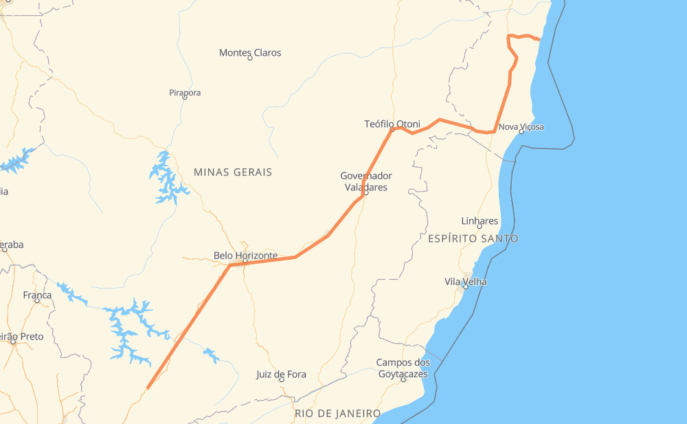
The distance from Nova Era to Porto Seguro is 1,263 kilometers by road including 333 kilometers on motorways. Road takes approximately 15 hours and 2 minutes and goes through Betim, Coronel Fabriciano, Teixeira de Freitas, Carmo da Cachoeira, Perdões, Santo Antônio do Amparo and Carmópolis de Minas.
| Shortest distance by air | 914 km ✈️ |
| Car route length | 1,263 km 🚗 |
| Driving time | 15 h 2 min |
| Fuel amount | 101.1 L |
| Fuel cost | 181.9 AUD |
| Point | Distance | Time | Fuel | |
| Nova Era | 0 km | 00 min | 0.0 L | |
|
BR-381 76 km, 42 min
|
||||
| Carmo da Cachoeira | 76 km | 42 min | 5.7 L | |
|
BR-381 44 km, 23 min
|
||||
| Perdões | 120 km | 1 h 06 min | 9.1 L | |
|
BR-381 30 km, 16 min
|
||||
| Santo Antônio do Amparo | 150 km | 1 h 23 min | 11.6 L | |
|
BR-381 61 km, 33 min
|
||||
| Carmópolis de Minas | 210 km | 1 h 56 min | 16.6 L | |
|
BR-381 28 km, 17 min
|
||||
| Itaguara | 238 km | 2 h 14 min | 18.3 L | |
|
BR-381 64 km, 41 min
|
||||
| Betim | 302 km | 2 h 55 min | 23.8 L | |
|
BR-381 230 km, 2 h 57 min
|
||||
| Coronel Fabriciano | 532 km | 5 h 53 min | 42.3 L | |
|
BR-381 BR-418 514 km, 6 h 31 min
|
||||
| Teixeira de Freitas | 1,046 km | 12 h 25 min | 83.3 L | |
|
BR-101 223 km, 2 h 36 min
|
||||
| Porto Seguro | 1,269 km | 15 h 02 min | 101.4 L | |
Hotels of Porto Seguro
Frequently Asked Questions
How much does it cost to drive from Nova Era to Porto Seguro?
Fuel cost: 181.9 AUD
This fuel cost is calculated as: (Route length 1,263 km / 100 km) * (Fuel consumption 8 L/100 km) * (Fuel price 1.8 AUD / L)
You can adjust fuel consumption and fuel price here.
How long is a car ride from Nova Era to Porto Seguro?
Driving time: 15 h 2 min
This time is calculated for driving at the maximum permitted speed, taking into account traffic rules restrictions.
- 245 km with a maximum speed 110 km/h = 2 h 13 min
- 7 km with a maximum speed 100 km/h = 4 min
- 405 km with a maximum speed 90 km/h = 4 h 29 min
- 523 km with a maximum speed 80 km/h = 6 h 31 min
- 5 km with a maximum speed 70 km/h = 4 min
- 55 km with a maximum speed 60 km/h = 54 min
- 4 km with a maximum speed 50 km/h = 5 min
- 26 km with a maximum speed 40 km/h = 38 min
The calculated driving time does not take into account intermediate stops and traffic jams.
How far is Nova Era to Porto Seguro by land?
The distance between Nova Era and Porto Seguro is 1,263 km by road including 333 km on motorways.
Precise satellite coordinates of highways were used for this calculation. The start and finish points are the centers of Nova Era and Porto Seguro respectively.
How far is Nova Era to Porto Seguro by plane?
The shortest distance (air line, as the crow flies) between Nova Era and Porto Seguro is 914 km.
This distance is calculated using the Haversine formula as a great-circle distance between two points on the surface of a sphere. The start and finish points are the centers of Nova Era and Porto Seguro respectively. Actual distance between airports may be different.
How many hours is Nova Era from Porto Seguro by plane?
Boeing 737 airliner needs 1 h 8 min to cover the distance of 914 km at a cruising speed of 800 km/h.
Small plane "Cessna 172" needs 4 h 9 min to flight this distance at average speed of 220 km/h.
This time is approximate and do not take into account takeoff and landing times, airport location and other real world factors.
How long is a helicopter ride from Nova Era to Porto Seguro?
Fast helicopter "Eurocopter AS350" or "Hughes OH-6 Cayuse" need 3 h 48 min to cover the distance of 914 km at a cruising speed of 240 km/h.
Popular "Robinson R44" needs 4 h 21 min to flight this distance at average speed of 210 km/h.
This time is approximate and do not take into account takeoff and landing times, aerodrome location and other real world factors.
What city is halfway between Nova Era and Porto Seguro?
The halfway point between Nova Era and Porto Seguro is Tiradentes. It is located about 11 km from the exact midpoint by road.
The distance from Tiradentes to Nova Era is 642 km and driving will take about 7 h 11 min. The road between Tiradentes and Porto Seguro has length 621 km and will take approximately 7 h 50 min.
The other cities located close to halfway point:
Where is Nova Era in relation to Porto Seguro?
Nova Era is located 914 km south-west of Porto Seguro.
Nova Era has geographic coordinates: latitude -21.89964, longitude -45.57714.
Porto Seguro has geographic coordinates: latitude -16.44348, longitude -39.06425.
Which highway goes from Nova Era to Porto Seguro?
The route from Nova Era to Porto Seguro follows BR-381, BR-418, BR-101, BR-116.
Other minor sections pass along the road:
- BR-367: 61 km
- BR-262: 38 km
- MGC-418: 31 km
- BR-040: 3 km
- BR-494: 2 km
- BR-342: 2 km
- MG-129: 1 km