Distance between Ober-Hohenelbe and Weidenau
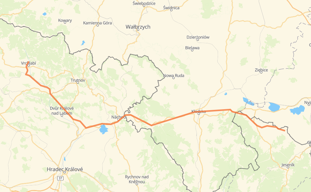
The distance from Ober-Hohenelbe to Weidenau is 151 kilometers by road. Road takes approximately 2 hours and 15 minutes and goes through Hohenelbe, Arnau, Königinhof an der Elbe, Jermer, Böhmisch Skalitz, Nachod and Staré Město nad Metují.
| Shortest distance by air | 116 km ✈️ |
| Car route length | 151 km 🚗 |
| Driving time | 2 h 15 min |
| Fuel amount | 12.1 L |
| Fuel cost | 21.7 AUD |
| Point | Distance | Time | Fuel | |
| Hohenelbe | 0 km | 00 min | 0.0 L | |
|
295 7 km, 05 min
|
||||
| Hennersdorf | 7 km | 05 min | 0.4 L | |
|
2953 32551 6 km, 06 min
|
||||
| Mönchsdorf | 13 km | 12 min | 0.9 L | |
|
32551 5 km, 04 min
|
||||
| Arnau | 18 km | 16 min | 1.1 L | |
|
32551 29928 16 km, 17 min
|
||||
| Königinhof an der Elbe | 34 km | 34 min | 2.4 L | |
|
37 33 19 km, 17 min
|
||||
| Böhmisch Skalitz | 54 km | 51 min | 4.1 L | |
|
33 11 km, 08 min
|
||||
| Nachod | 64 km | 59 min | 4.9 L | |
|
33 8 41 km, 37 min
|
||||
| Glatz | 105 km | 1 h 36 min | 8.1 L | |
|
8 46 19 km, 16 min
|
||||
| Złoty Stok | 125 km | 1 h 53 min | 9.9 L | |
|
46 4531 26 km, 21 min
|
||||
| Weidenau | 151 km | 2 h 15 min | 11.6 L | |
Frequently Asked Questions
How much does it cost to drive from Ober-Hohenelbe to Weidenau?
Fuel cost: 21.7 AUD
This fuel cost is calculated as: (Route length 151 km / 100 km) * (Fuel consumption 8 L/100 km) * (Fuel price 1.8 AUD / L)
You can adjust fuel consumption and fuel price here.
How long is a car ride from Ober-Hohenelbe to Weidenau?
Driving time: 2 h 15 min
This time is calculated for driving at the maximum permitted speed, taking into account traffic rules restrictions.
- 53 km with a maximum speed 90 km/h = 35 min
- 37 km with a maximum speed 80 km/h = 27 min
- 1 km with a maximum speed 70 km/h = 1 min
- 1 km with a maximum speed 60 km/h = 1 min
- 56 km with a maximum speed 50 km/h = 1 h 7 min
- 2 km with a maximum speed 40 km/h = 2 min
The calculated driving time does not take into account intermediate stops and traffic jams.
How far is Ober-Hohenelbe to Weidenau by land?
The distance between Ober-Hohenelbe and Weidenau is 151 km by road.
Precise satellite coordinates of highways were used for this calculation. The start and finish points are the centers of Ober-Hohenelbe and Weidenau respectively.
How far is Ober-Hohenelbe to Weidenau by plane?
The shortest distance (air line, as the crow flies) between Ober-Hohenelbe and Weidenau is 116 km.
This distance is calculated using the Haversine formula as a great-circle distance between two points on the surface of a sphere. The start and finish points are the centers of Ober-Hohenelbe and Weidenau respectively. Actual distance between airports may be different.
How many hours is Ober-Hohenelbe from Weidenau by plane?
Boeing 737 airliner needs 8 min to cover the distance of 116 km at a cruising speed of 800 km/h.
Small plane "Cessna 172" needs 31 min to flight this distance at average speed of 220 km/h.
This time is approximate and do not take into account takeoff and landing times, airport location and other real world factors.
How long is a helicopter ride from Ober-Hohenelbe to Weidenau?
Fast helicopter "Eurocopter AS350" or "Hughes OH-6 Cayuse" need 29 min to cover the distance of 116 km at a cruising speed of 240 km/h.
Popular "Robinson R44" needs 33 min to flight this distance at average speed of 210 km/h.
This time is approximate and do not take into account takeoff and landing times, aerodrome location and other real world factors.
What city is halfway between Ober-Hohenelbe and Weidenau?
The halfway point between Ober-Hohenelbe and Weidenau is Leśna. It is located about 2 km from the exact midpoint by road.
The distance from Leśna to Ober-Hohenelbe is 77 km and driving will take about 1 h 12 min. The road between Leśna and Weidenau has length 73 km and will take approximately 1 h 3 min.
The other cities located close to halfway point:
Where is Ober-Hohenelbe in relation to Weidenau?
Ober-Hohenelbe is located 116 km west of Weidenau.
Ober-Hohenelbe has geographic coordinates: latitude 50.64392, longitude 15.60853.
Weidenau has geographic coordinates: latitude 50.37243, longitude 17.18612.