Distance between Oeynhausen and Bad
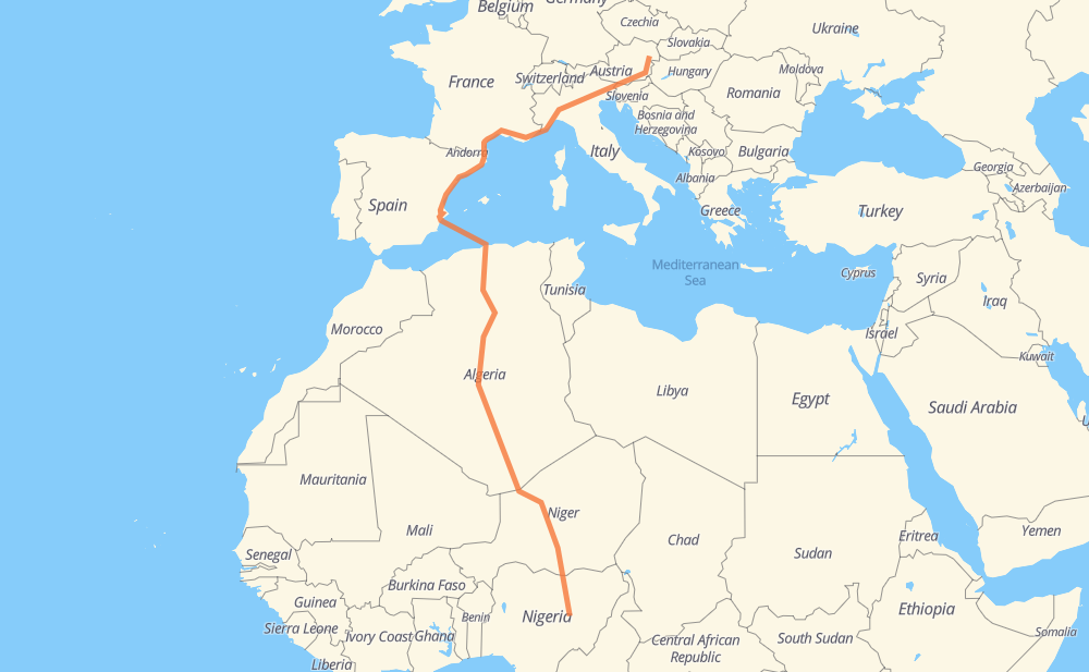
The distance from Oeynhausen to Bad is 6,488 kilometers by road including 2,631 kilometers on motorways. Road takes approximately 89 hours and 46 minutes and goes through Graz, Udine, Vicence, Vérone, Brescia, Crémone and Plasencia.
| Shortest distance by air | 4,312 km ✈️ |
| Car route length | 6,488 km 🚗 |
| Driving time | 89 h 46 min |
| Fuel amount | 519 L |
| Fuel cost | 934.3 AUD |
| Point | Distance | Time | Fuel | |
| 47.98676, 16.29369 | 0 km | 00 min | 0.0 L | |
|
A2 161 km, 1 h 29 min
|
||||
| Graz | 161 km | 1 h 29 min | 25.6 L | |
|
A2 290 km, 2 h 43 min
|
||||
| Udine | 452 km | 4 h 12 min | 48.6 L | |
|
A23 A4 189 km, 1 h 43 min
|
||||
| Vicence | 640 km | 5 h 55 min | 63.6 L | |
|
A4 47 km, 25 min
|
||||
| Vérone | 687 km | 6 h 21 min | 67.2 L | |
|
A4 63 km, 35 min
|
||||
| Brescia | 750 km | 6 h 56 min | 72.6 L | |
|
A21 40 km, 22 min
|
||||
| Crémone | 791 km | 7 h 19 min | 75.5 L | |
|
A21 31 km, 16 min
|
||||
| Plasencia | 821 km | 7 h 36 min | 77.7 L | |
|
A21 149 km, 1 h 24 min
|
||||
| Genoa | 970 km | 9 h 00 min | 90.0 L | |
|
A26 A 10 30 km, 16 min
|
||||
| Savone | 1,000 km | 9 h 17 min | 92.6 L | |
|
A10 147 km, 1 h 23 min
|
||||
| Niza | 1,147 km | 10 h 40 min | 104.0 L | |
|
A 8 177 km, 1 h 39 min
|
||||
| Aix-en-Provence | 1,324 km | 12 h 19 min | 118.2 L | |
|
A 8 A 54 99 km, 58 min
|
||||
| Nîmes | 1,424 km | 13 h 18 min | 126.4 L | |
|
A 54 A 9 45 km, 24 min
|
||||
| Montpellier | 1,468 km | 13 h 42 min | 129.9 L | |
|
A 9 151 km, 1 h 22 min
|
||||
| Perpiñán | 1,619 km | 15 h 05 min | 141.9 L | |
|
A 9 AP-7 1,116 km, 25 h 30 min
|
||||
| Blida | 2,735 km | 40 h 36 min | 231.5 L | |
|
A1 RN 1 25 km, 17 min
|
||||
| Medea | 2,760 km | 40 h 53 min | 233.0 L | |
|
RN 1 126 km, 1 h 32 min
|
||||
| Ain Oussara | 2,886 km | 42 h 25 min | 241.5 L | |
|
RN 1 99 km, 1 h 15 min
|
||||
| Djelfa | 2,985 km | 43 h 41 min | 249.9 L | |
|
RN 1 102 km, 1 h 14 min
|
||||
| Laghouat | 3,088 km | 44 h 55 min | 258.5 L | |
|
RN 1 186 km, 2 h 07 min
|
||||
| Ghardaia | 3,274 km | 47 h 02 min | 274.0 L | |
|
RN 1 2,170 km, 27 h 10 min
|
||||
| Arlit | 5,445 km | 74 h 13 min | 448.3 L | |
|
N 25 240 km, 2 h 40 min
|
||||
| Agadez | 5,685 km | 76 h 54 min | 467.4 L | |
|
N 25 N 11 286 km, 3 h 25 min
|
||||
| Tanout | 5,971 km | 80 h 19 min | 490.0 L | |
|
N 11 151 km, 1 h 53 min
|
||||
| Zinder | 6,122 km | 82 h 13 min | 502.4 L | |
|
N 11 81 km, 1 h 00 min
|
||||
| Magaria | 6,202 km | 83 h 13 min | 506.4 L | |
|
N 11 F.244 509 km, 6 h 38 min
|
||||
| Gyangyan | 6,712 km | 89 h 51 min | 549.5 L | |
Frequently Asked Questions
How much does it cost to drive from Oeynhausen to Bad?
Fuel cost: 934.3 AUD
This fuel cost is calculated as: (Route length 6,488 km / 100 km) * (Fuel consumption 8 L/100 km) * (Fuel price 1.8 AUD / L)
You can adjust fuel consumption and fuel price here.
How long is a car ride from Oeynhausen to Bad?
Driving time: 89 h 46 min
This time is calculated for driving at the maximum permitted speed, taking into account traffic rules restrictions.
- 1,972 km with a maximum speed 110 km/h = 17 h 55 min
- 322 km with a maximum speed 100 km/h = 3 h 13 min
- 1,423 km with a maximum speed 90 km/h = 15 h 48 min
- 2,256 km with a maximum speed 80 km/h = 28 h 11 min
- 6 km with a maximum speed 70 km/h = 4 min
- 275 km with a maximum speed 60 km/h = 4 h 34 min
- 73 km with a maximum speed 50 km/h = 1 h 27 min
- 9 km with a maximum speed 40 km/h = 13 min
- 1 km with a maximum speed 30 km/h = 2 min
- 365 km with a maximum speed 20 km/h = 18 h 14 min
The calculated driving time does not take into account intermediate stops and traffic jams.
How far is Oeynhausen to Bad by land?
The distance between Oeynhausen and Bad is 6,488 km by road including 2,631 km on motorways.
Precise satellite coordinates of highways were used for this calculation. The start and finish points are the centers of Oeynhausen and Bad respectively.
How far is Oeynhausen to Bad by plane?
The shortest distance (air line, as the crow flies) between Oeynhausen and Bad is 4,312 km.
This distance is calculated using the Haversine formula as a great-circle distance between two points on the surface of a sphere. The start and finish points are the centers of Oeynhausen and Bad respectively. Actual distance between airports may be different.
How many hours is Oeynhausen from Bad by plane?
Boeing 737 airliner needs 5 h 23 min to cover the distance of 4,312 km at a cruising speed of 800 km/h.
Small plane "Cessna 172" needs 19 h 36 min to flight this distance at average speed of 220 km/h.
This time is approximate and do not take into account takeoff and landing times, airport location and other real world factors.
How long is a helicopter ride from Oeynhausen to Bad?
Fast helicopter "Eurocopter AS350" or "Hughes OH-6 Cayuse" need 17 h 58 min to cover the distance of 4,312 km at a cruising speed of 240 km/h.
Popular "Robinson R44" needs 20 h 32 min to flight this distance at average speed of 210 km/h.
This time is approximate and do not take into account takeoff and landing times, aerodrome location and other real world factors.
What city is halfway between Oeynhausen and Bad?
The halfway point between Oeynhausen and Bad is Berriane. It is located about 5 km from the exact midpoint by road.
The distance from Berriane to Oeynhausen is 3,239 km and driving will take about 46 h 30 min. The road between Berriane and Bad has length 3,249 km and will take approximately 43 h 15 min.
The other cities located close to halfway point:
Where is Oeynhausen in relation to Bad?
Oeynhausen is located 4,312 km north of Bad.
Oeynhausen has geographic coordinates: latitude 47.98676, longitude 16.29369.
Bad has geographic coordinates: latitude 9.6, longitude 9.86666.
Which highway goes from Oeynhausen to Bad?
The route from Oeynhausen to Bad follows RN 1, N 25, N 11, AP-7, A2, A4, A 9, A 8, A21, A-7, A23, A10.
Other minor sections pass along the road:
- F.244: 49 km
- A 54: 48 km
- A26: 44 km
- A237: 43 km
- A1: 40 km
- F.247: 30 km
- N 113: 20 km
- V-21: 18 km
- F.130: 18 km
- A26/A7: 16 km
- V-31: 14 km
- A 10: 11 km
- A 7: 11 km
- A7: 8 km
- A-77: 7 km
- N 572: 4 km
- A-31: 4 km
- A-70: 4 km
- A3: 4 km
- F.131: 3 km
- ط و 1: 2 km
- RN 11: 2 km
- RN 8: 1 km
- B210: 1 km