Distance between Pánuco de Coronado and Tamazula
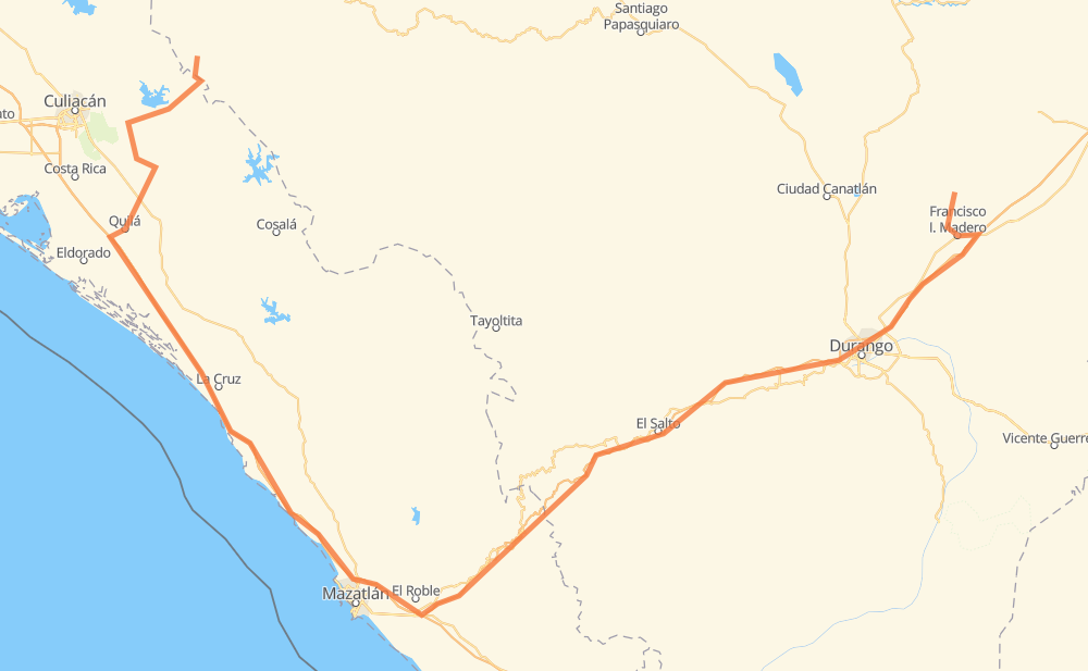
The distance from Pánuco de Coronado to Tamazula is 602 kilometers by road including 319 kilometers on motorways. Road takes approximately 7 hours and 11 minutes and goes through Dimas (Estación Dimas), Francisco I. Madero, El Salto, Tanques and Sanalona.
| Shortest distance by air | 271 km ✈️ |
| Car route length | 602 km 🚗 |
| Driving time | 7 h 11 min |
| Fuel amount | 48.2 L |
| Fuel cost | 86.7 AUD |
| Toll roads cost | 886 + ? MXN |
| Point | Distance | Time | Fuel | |
| Pánuco de Coronado | 0 km | 00 min | 0.0 L | |
|
DGO 149 18 km, 20 min
|
||||
| General Lázaro Cardenas | 18 km | 20 min | 1.3 L | |
|
DGO 137 7 km, 05 min
|
||||
| Francisco I. Madero | 25 km | 25 min | 1.5 L | |
|
MEX 40 6 km, 04 min
|
||||
| José Jerónimo Hernández | 31 km | 30 min | 2.4 L | |
|
MEX 40D 127 km, 1 h 24 min
|
||||
| Llano Grande | 158 km | 1 h 54 min | 12.4 L | |
|
MEX 40D 23 km, 16 min
|
||||
| El Salto | 180 km | 2 h 11 min | 13.9 L | |
|
MEX 40D 220 km, 2 h 28 min
|
||||
| Dimas (Estación Dimas) | 400 km | 4 h 39 min | 30.9 L | |
|
MEX 15D 44 km, 31 min
|
||||
| Tanques | 444 km | 5 h 10 min | 35.0 L | |
|
MEX 15D 120 km, 1 h 25 min
|
||||
| Sanalona | 564 km | 6 h 35 min | 43.9 L | |
|
Sin 324 48 km, 35 min
|
||||
| Tamazula | 611 km | 7 h 11 min | 48.8 L | |
Frequently Asked Questions
How many toll booths are there from Pánuco de Coronado to Tamazula?
There are 7 toll booths between Pánuco de Coronado and Tamazula: Quila, Marmol, Mesillas, Durango, Durango 95, Llano Grande and Coscomate.
How much does the toll booths cost from Pánuco de Coronado to Tamazula?
Toll roads cost: Durango (?) + Durango 95 (67 MXN) + Llano Grande (100 MXN) + Coscomate (315 MXN) + Mesillas (166 MXN) + Marmol (131 MXN) + Quila (107 MXN) = 886 + ? MXN
How much does it cost to drive from Pánuco de Coronado to Tamazula?
Fuel cost: 86.7 AUD
This fuel cost is calculated as: (Route length 602 km / 100 km) * (Fuel consumption 8 L/100 km) * (Fuel price 1.8 AUD / L)
You can adjust fuel consumption and fuel price here.
Toll roads cost: 886 + ? MXN
How long is a car ride from Pánuco de Coronado to Tamazula?
Driving time: 7 h 11 min
This time is calculated for driving at the maximum permitted speed, taking into account traffic rules restrictions.
- 72 km with a maximum speed 110 km/h = 39 min
- 112 km with a maximum speed 100 km/h = 1 h 7 min
- 145 km with a maximum speed 90 km/h = 1 h 36 min
- 258 km with a maximum speed 80 km/h = 3 h 13 min
- 5 km with a maximum speed 60 km/h = 5 min
- 18 km with a maximum speed 50 km/h = 21 min
- 1 km with a maximum speed 20 km/h = 2 min
- 1 km with a maximum speed 10 km/h = 6 min
The calculated driving time does not take into account intermediate stops and traffic jams.
How far is Pánuco de Coronado to Tamazula by land?
The distance between Pánuco de Coronado and Tamazula is 602 km by road including 319 km on motorways.
Precise satellite coordinates of highways were used for this calculation. The start and finish points are the centers of Pánuco de Coronado and Tamazula respectively.
How far is Pánuco de Coronado to Tamazula by plane?
The shortest distance (air line, as the crow flies) between Pánuco de Coronado and Tamazula is 271 km.
This distance is calculated using the Haversine formula as a great-circle distance between two points on the surface of a sphere. The start and finish points are the centers of Pánuco de Coronado and Tamazula respectively. Actual distance between airports may be different.
How many hours is Pánuco de Coronado from Tamazula by plane?
Boeing 737 airliner needs 20 min to cover the distance of 271 km at a cruising speed of 800 km/h.
Small plane "Cessna 172" needs 1 h 13 min to flight this distance at average speed of 220 km/h.
This time is approximate and do not take into account takeoff and landing times, airport location and other real world factors.
How long is a helicopter ride from Pánuco de Coronado to Tamazula?
Fast helicopter "Eurocopter AS350" or "Hughes OH-6 Cayuse" need 1 h 7 min to cover the distance of 271 km at a cruising speed of 240 km/h.
Popular "Robinson R44" needs 1 h 17 min to flight this distance at average speed of 210 km/h.
This time is approximate and do not take into account takeoff and landing times, aerodrome location and other real world factors.
What city is halfway between Pánuco de Coronado and Tamazula?
The halfway point between Pánuco de Coronado and Tamazula is Ejido Caleritas.
The distance from Ejido Caleritas to Pánuco de Coronado is 301 km and driving will take about 3 h 36 min. The road between Ejido Caleritas and Tamazula has length 302 km and will take approximately 3 h 35 min.
The other cities located close to halfway point:
Where is Pánuco de Coronado in relation to Tamazula?
Pánuco de Coronado is located 271 km east of Tamazula.
Pánuco de Coronado has geographic coordinates: latitude 24.53963, longitude -104.32912.
Tamazula has geographic coordinates: latitude 24.97027, longitude -106.9662.
Which highway goes from Pánuco de Coronado to Tamazula?
The route from Pánuco de Coronado to Tamazula follows MEX 40D, MEX 15D.
Other minor sections pass along the road:
- Sin 324: 51 km
- MEX 40: 27 km
- DGO 149: 16 km
- DGO 137: 7 km