Distance between Paraty and Santa Helena
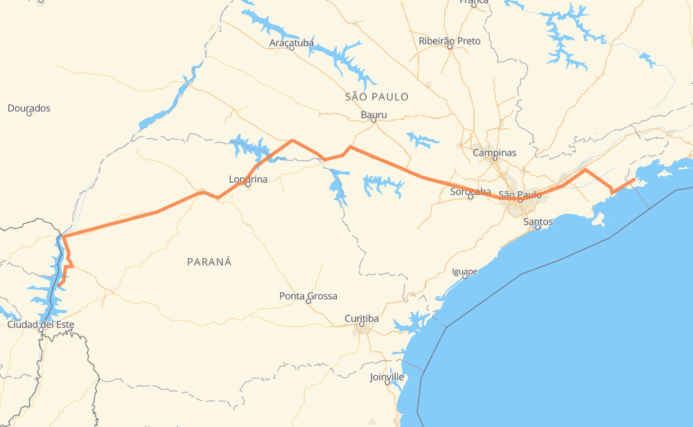
The distance from Paraty to Santa Helena is 1,319 kilometers by road including 613 kilometers on motorways. Road takes approximately 14 hours and 9 minutes and goes through Jacareí, Barueri, Assis, Praia do Estaleiro, Praia do Prumirim, Barra Seca and Parque Interlagos.
| Shortest distance by air | 993 km ✈️ |
| Car route length | 1,319 km 🚗 |
| Driving time | 14 h 9 min |
| Fuel amount | 105.5 L |
| Fuel cost | 189.9 AUD |
| Point | Distance | Time | Fuel | |
| Paraty | 0 km | 00 min | 0.0 L | |
|
BR-101 38 km, 28 min
|
||||
| Praia do Estaleiro | 38 km | 28 min | 2.7 L | |
|
BR-101 14 km, 10 min
|
||||
| Praia do Prumirim | 52 km | 38 min | 4.0 L | |
|
BR-101 17 km, 12 min
|
||||
| Barra Seca | 69 km | 51 min | 5.5 L | |
|
BR-101 SP-125 135 km, 1 h 26 min
|
||||
| Parque Interlagos | 204 km | 2 h 18 min | 16.1 L | |
|
SP-070 12 km, 07 min
|
||||
| Jacareí | 217 km | 2 h 25 min | 17.1 L | |
|
SP-070 13 km, 07 min
|
||||
| Goiabal | 229 km | 2 h 32 min | 18.2 L | |
|
SP-070 16 km, 09 min
|
||||
| Taboão | 245 km | 2 h 42 min | 19.2 L | |
|
SP-070 75 km, 46 min
|
||||
| Barueri | 321 km | 3 h 28 min | 25.1 L | |
|
BR-374 406 km, 3 h 48 min
|
||||
| Assis | 727 km | 7 h 16 min | 56.9 L | |
|
SP-270 PR-323 592 km, 6 h 52 min
|
||||
| -24.85917, -54.33288 | 1,319 km | 14 h 09 min | 105.5 L | |
Frequently Asked Questions
How much does it cost to drive from Paraty to Santa Helena?
Fuel cost: 189.9 AUD
This fuel cost is calculated as: (Route length 1,319 km / 100 km) * (Fuel consumption 8 L/100 km) * (Fuel price 1.8 AUD / L)
You can adjust fuel consumption and fuel price here.
How long is a car ride from Paraty to Santa Helena?
Driving time: 14 h 9 min
This time is calculated for driving at the maximum permitted speed, taking into account traffic rules restrictions.
- 499 km with a maximum speed 110 km/h = 4 h 32 min
- 50 km with a maximum speed 100 km/h = 30 min
- 612 km with a maximum speed 90 km/h = 6 h 47 min
- 109 km with a maximum speed 80 km/h = 1 h 21 min
- 7 km with a maximum speed 70 km/h = 6 min
- 23 km with a maximum speed 60 km/h = 23 min
- 1 km with a maximum speed 50 km/h = 1 min
- 16 km with a maximum speed 40 km/h = 23 min
- 1 km with a maximum speed 30 km/h = 2 min
The calculated driving time does not take into account intermediate stops and traffic jams.
How far is Paraty to Santa Helena by land?
The distance between Paraty and Santa Helena is 1,319 km by road including 613 km on motorways.
Precise satellite coordinates of highways were used for this calculation. The start and finish points are the centers of Paraty and Santa Helena respectively.
How far is Paraty to Santa Helena by plane?
The shortest distance (air line, as the crow flies) between Paraty and Santa Helena is 993 km.
This distance is calculated using the Haversine formula as a great-circle distance between two points on the surface of a sphere. The start and finish points are the centers of Paraty and Santa Helena respectively. Actual distance between airports may be different.
How many hours is Paraty from Santa Helena by plane?
Boeing 737 airliner needs 1 h 14 min to cover the distance of 993 km at a cruising speed of 800 km/h.
Small plane "Cessna 172" needs 4 h 30 min to flight this distance at average speed of 220 km/h.
This time is approximate and do not take into account takeoff and landing times, airport location and other real world factors.
How long is a helicopter ride from Paraty to Santa Helena?
Fast helicopter "Eurocopter AS350" or "Hughes OH-6 Cayuse" need 4 h 8 min to cover the distance of 993 km at a cruising speed of 240 km/h.
Popular "Robinson R44" needs 4 h 43 min to flight this distance at average speed of 210 km/h.
This time is approximate and do not take into account takeoff and landing times, aerodrome location and other real world factors.
What city is halfway between Paraty and Santa Helena?
The halfway point between Paraty and Santa Helena is Salto Grande. It is located about 16 km from the exact midpoint by road.
The distance from Salto Grande to Paraty is 675 km and driving will take about 6 h 46 min. The road between Salto Grande and Santa Helena has length 644 km and will take approximately 7 h 22 min.
The other cities located close to halfway point:
Where is Paraty in relation to Santa Helena?
Paraty is located 993 km east of Santa Helena.
Paraty has geographic coordinates: latitude -23.22211, longitude -44.71747.
Santa Helena has geographic coordinates: latitude -24.85917, longitude -54.33288.
Which highway goes from Paraty to Santa Helena?
The route from Paraty to Santa Helena follows BR-374, SP-280, PR-323, SP-070.
Other minor sections pass along the road:
- SP-125: 88 km
- BR-383: 88 km
- BR-101: 71 km
- BR-369: 66 km
- SP-270: 65 km
- BR-272: 54 km
- BR-163: 53 km
- SP-333: 46 km
- PR-495: 40 km
- PR-444: 39 km
- SP-327: 33 km
- SP-015: 21 km
- BR-376: 21 km
- SP-225: 19 km
- BR-116: 16 km
- PR-317: 15 km
- PR-445: 13 km
- PRC-467: 11 km
- BR-467: 11 km
- PR-986: 10 km
- BR-050: 7 km
- SPM-280 D: 5 km