Distance between Placentia NL and Grand Falls-Windsor NL
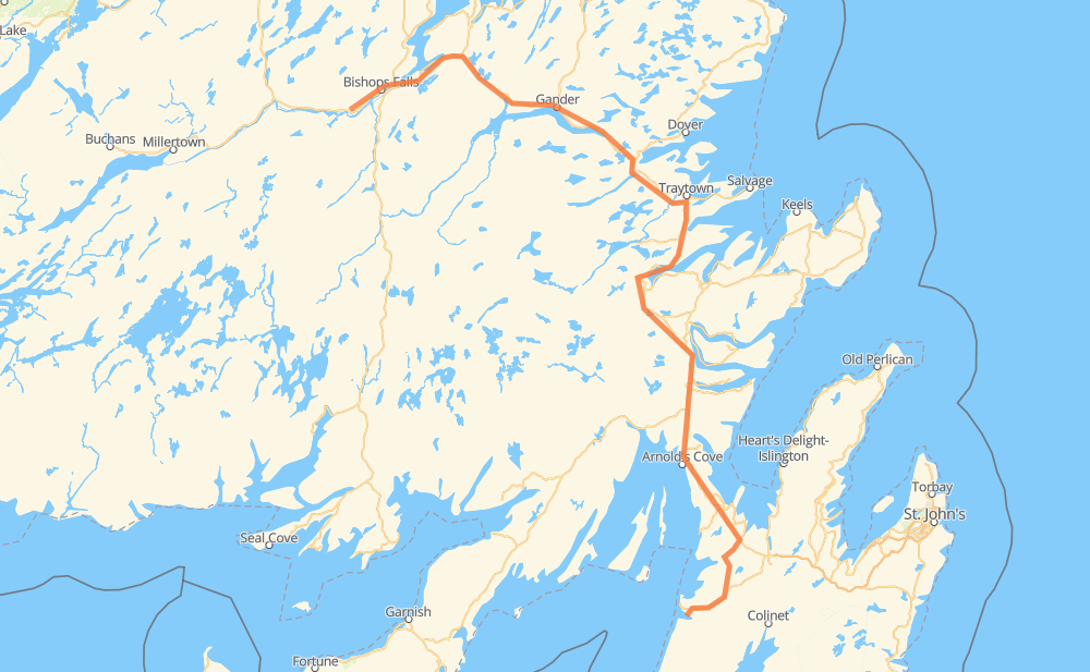
The distance from Placentia to Grand Falls-Windsor is 372 kilometers by road. Road takes approximately 4 hours and 12 minutes and goes through Dunville, Long Harbour-Mount Arlington Heights, Chapel Arm, Arnold's Cove, Come By Chance, Sunnyside and Clarenville.
| Shortest distance by air | 227 km ✈️ |
| Car route length | 372 km 🚗 |
| Driving time | 4 h 12 min |
| Fuel amount | 29.8 L |
| Fuel cost | 53.6 AUD |
| Point | Distance | Time | Fuel | |
| Placentia | 0 km | 00 min | 0.0 L | |
|
100 101 40 km, 30 min
|
||||
| Long Harbour-Mount Arlington Heights | 40 km | 30 min | 2.8 L | |
|
202 18 km, 12 min
|
||||
| Chapel Arm | 58 km | 43 min | 3.5 L | |
|
1 27 km, 18 min
|
||||
| Arnold's Cove | 85 km | 1 h 01 min | 6.7 L | |
|
1 9 km, 06 min
|
||||
| Sunnyside | 94 km | 1 h 07 min | 6.9 L | |
|
1 41 km, 27 min
|
||||
| Clarenville | 136 km | 1 h 35 min | 9.8 L | |
|
1 88 km, 58 min
|
||||
| Glovertown | 224 km | 2 h 33 min | 17.0 L | |
|
1 59 km, 39 min
|
||||
| Gander | 283 km | 3 h 13 min | 21.1 L | |
|
1 19 km, 12 min
|
||||
| Appleton | 301 km | 3 h 25 min | 24.1 L | |
|
1 73 km, 48 min
|
||||
| Grand Falls-Windsor | 374 km | 4 h 14 min | 29.1 L | |
Hotels of Grand Falls-Windsor
Frequently Asked Questions
How much does it cost to drive from Placentia to Grand Falls-Windsor?
Fuel cost: 53.6 AUD
This fuel cost is calculated as: (Route length 372 km / 100 km) * (Fuel consumption 8 L/100 km) * (Fuel price 1.8 AUD / L)
You can adjust fuel consumption and fuel price here.
How long is a car ride from Placentia to Grand Falls-Windsor?
Driving time: 4 h 12 min
This time is calculated for driving at the maximum permitted speed, taking into account traffic rules restrictions.
- 328 km with a maximum speed 90 km/h = 3 h 38 min
- 42 km with a maximum speed 80 km/h = 31 min
- 2 km with a maximum speed 50 km/h = 2 min
The calculated driving time does not take into account intermediate stops and traffic jams.
How far is Placentia to Grand Falls-Windsor by land?
The distance between Placentia and Grand Falls-Windsor is 372 km by road.
Precise satellite coordinates of highways were used for this calculation. The start and finish points are the centers of Placentia and Grand Falls-Windsor respectively.
How far is Placentia to Grand Falls-Windsor by plane?
The shortest distance (air line, as the crow flies) between Placentia and Grand Falls-Windsor is 227 km.
This distance is calculated using the Haversine formula as a great-circle distance between two points on the surface of a sphere. The start and finish points are the centers of Placentia and Grand Falls-Windsor respectively. Actual distance between airports may be different.
How many hours is Placentia from Grand Falls-Windsor by plane?
Boeing 737 airliner needs 17 min to cover the distance of 227 km at a cruising speed of 800 km/h.
Small plane "Cessna 172" needs 1 h 1 min to flight this distance at average speed of 220 km/h.
This time is approximate and do not take into account takeoff and landing times, airport location and other real world factors.
How long is a helicopter ride from Placentia to Grand Falls-Windsor?
Fast helicopter "Eurocopter AS350" or "Hughes OH-6 Cayuse" need 56 min to cover the distance of 227 km at a cruising speed of 240 km/h.
Popular "Robinson R44" needs 1 h 4 min to flight this distance at average speed of 210 km/h.
This time is approximate and do not take into account takeoff and landing times, aerodrome location and other real world factors.
What city is halfway between Placentia and Grand Falls-Windsor?
The halfway point between Placentia and Grand Falls-Windsor is Glovertown. It is located about 38 km from the exact midpoint by road.
The distance from Glovertown to Placentia is 224 km and driving will take about 2 h 33 min. The road between Glovertown and Grand Falls-Windsor has length 148 km and will take approximately 1 h 39 min.
The other cities located close to halfway point:
Where is Placentia in relation to Grand Falls-Windsor?
Placentia is located 227 km south-east of Grand Falls-Windsor.
Placentia has geographic coordinates: latitude 47.24351, longitude -53.96355.
Grand Falls-Windsor has geographic coordinates: latitude 48.94415, longitude -55.65262.
Which highway goes from Placentia to Grand Falls-Windsor?
The route from Placentia to Grand Falls-Windsor follows 1.
Other minor sections pass along the road:
- 100: 18 km
- 101: 15 km
- 202: 9 km
- 100-20: 2 km