Distance between Porto Acre and Itamaraju
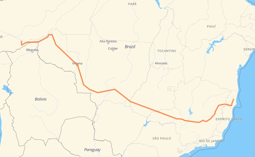
The distance from Porto Acre to Itamaraju is 4,389 kilometers by road including 363 kilometers on motorways. Road takes approximately 53 hours and 17 minutes and goes through Rio Branco, Ariquemes, Betim, Coronel Fabriciano and Teixeira de Freitas.
| Shortest distance by air | 3,138 km ✈️ |
| Car route length | 4,389 km 🚗 |
| Driving time | 53 h 17 min |
| Fuel amount | 351.1 L |
| Fuel cost | 632 AUD |
| Point | Distance | Time | Fuel | |
| Porto Acre | 0 km | 00 min | 0.0 L | |
|
AC-010 62 km, 1 h 07 min
|
||||
| Rio Branco | 62 km | 1 h 07 min | 4.4 L | |
|
AC-010 BR-364 724 km, 8 h 59 min
|
||||
| Ariquemes | 785 km | 10 h 07 min | 60.8 L | |
|
BR-364 118 km, 2 h 00 min
|
||||
| Ouro Preto do Oeste | 904 km | 12 h 08 min | 71.7 L | |
|
BR-364 60 km, 43 min
|
||||
| Presidente Médici | 963 km | 12 h 51 min | 75.8 L | |
|
BR-364 89 km, 1 h 01 min
|
||||
| Cacoal | 1,052 km | 13 h 52 min | 83.4 L | |
|
BR-364 2,530 km, 29 h 03 min
|
||||
| Betim | 3,582 km | 42 h 56 min | 286.1 L | |
|
BR-262 BR-381 231 km, 2 h 58 min
|
||||
| Coronel Fabriciano | 3,813 km | 45 h 54 min | 304.8 L | |
|
BR-381 BR-418 514 km, 6 h 31 min
|
||||
| Teixeira de Freitas | 4,327 km | 52 h 26 min | 345.7 L | |
|
BR-101 70 km, 50 min
|
||||
| Itamaraju | 4,396 km | 53 h 16 min | 351.3 L | |
Frequently Asked Questions
How much does it cost to drive from Porto Acre to Itamaraju?
Fuel cost: 632 AUD
This fuel cost is calculated as: (Route length 4,389 km / 100 km) * (Fuel consumption 8 L/100 km) * (Fuel price 1.8 AUD / L)
You can adjust fuel consumption and fuel price here.
How long is a car ride from Porto Acre to Itamaraju?
Driving time: 53 h 17 min
This time is calculated for driving at the maximum permitted speed, taking into account traffic rules restrictions.
- 261 km with a maximum speed 110 km/h = 2 h 22 min
- 62 km with a maximum speed 100 km/h = 37 min
- 1,847 km with a maximum speed 90 km/h = 20 h 31 min
- 1,969 km with a maximum speed 80 km/h = 24 h 36 min
- 5 km with a maximum speed 70 km/h = 4 min
- 90 km with a maximum speed 60 km/h = 1 h 29 min
- 101 km with a maximum speed 50 km/h = 2 h
- 60 km with a maximum speed 40 km/h = 1 h 29 min
- 1 km with a maximum speed 20 km/h = 3 min
The calculated driving time does not take into account intermediate stops and traffic jams.
How far is Porto Acre to Itamaraju by land?
The distance between Porto Acre and Itamaraju is 4,389 km by road including 363 km on motorways.
Precise satellite coordinates of highways were used for this calculation. The start and finish points are the centers of Porto Acre and Itamaraju respectively.
How far is Porto Acre to Itamaraju by plane?
The shortest distance (air line, as the crow flies) between Porto Acre and Itamaraju is 3,138 km.
This distance is calculated using the Haversine formula as a great-circle distance between two points on the surface of a sphere. The start and finish points are the centers of Porto Acre and Itamaraju respectively. Actual distance between airports may be different.
How many hours is Porto Acre from Itamaraju by plane?
Boeing 737 airliner needs 3 h 55 min to cover the distance of 3,138 km at a cruising speed of 800 km/h.
Small plane "Cessna 172" needs 14 h 15 min to flight this distance at average speed of 220 km/h.
This time is approximate and do not take into account takeoff and landing times, airport location and other real world factors.
How long is a helicopter ride from Porto Acre to Itamaraju?
Fast helicopter "Eurocopter AS350" or "Hughes OH-6 Cayuse" need 13 h 4 min to cover the distance of 3,138 km at a cruising speed of 240 km/h.
Popular "Robinson R44" needs 14 h 56 min to flight this distance at average speed of 210 km/h.
This time is approximate and do not take into account takeoff and landing times, aerodrome location and other real world factors.
What city is halfway between Porto Acre and Itamaraju?
The halfway point between Porto Acre and Itamaraju is Jaciara. It is located about 25 km from the exact midpoint by road.
The distance from Jaciara to Porto Acre is 2,170 km and driving will take about 27 h 2 min. The road between Jaciara and Itamaraju has length 2,219 km and will take approximately 26 h 14 min.
The other cities located close to halfway point:
Where is Porto Acre in relation to Itamaraju?
Porto Acre is located 3,138 km west of Itamaraju.
Porto Acre has geographic coordinates: latitude -9.58797, longitude -67.53307.
Itamaraju has geographic coordinates: latitude -17.03631, longitude -39.528.
Which highway goes from Porto Acre to Itamaraju?
The route from Porto Acre to Itamaraju follows BR-364, BR-174, BR-262, BR-452, BR-381, BR-070, BR-418, BR-163, BR-116, BR-101.
Other minor sections pass along the road:
- BR-060: 96 km
- BR-365: 91 km
- BR-153: 57 km
- AC-010: 57 km
- MGC-418: 31 km
- AC-22: 27 km
- MT-407: 16 km
- BR-354: 12 km
- MT-100: 7 km
- BR-158: 5 km
- BR-050: 5 km
- BR-040: 3 km
- BR-342: 2 km
- MG-129: 1 km