Distance between Porto Alegre and Manaus
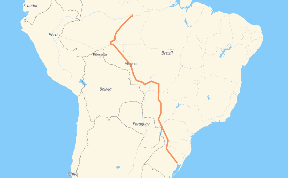
The distance from Porto Alegre to Manaus is 4,466 kilometers by road including 215 kilometers on motorways. Road takes approximately 54 hours and 8 minutes and goes through Ariquemes, Porto Velho, Berto Círio, Bom Pastor, Boca da Picada, Maravilha and Marechal Candido Rondon.
| Shortest distance by air | 3,131 km ✈️ |
| Car route length | 4,466 km 🚗 |
| Driving time | 54 h 8 min |
| Fuel amount | 357.3 L |
| Fuel cost | 628.8 AUD |
| Point | Distance | Time | Fuel | |
| Porto Alegre | 0 km | 00 min | 0.0 L | |
|
BR-448 21 km, 15 min
|
||||
| Berto Círio | 21 km | 15 min | 1.4 L | |
|
BR-386 97 km, 1 h 13 min
|
||||
| Bom Pastor | 118 km | 1 h 28 min | 9.3 L | |
|
BR-386 293 km, 3 h 17 min
|
||||
| Boca da Picada | 411 km | 4 h 45 min | 32.8 L | |
|
BR-386 BR-158 105 km, 1 h 25 min
|
||||
| Maravilha | 517 km | 6 h 11 min | 41.2 L | |
|
BR-163 352 km, 4 h 17 min
|
||||
| Marechal Candido Rondon | 869 km | 10 h 29 min | 69.2 L | |
|
BR-163 90 km, 1 h 02 min
|
||||
| Mundo Novo | 959 km | 11 h 32 min | 76.3 L | |
|
BR-163 2,407 km, 28 h 46 min
|
||||
| Ariquemes | 3,366 km | 40 h 18 min | 267.3 L | |
|
BR-364 217 km, 2 h 37 min
|
||||
| Porto Velho | 3,583 km | 42 h 56 min | 286.5 L | |
|
BR-319 883 km, 11 h 12 min
|
||||
| Manaus | 4,466 km | 54 h 08 min | 357.1 L | |
Hotels of Manaus
Frequently Asked Questions
How much does it cost to drive from Porto Alegre to Manaus?
Fuel cost: 628.8 AUD
This fuel cost is calculated as: (Route length 4,466 km / 100 km) * (Fuel consumption 8 L/100 km) * (Fuel price 1.76 AUD / L)
You can adjust fuel consumption and fuel price here.
How long is a car ride from Porto Alegre to Manaus?
Driving time: 54 h 8 min
This time is calculated for driving at the maximum permitted speed, taking into account traffic rules restrictions.
- 73 km with a maximum speed 110 km/h = 40 min
- 102 km with a maximum speed 100 km/h = 1 h 1 min
- 2,113 km with a maximum speed 90 km/h = 23 h 28 min
- 1,972 km with a maximum speed 80 km/h = 24 h 38 min
- 72 km with a maximum speed 60 km/h = 1 h 11 min
- 103 km with a maximum speed 50 km/h = 2 h 3 min
- 19 km with a maximum speed 40 km/h = 28 min
- 12 km with a maximum speed 20 km/h = 35 min
The calculated driving time does not take into account intermediate stops and traffic jams.
How far is Porto Alegre to Manaus by land?
The distance between Porto Alegre and Manaus is 4,466 km by road including 215 km on motorways.
Precise satellite coordinates of highways were used for this calculation. The start and finish points are the centers of Porto Alegre and Manaus respectively.
How far is Porto Alegre to Manaus by plane?
The shortest distance (air line, as the crow flies) between Porto Alegre and Manaus is 3,131 km.
This distance is calculated using the Haversine formula as a great-circle distance between two points on the surface of a sphere. The start and finish points are the centers of Porto Alegre and Manaus respectively. Actual distance between airports may be different.
How many hours is Porto Alegre from Manaus by plane?
Boeing 737 airliner needs 3 h 54 min to cover the distance of 3,131 km at a cruising speed of 800 km/h.
Small plane "Cessna 172" needs 14 h 13 min to flight this distance at average speed of 220 km/h.
This time is approximate and do not take into account takeoff and landing times, airport location and other real world factors.
How long is a helicopter ride from Porto Alegre to Manaus?
Fast helicopter "Eurocopter AS350" or "Hughes OH-6 Cayuse" need 13 h 2 min to cover the distance of 3,131 km at a cruising speed of 240 km/h.
Popular "Robinson R44" needs 14 h 54 min to flight this distance at average speed of 210 km/h.
This time is approximate and do not take into account takeoff and landing times, aerodrome location and other real world factors.
What city is halfway between Porto Alegre and Manaus?
The halfway point between Porto Alegre and Manaus is Sadia. It is located about 73 km from the exact midpoint by road.
The distance from Sadia to Porto Alegre is 2,306 km and driving will take about 27 h 15 min. The road between Sadia and Manaus has length 2,160 km and will take approximately 26 h 53 min.
The other cities located close to halfway point:
Where is Porto Alegre in relation to Manaus?
Porto Alegre is located 3,131 km south-east of Manaus.
Porto Alegre has geographic coordinates: latitude -30.0325, longitude -51.23038.
Manaus has geographic coordinates: latitude -3.13163, longitude -59.9825.
Which highway goes from Porto Alegre to Manaus?
The route from Porto Alegre to Manaus follows BR-163, BR-364, BR-319, BR-174, BR-386, BR-070, BR-060.
Other minor sections pass along the road:
- PR-182: 75 km
- BR-467: 67 km
- BR-487: 62 km
- BR-158: 49 km
- BR-267: 41 km
- PR-180: 37 km
- BR-153: 34 km
- PR-483: 26 km
- BR-230: 23 km
- SC-160: 21 km
- SC-492: 16 km
- MT-407: 16 km
- BR-262: 15 km
- BR-448: 12 km
- BR-287: 6 km
- ERS-128: 5 km
- PR-317: 5 km
- BR-282: 3 km
- ERS-332: 3 km
- BR-290: 2 km
- BR-116: 2 km