Distance between Porto Velho and Rua do Fogo
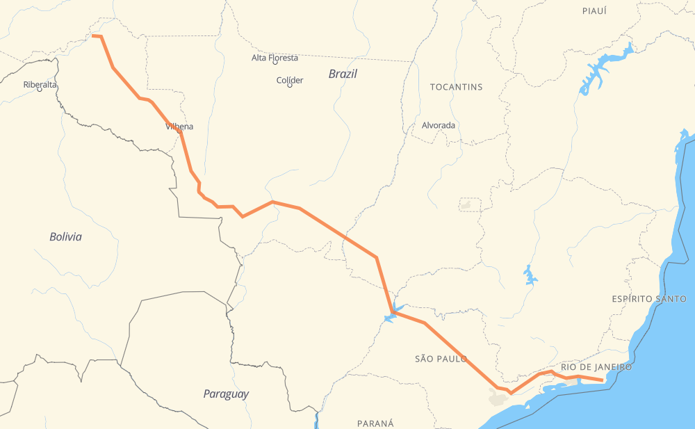
The distance from Porto Velho to Rua do Fogo is 3,573 kilometers by road including 1,145 kilometers on motorways. Road takes approximately 40 hours and 17 minutes and goes through Ariquemes, Rio Claro, Itatiba, Atibaia, Jacareí, Guaratinguetá and Magé.
| Shortest distance by air | 2,798 km ✈️ |
| Car route length | 3,573 km 🚗 |
| Driving time | 40 h 17 min |
| Fuel amount | 285.8 L |
| Fuel cost | 514.5 AUD |
| Point | Distance | Time | Fuel | |
| Porto Velho | 0 km | 00 min | 0.0 L | |
|
BR-319 BR-364 219 km, 2 h 38 min
|
||||
| Ariquemes | 219 km | 2 h 38 min | 15.6 L | |
|
BR-364 118 km, 2 h 00 min
|
||||
| Ouro Preto do Oeste | 337 km | 4 h 39 min | 26.4 L | |
|
BR-364 2,527 km, 28 h 16 min
|
||||
| Rio Claro | 2,864 km | 32 h 55 min | 228.7 L | |
|
SP-310 SP-330 113 km, 1 h 07 min
|
||||
| Itatiba | 2,977 km | 34 h 03 min | 237.7 L | |
|
SP-065 26 km, 14 min
|
||||
| Atibaia | 3,003 km | 34 h 18 min | 239.2 L | |
|
SP-065 80 km, 46 min
|
||||
| Jacareí | 3,084 km | 35 h 04 min | 246.4 L | |
|
SP-060 BR-116 99 km, 58 min
|
||||
| Guaratinguetá | 3,183 km | 36 h 02 min | 254.4 L | |
|
SP-060 BR-116 271 km, 2 h 58 min
|
||||
| Magé | 3,454 km | 39 h 01 min | 275.8 L | |
|
BR-493 RJ-124 121 km, 1 h 15 min
|
||||
| Rua do Fogo | 3,575 km | 40 h 16 min | 285.3 L | |
Frequently Asked Questions
How much does it cost to drive from Porto Velho to Rua do Fogo?
Fuel cost: 514.5 AUD
This fuel cost is calculated as: (Route length 3,573 km / 100 km) * (Fuel consumption 8 L/100 km) * (Fuel price 1.8 AUD / L)
You can adjust fuel consumption and fuel price here.
How long is a car ride from Porto Velho to Rua do Fogo?
Driving time: 40 h 17 min
This time is calculated for driving at the maximum permitted speed, taking into account traffic rules restrictions.
- 767 km with a maximum speed 110 km/h = 6 h 58 min
- 235 km with a maximum speed 100 km/h = 2 h 20 min
- 1,648 km with a maximum speed 90 km/h = 18 h 18 min
- 765 km with a maximum speed 80 km/h = 9 h 33 min
- 31 km with a maximum speed 70 km/h = 26 min
- 12 km with a maximum speed 60 km/h = 11 min
- 94 km with a maximum speed 50 km/h = 1 h 52 min
- 23 km with a maximum speed 40 km/h = 34 min
The calculated driving time does not take into account intermediate stops and traffic jams.
How far is Porto Velho to Rua do Fogo by land?
The distance between Porto Velho and Rua do Fogo is 3,573 km by road including 1,145 km on motorways.
Precise satellite coordinates of highways were used for this calculation. The start and finish points are the centers of Porto Velho and Rua do Fogo respectively.
How far is Porto Velho to Rua do Fogo by plane?
The shortest distance (air line, as the crow flies) between Porto Velho and Rua do Fogo is 2,798 km.
This distance is calculated using the Haversine formula as a great-circle distance between two points on the surface of a sphere. The start and finish points are the centers of Porto Velho and Rua do Fogo respectively. Actual distance between airports may be different.
How many hours is Porto Velho from Rua do Fogo by plane?
Boeing 737 airliner needs 3 h 29 min to cover the distance of 2,798 km at a cruising speed of 800 km/h.
Small plane "Cessna 172" needs 12 h 43 min to flight this distance at average speed of 220 km/h.
This time is approximate and do not take into account takeoff and landing times, airport location and other real world factors.
How long is a helicopter ride from Porto Velho to Rua do Fogo?
Fast helicopter "Eurocopter AS350" or "Hughes OH-6 Cayuse" need 11 h 39 min to cover the distance of 2,798 km at a cruising speed of 240 km/h.
Popular "Robinson R44" needs 13 h 19 min to flight this distance at average speed of 210 km/h.
This time is approximate and do not take into account takeoff and landing times, aerodrome location and other real world factors.
What city is halfway between Porto Velho and Rua do Fogo?
The halfway point between Porto Velho and Rua do Fogo is Vila Goulart. It is located about 106 km from the exact midpoint by road.
The distance from Vila Goulart to Porto Velho is 1,680 km and driving will take about 20 h 26 min. The road between Vila Goulart and Rua do Fogo has length 1,893 km and will take approximately 19 h 50 min.
The other cities located close to halfway point:
Where is Porto Velho in relation to Rua do Fogo?
Porto Velho is located 2,798 km north-west of Rua do Fogo.
Porto Velho has geographic coordinates: latitude -8.74945, longitude -63.87354.
Rua do Fogo has geographic coordinates: latitude -22.80671, longitude -42.12264.
Which highway goes from Porto Velho to Rua do Fogo?
The route from Porto Velho to Rua do Fogo follows BR-364, BR-174, BR-116, SP-310, BR-070, BR-163, SP-320, SP-060, GO-184, BR-158, SP-065.
Other minor sections pass along the road:
- BR-060: 81 km
- BR-493: 71 km
- BR-267: 59 km
- RJ-124: 57 km
- SP-330: 49 km
- BR-050: 49 km
- BR-101: 35 km
- GO-302: 27 km
- RJ-109: 19 km
- MT-407: 16 km
- BR-459: 14 km
- BR-383: 11 km
- MT-100: 7 km
- RJ-106: 5 km
- KM-272: 3 km
- RJ-140: 3 km
- BR-319: 2 km
- BR-436: 2 km