Distance between Puelches and Trevelin
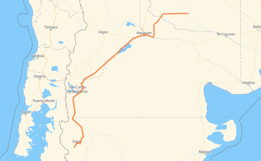
The distance from Puelches to Trevelin is 1,005 kilometers by road. Road takes approximately 11 hours and 43 minutes and goes through Neuquén, San Carlos de Bariloche, Villa Casa de Piedra, Ex Isla 10, Cipolletti, Plottier and Las Brisas.
| Shortest distance by air | 721 km ✈️ |
| Car route length | 1,005 km 🚗 |
| Driving time | 11 h 43 min |
| Fuel amount | 80.4 L |
| Fuel cost | 143.9 AUD |
| Point | Distance | Time | Fuel | |
| Puelches | 0 km | 00 min | 0.0 L | |
|
RN152 114 km, 1 h 17 min
|
||||
| Villa Casa de Piedra | 114 km | 1 h 17 min | 8.7 L | |
|
RN152 RP6 138 km, 1 h 34 min
|
||||
| Ex Isla 10 | 252 km | 2 h 52 min | 20.0 L | |
|
RN22 8 km, 05 min
|
||||
| Cipolletti | 261 km | 2 h 58 min | 20.7 L | |
|
RN22 9 km, 07 min
|
||||
| Neuquén | 270 km | 3 h 05 min | 21.1 L | |
|
18 km, 14 min
|
||||
| Plottier | 289 km | 3 h 20 min | 22.2 L | |
|
RN22 14 km, 10 min
|
||||
| Senillosa | 302 km | 3 h 30 min | 24.0 L | |
|
RN22 22 km, 15 min
|
||||
| Arroyito | 324 km | 3 h 46 min | 24.6 L | |
|
RN237 371 km, 4 h 24 min
|
||||
| San Carlos de Bariloche | 695 km | 8 h 11 min | 55.1 L | |
|
RP237 RN40 309 km, 3 h 31 min
|
||||
| Trevelin | 1,005 km | 11 h 43 min | 79.3 L | |
Frequently Asked Questions
How much does it cost to drive from Puelches to Trevelin?
Fuel cost: 143.9 AUD
This fuel cost is calculated as: (Route length 1,005 km / 100 km) * (Fuel consumption 8 L/100 km) * (Fuel price 1.79 AUD / L)
You can adjust fuel consumption and fuel price here.
How long is a car ride from Puelches to Trevelin?
Driving time: 11 h 43 min
This time is calculated for driving at the maximum permitted speed, taking into account traffic rules restrictions.
- 841 km with a maximum speed 90 km/h = 9 h 20 min
- 87 km with a maximum speed 80 km/h = 1 h 5 min
- 73 km with a maximum speed 60 km/h = 1 h 13 min
- 2 km with a maximum speed 40 km/h = 3 min
The calculated driving time does not take into account intermediate stops and traffic jams.
How far is Puelches to Trevelin by land?
The distance between Puelches and Trevelin is 1,005 km by road.
Precise satellite coordinates of highways were used for this calculation. The start and finish points are the centers of Puelches and Trevelin respectively.
How far is Puelches to Trevelin by plane?
The shortest distance (air line, as the crow flies) between Puelches and Trevelin is 721 km.
This distance is calculated using the Haversine formula as a great-circle distance between two points on the surface of a sphere. The start and finish points are the centers of Puelches and Trevelin respectively. Actual distance between airports may be different.
How many hours is Puelches from Trevelin by plane?
Boeing 737 airliner needs 54 min to cover the distance of 721 km at a cruising speed of 800 km/h.
Small plane "Cessna 172" needs 3 h 16 min to flight this distance at average speed of 220 km/h.
This time is approximate and do not take into account takeoff and landing times, airport location and other real world factors.
How long is a helicopter ride from Puelches to Trevelin?
Fast helicopter "Eurocopter AS350" or "Hughes OH-6 Cayuse" need 3 h to cover the distance of 721 km at a cruising speed of 240 km/h.
Popular "Robinson R44" needs 3 h 26 min to flight this distance at average speed of 210 km/h.
This time is approximate and do not take into account takeoff and landing times, aerodrome location and other real world factors.
What city is halfway between Puelches and Trevelin?
The halfway point between Puelches and Trevelin is Piedra del Águila. It is located about 10 km from the exact midpoint by road.
The distance from Piedra del Águila to Puelches is 493 km and driving will take about 5 h 43 min. The road between Piedra del Águila and Trevelin has length 512 km and will take approximately 6 h.
The other cities located close to halfway point:
Where is Puelches in relation to Trevelin?
Puelches is located 721 km north-east of Trevelin.
Puelches has geographic coordinates: latitude -38.14635, longitude -65.91411.
Trevelin has geographic coordinates: latitude -43.07902, longitude -71.46409.
Which highway goes from Puelches to Trevelin?
The route from Puelches to Trevelin follows RN237, RN40, RN152, RP6.
Other minor sections pass along the road:
- RN22: 62 km
- RN259: 36 km
- RP237: 6 km