Distance between Punta Mejillón and Anita
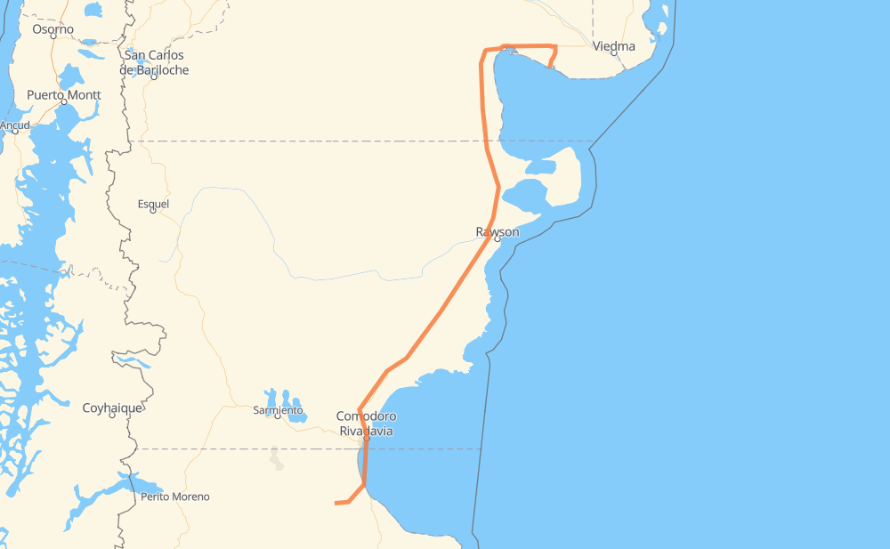
The distance from Punta Mejillón to Anita is 940 kilometers by road. Road takes approximately 10 hours and 54 minutes and goes through Comodoro Rivadavia, Caleta Olivia, El Empalme, Sierra Grande, El Doradillo, Los Teros and Campamento Primero.
| Shortest distance by air | 703 km ✈️ |
| Car route length | 940 km 🚗 |
| Driving time | 10 h 54 min |
| Fuel amount | 75.2 L |
| Fuel cost | 135.4 AUD |
| Point | Distance | Time | Fuel | |
| Punta Mejillón | 0 km | 00 min | 0.0 L | |
|
RP52 RN3 108 km, 1 h 19 min
|
||||
| El Empalme | 108 km | 1 h 19 min | 7.5 L | |
|
RN3 132 km, 1 h 28 min
|
||||
| Sierra Grande | 241 km | 2 h 48 min | 19.2 L | |
|
RN3 121 km, 1 h 21 min
|
||||
| El Doradillo | 362 km | 4 h 09 min | 28.7 L | |
|
RN3 76 km, 51 min
|
||||
| Los Teros | 438 km | 5 h 00 min | 34.9 L | |
|
RN3 336 km, 3 h 44 min
|
||||
| Campamento Primero | 774 km | 8 h 44 min | 60.8 L | |
|
RN3 18 km, 12 min
|
||||
| Astra | 792 km | 8 h 57 min | 63.1 L | |
|
RN3 15 km, 13 min
|
||||
| Zona Franca Portuaria | 807 km | 9 h 11 min | 64.5 L | |
|
RN3 1 km, 01 min
|
||||
| Comodoro Rivadavia | 808 km | 9 h 12 min | 64.6 L | |
|
RN3 133 km, 1 h 41 min
|
||||
| Anita | 940 km | 10 h 53 min | 75.1 L | |
Frequently Asked Questions
How much does it cost to drive from Punta Mejillón to Anita?
Fuel cost: 135.4 AUD
This fuel cost is calculated as: (Route length 940 km / 100 km) * (Fuel consumption 8 L/100 km) * (Fuel price 1.8 AUD / L)
You can adjust fuel consumption and fuel price here.
How long is a car ride from Punta Mejillón to Anita?
Driving time: 10 h 54 min
This time is calculated for driving at the maximum permitted speed, taking into account traffic rules restrictions.
- 836 km with a maximum speed 90 km/h = 9 h 17 min
- 59 km with a maximum speed 80 km/h = 44 min
- 30 km with a maximum speed 60 km/h = 29 min
- 8 km with a maximum speed 50 km/h = 9 min
- 6 km with a maximum speed 40 km/h = 8 min
- 1 km with a maximum speed 20 km/h = 4 min
The calculated driving time does not take into account intermediate stops and traffic jams.
How far is Punta Mejillón to Anita by land?
The distance between Punta Mejillón and Anita is 940 km by road.
Precise satellite coordinates of highways were used for this calculation. The start and finish points are the centers of Punta Mejillón and Anita respectively.
How far is Punta Mejillón to Anita by plane?
The shortest distance (air line, as the crow flies) between Punta Mejillón and Anita is 703 km.
This distance is calculated using the Haversine formula as a great-circle distance between two points on the surface of a sphere. The start and finish points are the centers of Punta Mejillón and Anita respectively. Actual distance between airports may be different.
How many hours is Punta Mejillón from Anita by plane?
Boeing 737 airliner needs 52 min to cover the distance of 703 km at a cruising speed of 800 km/h.
Small plane "Cessna 172" needs 3 h 11 min to flight this distance at average speed of 220 km/h.
This time is approximate and do not take into account takeoff and landing times, airport location and other real world factors.
How long is a helicopter ride from Punta Mejillón to Anita?
Fast helicopter "Eurocopter AS350" or "Hughes OH-6 Cayuse" need 2 h 55 min to cover the distance of 703 km at a cruising speed of 240 km/h.
Popular "Robinson R44" needs 3 h 20 min to flight this distance at average speed of 210 km/h.
This time is approximate and do not take into account takeoff and landing times, aerodrome location and other real world factors.
What city is halfway between Punta Mejillón and Anita?
The halfway point between Punta Mejillón and Anita is Los Teros. It is located about 32 km from the exact midpoint by road.
The distance from Los Teros to Punta Mejillón is 438 km and driving will take about 5 h. The road between Los Teros and Anita has length 503 km and will take approximately 5 h 53 min.
The other cities located close to halfway point:
Where is Punta Mejillón in relation to Anita?
Punta Mejillón is located 703 km north-east of Anita.
Punta Mejillón has geographic coordinates: latitude -41.01263, longitude -64.16246.
Anita has geographic coordinates: latitude -46.67722, longitude -68.04619.
Which highway goes from Punta Mejillón to Anita?
The route from Punta Mejillón to Anita follows RN3.
Other minor sections pass along the road:
- RP52: 33 km
- RP12: 31 km
- RP1: 4 km