Distance between Rochinha and Estreito da Calheta
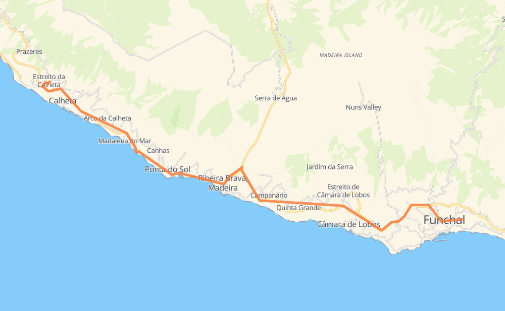
The distance from Rochinha to Estreito da Calheta is 38 kilometers by road. Road takes approximately 31 minutes and goes through Estreito de Câmara de Lobos, Ribeira Brava, Ponta do Sol, Campanário, Canhas and Arco da Calheta.
| Shortest distance by air | 29 km ✈️ |
| Car route length | 38 km 🚗 |
| Driving time | 31 min |
| Fuel amount | 3 L |
| Fuel cost | 5.4 AUD |
| Point | Distance | Time | Fuel | |
| Rochinha | 0 km | 00 min | 0.0 L | |
|
VR 1 11 km, 10 min
|
||||
| Estreito de Câmara de Lobos | 11 km | 10 min | 0.9 L | |
|
VR 1 6 km, 04 min
|
||||
| Campanário | 17 km | 14 min | 1.2 L | |
|
VR 1 4 km, 03 min
|
||||
| Ribeira Brava | 21 km | 17 min | 1.4 L | |
|
VE 3 3 km, 03 min
|
||||
| Lugar de Baixo | 24 km | 20 min | 1.9 L | |
|
VE 3 1 km, 00 min
|
||||
| Ponta do Sol | 25 km | 21 min | 2.0 L | |
|
VE 3 3 km, 02 min
|
||||
| Canhas | 28 km | 23 min | 2.1 L | |
|
VE 3 4 km, 03 min
|
||||
| Arco da Calheta | 32 km | 26 min | 2.4 L | |
|
VE 3 6 km, 04 min
|
||||
| Estreito da Calheta | 38 km | 31 min | 2.8 L | |
Hotels of Estreito da Calheta
Frequently Asked Questions
How much does it cost to drive from Rochinha to Estreito da Calheta?
Fuel cost: 5.4 AUD
This fuel cost is calculated as: (Route length 38 km / 100 km) * (Fuel consumption 8 L/100 km) * (Fuel price 1.8 AUD / L)
You can adjust fuel consumption and fuel price here.
How long is a car ride from Rochinha to Estreito da Calheta?
Driving time: 31 min
This time is calculated for driving at the maximum permitted speed, taking into account traffic rules restrictions.
- 8 km with a maximum speed 90 km/h = 5 min
- 13 km with a maximum speed 80 km/h = 10 min
- 9 km with a maximum speed 70 km/h = 8 min
- 2 km with a maximum speed 60 km/h = 1 min
- 5 km with a maximum speed 50 km/h = 5 min
The calculated driving time does not take into account intermediate stops and traffic jams.
How far is Rochinha to Estreito da Calheta by land?
The distance between Rochinha and Estreito da Calheta is 38 km by road.
Precise satellite coordinates of highways were used for this calculation. The start and finish points are the centers of Rochinha and Estreito da Calheta respectively.
What city is halfway between Rochinha and Estreito da Calheta?
The halfway point between Rochinha and Estreito da Calheta is Campanário. It is located about 2 km from the exact midpoint by road.
The distance from Campanário to Rochinha is 17 km and driving will take about 14 min. The road between Campanário and Estreito da Calheta has length 21 km and will take approximately 17 min.
The other cities located close to halfway point:
Where is Rochinha in relation to Estreito da Calheta?
Rochinha is located 29 km south-east of Estreito da Calheta.
Rochinha has geographic coordinates: latitude 32.65396, longitude -16.89573.
Estreito da Calheta has geographic coordinates: latitude 32.73666, longitude -17.18784.
Which highway goes from Rochinha to Estreito da Calheta?
The route from Rochinha to Estreito da Calheta follows VR 1, VE 3.
Other minor sections pass along the road:
- VE3: 1 km