Distance between São João da Ponte and Piraquara
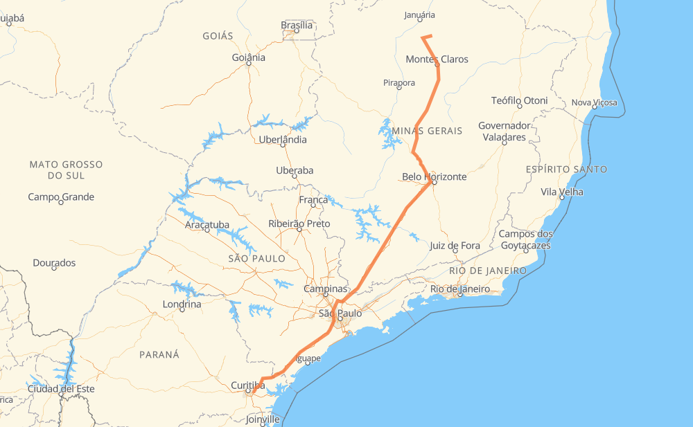
The distance from São João da Ponte to Piraquara is 1,519 kilometers by road including 1,032 kilometers on motorways. Road takes approximately 16 hours and 51 minutes and goes through Ribeirão das Neves, Contagem, Betim, Atibaia and Barueri.
| Shortest distance by air | 1,181 km ✈️ |
| Car route length | 1,519 km 🚗 |
| Driving time | 16 h 51 min |
| Fuel amount | 121.6 L |
| Fuel cost | 218.8 AUD |
| Point | Distance | Time | Fuel | |
| São João da Ponte | 0 km | 00 min | 0.0 L | |
|
MG-202 BR-135 68 km, 50 min
|
||||
| Mirabela | 68 km | 50 min | 4.7 L | |
|
BR-135 75 km, 51 min
|
||||
| Santo Amaro | 143 km | 1 h 42 min | 11.4 L | |
|
CMG-135 53 km, 38 min
|
||||
| Bocaiuva | 196 km | 2 h 20 min | 12.3 L | |
|
BR-135 335 km, 3 h 45 min
|
||||
| Ribeirão das Neves | 530 km | 6 h 06 min | 42.1 L | |
|
BR-040 22 km, 16 min
|
||||
| Contagem | 552 km | 6 h 22 min | 43.7 L | |
|
BR-381 16 km, 11 min
|
||||
| Betim | 568 km | 6 h 33 min | 45.0 L | |
|
BR-381 491 km, 4 h 52 min
|
||||
| Atibaia | 1,059 km | 11 h 25 min | 83.7 L | |
|
SP-065 SP-354 74 km, 51 min
|
||||
| Barueri | 1,133 km | 12 h 17 min | 90.4 L | |
|
SP-021 BR-116 401 km, 4 h 33 min
|
||||
| Piraquara | 1,534 km | 16 h 51 min | 121.6 L | |
Hotels of Piraquara
Frequently Asked Questions
How much does it cost to drive from São João da Ponte to Piraquara?
Fuel cost: 218.8 AUD
This fuel cost is calculated as: (Route length 1,519 km / 100 km) * (Fuel consumption 8 L/100 km) * (Fuel price 1.8 AUD / L)
You can adjust fuel consumption and fuel price here.
How long is a car ride from São João da Ponte to Piraquara?
Driving time: 16 h 51 min
This time is calculated for driving at the maximum permitted speed, taking into account traffic rules restrictions.
- 585 km with a maximum speed 110 km/h = 5 h 18 min
- 184 km with a maximum speed 100 km/h = 1 h 50 min
- 282 km with a maximum speed 90 km/h = 3 h 7 min
- 367 km with a maximum speed 80 km/h = 4 h 35 min
- 15 km with a maximum speed 70 km/h = 13 min
- 91 km with a maximum speed 60 km/h = 1 h 31 min
- 9 km with a maximum speed 40 km/h = 13 min
The calculated driving time does not take into account intermediate stops and traffic jams.
How far is São João da Ponte to Piraquara by land?
The distance between São João da Ponte and Piraquara is 1,519 km by road including 1,032 km on motorways.
Precise satellite coordinates of highways were used for this calculation. The start and finish points are the centers of São João da Ponte and Piraquara respectively.
How far is São João da Ponte to Piraquara by plane?
The shortest distance (air line, as the crow flies) between São João da Ponte and Piraquara is 1,181 km.
This distance is calculated using the Haversine formula as a great-circle distance between two points on the surface of a sphere. The start and finish points are the centers of São João da Ponte and Piraquara respectively. Actual distance between airports may be different.
How many hours is São João da Ponte from Piraquara by plane?
Boeing 737 airliner needs 1 h 28 min to cover the distance of 1,181 km at a cruising speed of 800 km/h.
Small plane "Cessna 172" needs 5 h 22 min to flight this distance at average speed of 220 km/h.
This time is approximate and do not take into account takeoff and landing times, airport location and other real world factors.
How long is a helicopter ride from São João da Ponte to Piraquara?
Fast helicopter "Eurocopter AS350" or "Hughes OH-6 Cayuse" need 4 h 55 min to cover the distance of 1,181 km at a cruising speed of 240 km/h.
Popular "Robinson R44" needs 5 h 37 min to flight this distance at average speed of 210 km/h.
This time is approximate and do not take into account takeoff and landing times, aerodrome location and other real world factors.
What city is halfway between São João da Ponte and Piraquara?
The halfway point between São João da Ponte and Piraquara is Perdões. It is located about 8 km from the exact midpoint by road.
The distance from Perdões to São João da Ponte is 751 km and driving will take about 8 h 27 min. The road between Perdões and Piraquara has length 768 km and will take approximately 8 h 23 min.
The other cities located close to halfway point:
Where is São João da Ponte in relation to Piraquara?
São João da Ponte is located 1,181 km north-east of Piraquara.
São João da Ponte has geographic coordinates: latitude -15.92833, longitude -44.0078.
Piraquara has geographic coordinates: latitude -25.44281, longitude -49.05979.
Which highway goes from São João da Ponte to Piraquara?
The route from São João da Ponte to Piraquara follows BR-135, BR-381, BR-116, SP-230, BR-040.
Other minor sections pass along the road:
- CMG-135: 85 km
- BR-478: 49 km
- SP-354: 40 km
- SP-010: 36 km
- MG-202: 33 km
- MGC-135: 24 km
- SP-021: 22 km
- SP-330: 15 km
- BR-050: 15 km
- SP-065: 12 km
- JAR-354: 9 km
- BR-262: 7 km
- BR-494: 3 km
- PR-415: 2 km